Thursday, August 23rd
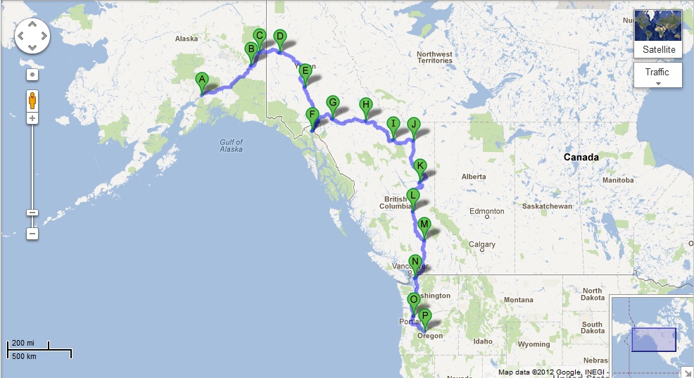
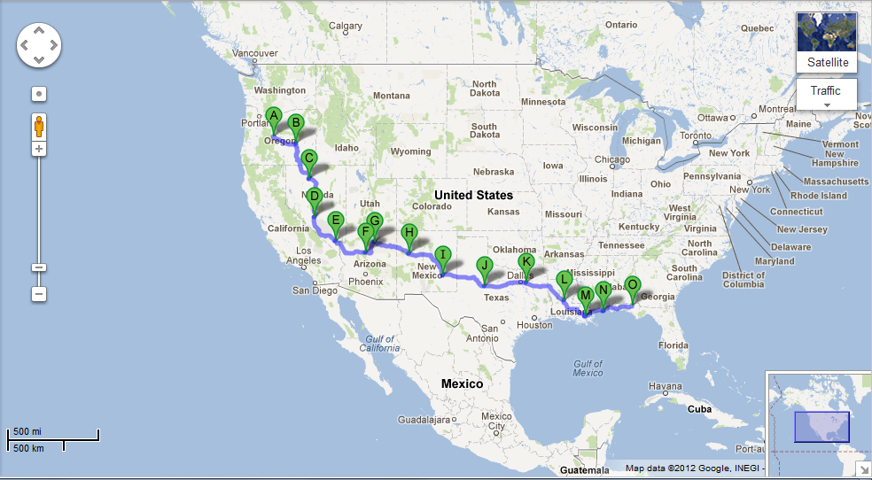
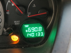 Now that we’re not moving, we have the time to look back and crunch some numbers relating to this trip. The math is pretty startling. We traveled a total of 6,690.8 miles through eleven U.S. states and two Canadian provinces. We spent 133 hours and two minutes in the car (a total of five days, thirteen hours, and two minutes) over the course of our 23-day trip. Of that, we spent 120 hours and 29 minutes (5 days and 29 minutes) physically moving, while we were stopped (in traffic, checking a map, taking photos, etc.) for 12 hours and 33 minutes.
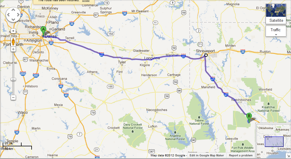
We stopped for gas 30 times, topping off in every state we traveled through with the exception of Alabama. Over our 30 fill-ups, we purchased 315.116 gallons of fuel. The most expensive gas we purchased was $6.041 per gallon in Toad River, British Columbia, while the least expensive gas was $3.369 per gallon in Gautier, Mississippi; our average gas cost was $4.193/gallon. And, the statistic that everyone is waiting for: Our overall mileage for the entire trip was 21.747 miles per gallon; our best mileage was 25.939 miles per gallon from Williams, Arizona, to Tuba City, Arizona, while our worst mileage was 17.660 miles per gallon from North Las Vegas, Nevada, to Williams, Arizona. (Yes, oddly enough, they were back-to-back tanks of gas.) We also used GoogleMaps to map out every gas station we visited:
(More to read below the maps.)
Follow Ups:
Charla’s train-whistle playing has improved dramatically. If they’re still on schedule, the Military Vehicle Preservation Association AlCan Convoy should be pulling into Whitehorse tonight. Despite checking the CBC, the Vancouver Sun, and the Whitehorse Star, we never discovered what crime had taken place at the Liard River Hotsprings. The United States won 104 Olympic medals, Canada won 18, and countries such as Algeria, Botswana, and Tajikistan each won one. As of today, the Las Vegas Metropolitan Police Department has no useful information on case number 120814-1353, more importantly known as “the case of the stolen bicycle tire.” We found every US license plate except for Rhode Island, Washington, D.C., and West Virginia. We also found randoms such as Romania, Western Australia, and Puerto Rico. For more details on those, check out our license plate game page. (Another fact: We had found over half of the U.S. states and over half of the Canadian provinces before we even left Alaska.) We are already dreaming about our next driving adventure. Also, stay tuned to this blog for information on our Florida adventures now that we’re here!
Wednesday, August 22nd
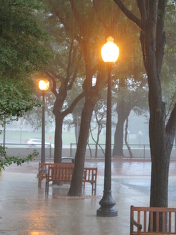
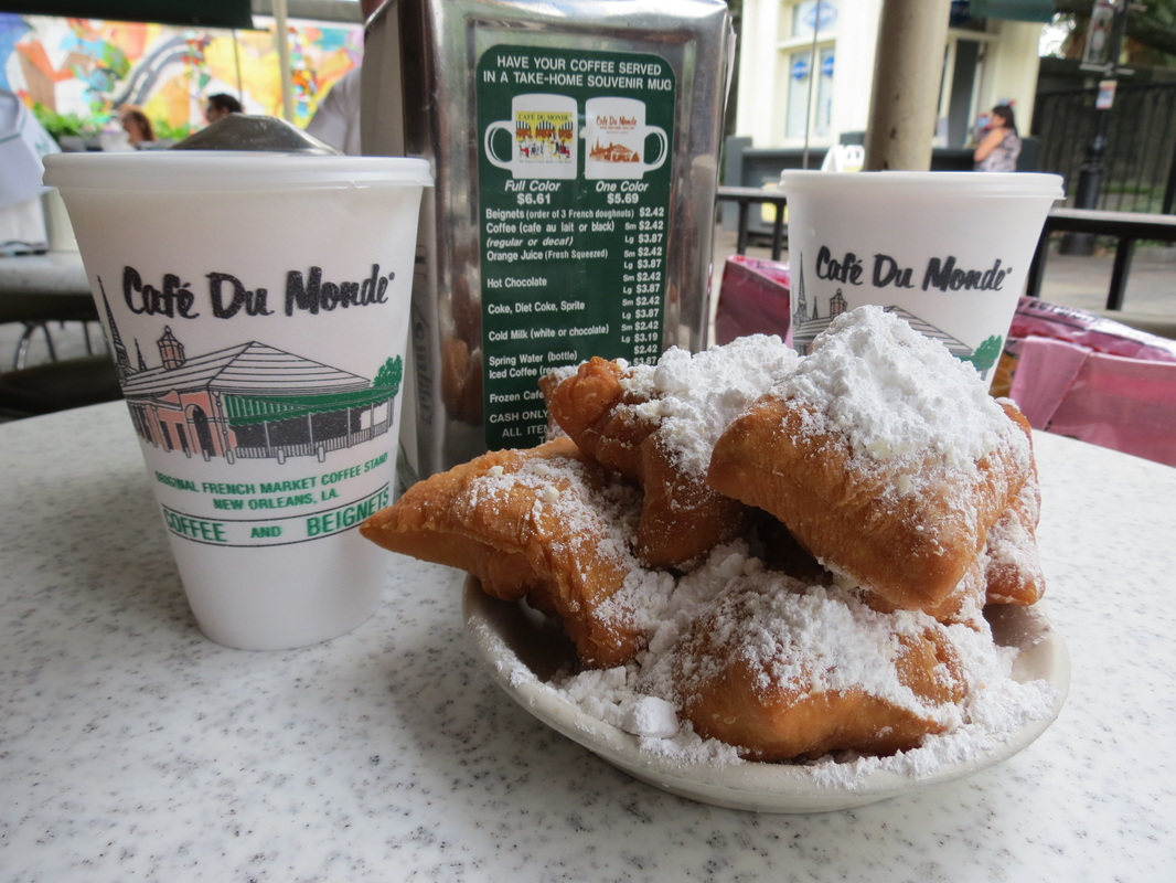
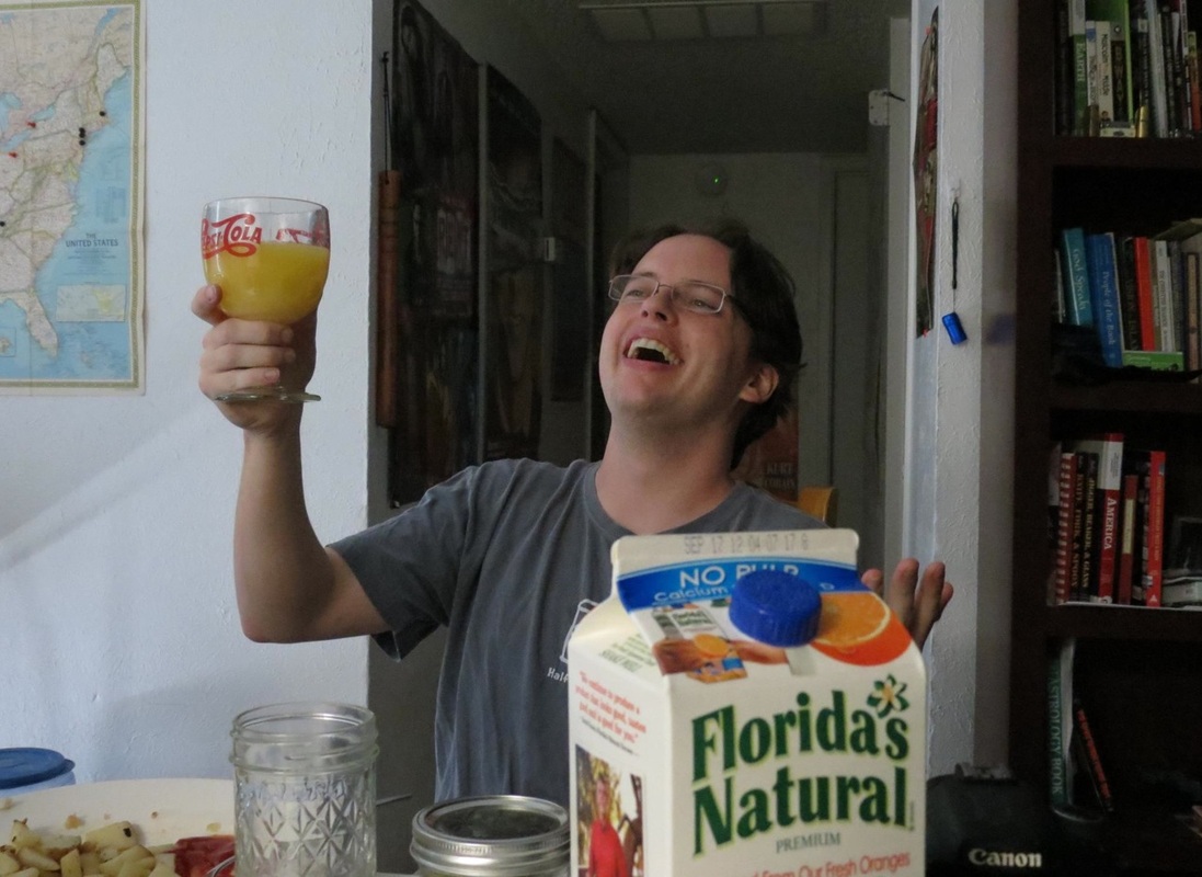
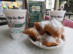 We started our final morning in New Orleans with the requisite trip back to Café du Monde for a delicious (though not nutritious) breakfast of beignets buried in a mountain of powdered sugar, as well as their famous chicory coffee to wake Charla up and, in anticipation of our arrival in the Sunshine State, some fresh-squeezed OJ for Chase. On our way out of town we drove across the 23-mile Pontchartrain Causeway. The bridge across Lake Pontchartrain is so long that allegedly one can see the curvature of the earth while crossing the bridge; unfortunately for us, a tanker truck was leaking corrosive chemical waste on I-10, which shut down the Interstate, and forced so much traffic onto the Causeway we didn’t get to see anything too exciting.
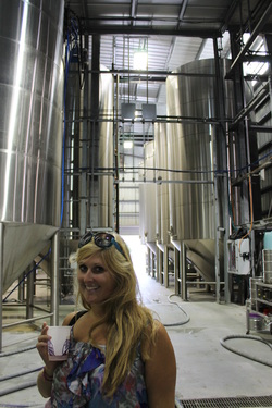 On the other side of Lake Pontchartrain, we finally arrived in Abita Springs, Louisiana, the home of Abita beer. The sweet smell of the brewery greeted us as we walked in to find the sampling room already open before our 2:00 tour. The tour of the facility started with two short videos, one about the brewing process and the other about Abita’s mission to go green, and then we were guided into the large room filled with tanks where our only instructions were not to touch anything shiny. The tour was short but informative, and most importantly, it left us with an even greater love of this Louisianan brew.
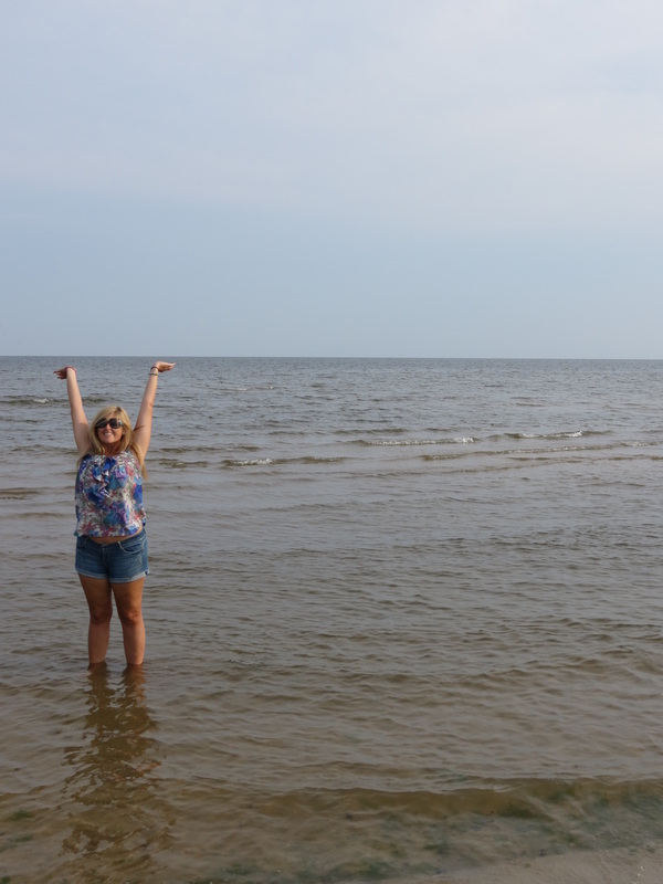
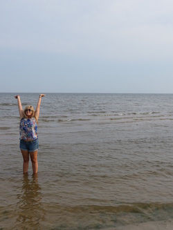 Leaving Abita we jumped on to I-12, to I-10, to the Mississippi state line and the shockingly nice Mississippi Welcome Center. Also near the Welcome Center is the NASA Infinity Center; the name sounded impressive yet vague, but when we arrived they had just closed and we didn’t end up learning anything more about it. Once we were in Mississippi we ducked off the Interstate onto US90, a scenic rural highway along the coast. In the town of Waveland we had a very exciting moment when we saw the Gulf of Mexico for the first time of the trip! We, of course, slammed on the brakes and waded out to play on Waveland Beach before continuing on east.
 We stayed on US90 until the sun set, and once the views were gone we jumped back on I-10 for the long slog east. I-10 passed us right on through the 55 miles of Alabama and the 200 miles of the Florida Panhandle before finally arriving in Tallahassee at 2AM. Charla operated as our Tallahassee tour guide, pointing out both the sights and the day-to-day necessities of the city, until we stopped for the night to say hello to Charla’s mom and goodbye to our road trip from Talkeetna to Tallahassee.
Tuesday, August 21st
 We started out our day in the Crescent City by exploring the French Quarter. A bit of aimless wandering and we found ourselves at Jackson Square, anchored by Saint Louis Cathedral, and also the location of the Louisiana State Museum. There were two main exhibits in the museum; the first floor was a poignant remembrance of Hurricane Katrina from the tropical depression forming over the Bahamas all the way through landfall, flood control failure, personal struggles, recovery, urban replanning, forecasting science, and the engineering of present and potentially future flood control systems, while the second floor held a much more upbeat exhibit about the history of Mardi Gras and carnivals in New Orleans, including turn-of-the-century dance cards and invitations to the krewes’ formal balls.
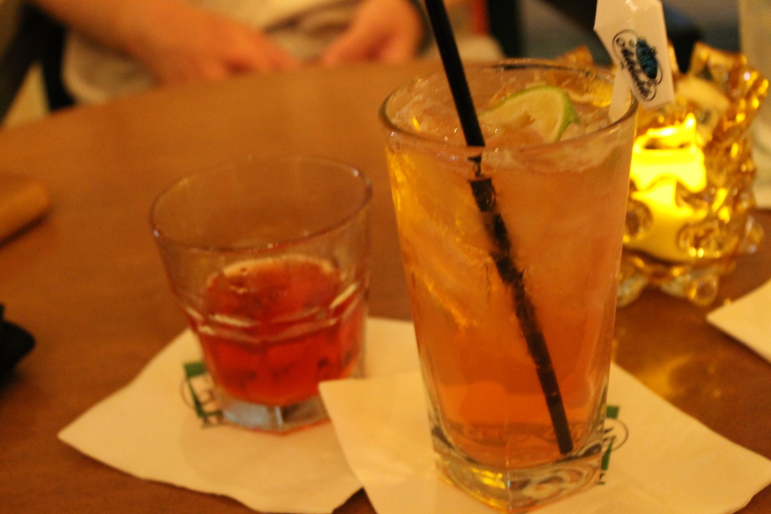
Leaving the museum we realized that we were getting a bit hungry for a late lunch, so our wandering began to include looking for a place to eat. After seeing more of the French Quarter, and even walking the famous Bourbon Street, we ended up at Johnny’s Po-Boys, consistently named one of the best po-boy restaurants in the city. The reviews did not lie, and our po-boys were delicious. After this mid-afternoon meal we wanted to rest for a bit, and headed back to the hotel to take advantage of the pool/hot tub/sauna and again watched the sun set over the Mississippi River from our room. 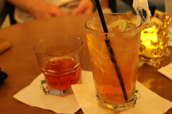 Refreshed and ready for a night out, we went downstairs, where we enjoyed bar food and cocktails at the Café Adelaide and Swizzle Stick Bar. The shrimp and tasso corndogs, shrimp and okra gumbo, and bacon encrusted oysters paired with an Adelaide Swizzle and a Sazerac made for a perfect last dinner in New Orleans (this time around).
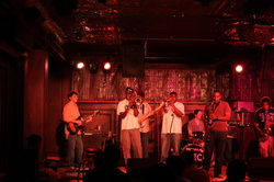 From the hotel, we walked through the French Quarter, where many bars and shops were already closed, for some reason we have yet to figure out. So, we headed for the music of Frenchmen Street, where we first went to the Spotted Cat Music Club. The Smokin' Time Jazz Club was playing in the window of the intimate club while swing dancers showed off their best moves on the floor. At the Spotted Cat, we met up with Charla’s classmate Paul, who is at the end of his forty-five-day journey around America on Amtrak, and his friends Kunal and Erin. While the band took a break, we stepped across the street to Café Negril, where we caught their funk band’s last song as they closed shop for the evening. Walking back towards the River, we found the Balcony Music Club, where a fantastic band was still rocking the house. Their set mixed some classic jazz tunes you would expect to hear in NOLA with some funky brass/rock hiphop tunes, like a cover of “Get Low,” that surprised and delighted the crowd. Our night started winding down, as we hung out at Molly’s to swap travel stories and then made our way to Café du Monde for a late night bag of beignets, which we ate as we walked back to the Loews.
Monday, August 20th
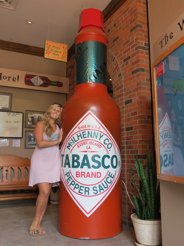
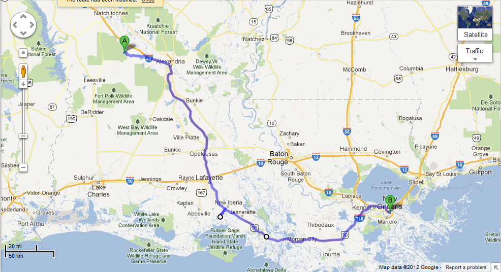
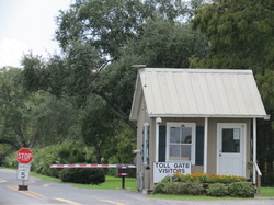 From the Kisatchie National Forest, we drove through the bayou to reach I-49 again and continuing heading south, bringing us to Alexandria. We made a loop that took us by the airpark and into town for gas and breakfast. About another hour south of Alexandria on I-49, we faced a decision in Lafayette: go further south to Avery Island or get on I-10 to go to Abita Springs. Chase made a few phone calls to reach the Abita Brewery and check their tour times, revealing that we would have to make Abita a stop on Wednesday if we wished to participate. So, we kept going south to the beautiful Avery Island, home of the McIlhenny family’s famous Tabasco sauce. To get on the island, we were stopped at a small tollbooth (well, really more of a tollhouse, like the cookie!), where a kind gentlemen asked for our dollar fee to support the wildlife conservation efforts and extended a stick with a clothespin on the end to exchange a card for our toll fee.
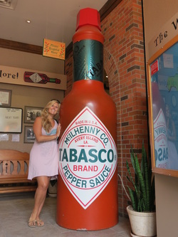 On Avery Island, we went on a Tabasco factory tour that included a guided exhibit and a short video before we filed past the bottling line. Though our hostess gave us two small bottles of Tabasco each, the best part of the tour was just a few steps away at the country store, where we were able to sample Tabasco’s range of sauces as well as jalapeno ice cream. Our favorite sauce was one of their newer products, the Sweet and Spicy Tabasco sauce, which Charla stocked up on for a shrimp boil in the very near future.
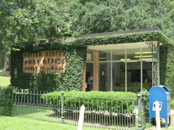 In the country store, we met Kina, a lovely sales associate who answered all of our questions, including where to find the nearest Post Office. Much of Avery Island (aside from the Tabasco property and something called Jungle Gardens) is restricted to residents only, but with Kina’s golden permission we were able to drive past the barricades to the Post Office. The Avery Island Post Office is a small, vine-covered building, with a nice Postmaster who helped us out with a variety of requests as we overloaded her with postcards, letters, and packages we’d been meaning to send for a while.
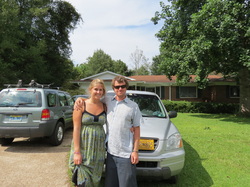
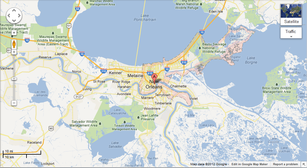
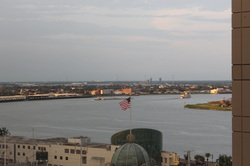 After leaving the restricted zone we jumped back on US90 to New Orleans and rolled into town in the mid-afternoon. As a gift to make the end of our trip awesome, Charla’s dad gave us a couple nights’ stay at the Loews New Orleans. We were greeted by the friendly staff outside who got a kick out of our vehicle that’s covered with dirt (and a few drawings in it), packed to the brim, and toting half of a bicycle. Inside, the front desk welcomed us with cold cherry lemonade and a basket of Louisiana treats like Abita beer and Zapp’s Voodoo potato chips. From there, we went up to the eighteenth floor, where our corner room offered nice views of the evening sun over the Mississippi River.
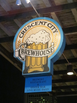 We only stayed in the room a short time before heading out to wander about the city of New Orleans. Coincidentally, on the way out the door the bellmen were just taking another vehicle with Alaska tags and “AK to FL” written on the windshield; come to find out we’re not the only guests in the hotel on this journey! They were on day twenty of an Anchorage – Fort Walton Beach drive, but they had taken a more northern route than us. After running into our “travel-mates” we continued on into the French Quarter to visit the Crescent City Brewhouse. They’re slogan is “The food’s so good you’ll forgot you came for the beer,” which largely proved true with unremarkable brews but amazing crabmeat stuffed shrimp and shrimp and grits! After dinner we decided to skip out on the wild-and-crazy French Quarter scene for the more sedate (and musically fascinating) scene on Frenchmen Street in the Faubourg Marginy neighborhood. We started our evening at Maison, which was hosting its Super Jam Open Mic night; on stage there was a core band of saxophone, keyboards, drums, and guitar, but accompanied by a constantly rotating assortment of horn players and vocalists. After a while of listening to different musicians, we moved a short way down the street to the Blue Nile where an extremely large and energetic brass band was rocking the night.
Sunday, August 19th
 As has been the pattern when we are staying with our friends, we got a late start out of Dallas. We were all treated to a scrumptious breakfast courtesy of Charla and Katie; deliciously fluffy scrambled eggs and potatoes from Charla and bacon from Katie. (While they were cooking, Chris and Chase were busy out on the town procuring Lindt truffles, so the boys were also working on important tasks.)
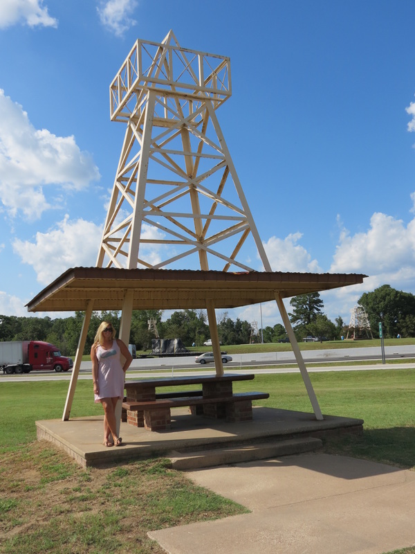
After a couple hours on I-20 heading out of town, we decided it was time for a snack and pulled over at a rest area to make sandwiches. Much to our surprise (or, maybe we shouldn’t have been shocked), each picnic table at the rest area was built to resemble a giant oil derrick on the side of the highway. Oh, Texas…
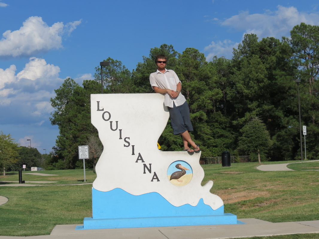
 Not far from the rest area, we crossed the Louisiana state line and then were soon in Shreveport. Although the Louisiana tourism booklet we picked up near the border suggested a lot to do there, Sunday night was not exactly an ideal time for a visit, as the majority of attractions were museums that would not be open until the next morning. We cruised through the city a bit, however, and decided to stop at the River Walk. The park is situated across from Bossier City and near some interesting metal bridges made for swinging and lifting to allow various ships down the Red River. While there, we also glimpsed a few old fashioned steamboats at rest (ahem, these days, riverboat casinos).
 From Shreveport, we traveled south on I-49. We were excited (and surely they were too) when we saw another car on the road with a Vassar license plate frame, this one a black mini SUV with Texas tags. While Chase slowed down so that our windows could meet, Charla made a sign saying “We went to Vassar too!” to hold up in the window. As soon as the two other travelers saw it, both drivers started honking while thumbs-ups and lots of waving went on in the passenger seats. After seeing the Vassar vehicle, our night was fairly quiet, as we made our way to the Kisatchie National Forest to set up our tent and have dinner.
Saturday, August 18th
 _ Our day started with a huge breakfast, unlike any that we have cooked on our little camp stove. Katie and Charla made pancakes, fried potatoes, and bacon. If you couldn’t tell by the Chick-Fil-A, we are back in the South!
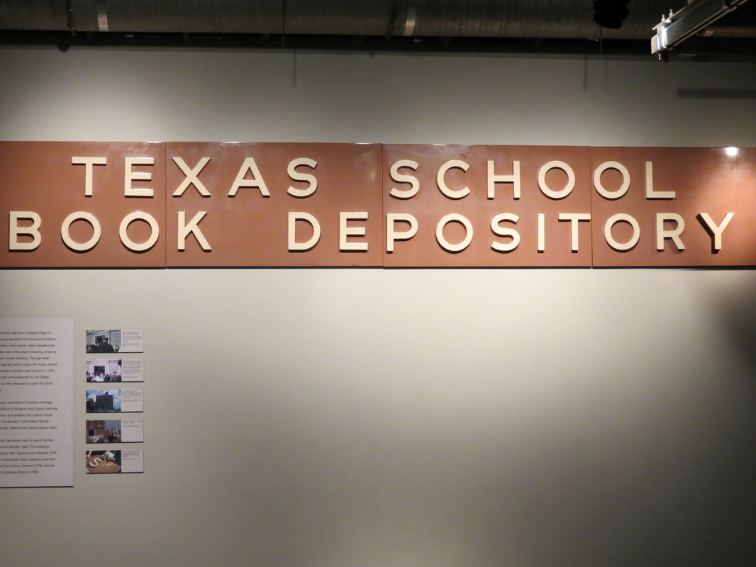
 _ After breakfast, we ventured downtown with Chris to visit Dealy Plaza and the Sixth Floor Museum at the former Texas School Book Depository. While in our travels, we have both experienced some incredible museums, this one was outstanding for its ability to arouse both questions and emotions. As we exited the elevator on the sixth floor, we began our audio-guided tour with some background on the political and cultural climate of the late 1950’s and early 1960’s, including some original movie posters, newspapers, and novels. After that, we toured through the sections on John F. Kennedy’s campaign, election, presidency, and Dallas tour and then arrived at the window where Lee Harvey Oswald supposedly sat as the motorcade rounded the hairpin turn from Elm Street, which was recreated with school book boxes. The rest of the museum included videos and displays about the world’s reactions to JFK’s death and his legacy as well as the investigations into the events of that day in November 1963—from evidence, the Zapruder film timeline, and further conjectures about possible conspiracy theories. The tour ended with a short film featuring Walter Cronkite, the famous voice of CBS news, that left the three of us pensive as we left the museum.
 _ We planned to walk around Dealy Plaza a bit more, but a thunderstorm had set in for the night. The rain poured down as the National Weather Service repeatedly issued flash flood warnings for our area. Trying to work our way out of downtown was difficult, as all the traffic lights were out of order and many roads were impassable due to standing water. Dallas’s sprawling infrastructure and insufficient highway systems weren’t helping the matter either, but we somehow made it back to the apartment in time to grill up the rest of the tilapia in the rain, as well as enjoy corn and potatoes. We ended off the evening with a healthy dose of MarioKart 64, the go-kart driving game from the 90’s on Nintendo64. During college Chase and Chris spent the a significant portion of time playing all of the racetracks in “Versus” mode, so it was great to rekindle old rivalries and again speed towards the checkered flag.
Friday, August 17th
 _ Heading east on Highway 380 out of Brownfield, we drove through several other small towns before connecting on Highway 82 to I-20. I-20 led us to a nice rest area at Stink Creek, where we made breakfast on our trusty Coleman camp stove. Our egg sandwiches were far from stinky, and we were ready to head to Dallas.
 _ After breakfast, we had the pleasure of meeting Officer Hubbard of the Texas Highway Patrol. Unfortunately, we met Officer Hubbard on the shoulder of I-20 shortly after we had been driving 80 miles per hour in a 75 mile-per-hour-zone. After answering a few cursory questions and letting Officer Hubbard take Chase’s Alaska drivers’ license back to his patrol car, Chase received a typewritten warning about his speed (but not a speeding ticket, with no points on his license and nothing added to his record). Interestingly enough, the warning goes so far as to imply that the Texas Department of Public Safety feels that Chase is a good citizen, which left us both feeling happy.
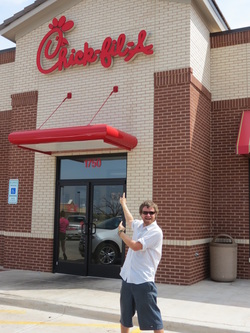 _ The next exit of the interstate made us feel even happier, as we happened upon our first Chick-Fil-A of the trip. Chick-Fil-A is a fast food chicken restaurant in the South (they didn’t invent chicken, just the chicken sandwich) which does not have any locations in Alaska; Chase hadn’t eaten at a Chick-Fil-A since last year when he left the Lower 48. Ever since the trip started, we had a deal that we’d stop to eat at the first one we saw. Despite just recently eating breakfast, it was time to make good on the deal. After a small meal of chicken strips and Chick-Fil-A’s famous waffle fries, we were back on the road towards Dallas.
_ As we neared Dallas, we came to the realization that the city road planners don’t really understand how to use the four cardinal directions. First of all, we were heading to an apartment building that was located on East Northwest Highway. Even more perplexing, to get to East Northwest, we had to drive on I-35 East North. Somehow we found our way and arrived at Chris and Mary’s apartment. Chris welcomed us with some Shiner, a local Texan beer, and we immediately began reminiscing about our college experience. The four of us all attended Vassar College (Chris and Chase were roommates for a while), so we definitely had a lot to talk about. Unfortunately, Mary has been waylaid by a knee injury and is spending a lot of time in bed. We also met Chris and Mary’s roommate Katie, and we all ended up getting along swimmingly. We interrupted our trip down Memory Lane to run to the store and grab food for a barbecue. But, our idea of a barbecue suddenly veered slightly off course and turned into a seafood feast since shrimp was a good price and tilapia filets were “buy one two-pound package, get three free.” Charla boiled a pound and a half of shrimp for us all, while Chris grilled up four pounds of tilapia for a delicious dinner with friends.
Thursday, August 16th
 _ We got a fairy early start from the Cibola National Forest, somewhere between McGaffney and Fort Wingate. A few miles down I-40, we ventured into Grants to explore a bit more of the Historic Route 66. After I-40 by-passed the small town, Grants was not kept up quite like Williams, so we made our way down Main Street until it crossed the interstate again and took us to the interagency Visitors’ Center. The helpful Park Service and Forest Service rangers directed us to the local coffee shop as well as to take a more scenic route to Roswell than the one we had originally charted. Before setting off for the land of the alien encounters, we enjoyed coffee and muffins at Cocoa Beans Café and left our mark on the map there as the first customers from both Talkeetna and Tallahassee.
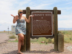
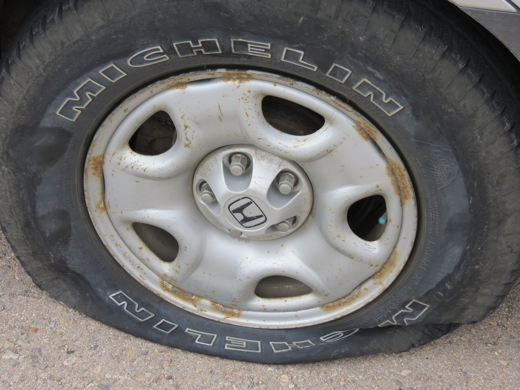
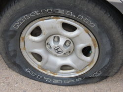 _ Getting into southern New Mexico, highway 380 brought us to the edge of the White Sands Missile Range, the location of the Trinity Site, the site of the first atomic detonation by the United States. We hoped that we could check out some of our nation’s nuclear history, but the security guard at the gate politely notified us that it was a secured military installation and we certainly were not welcome beyond the gate. Passing White Sands, we stopped for a quick lunch at a “roadside table” before hitting the road again. Unfortunately, this time the road hit back, and we suffered a flat tire. Not just any flat tire, but approximately a half inch gash that left air gushing out the tread. Before we lost too much, we jumped back in and milked the Pilot into the parking lot of the Capitan Municipal High School to switch it out. Our goal was to be back on the road before school got out for the day, but we weren’t that quick, and we became our own sort of tourist attraction for the juniors and seniors who were driving home.
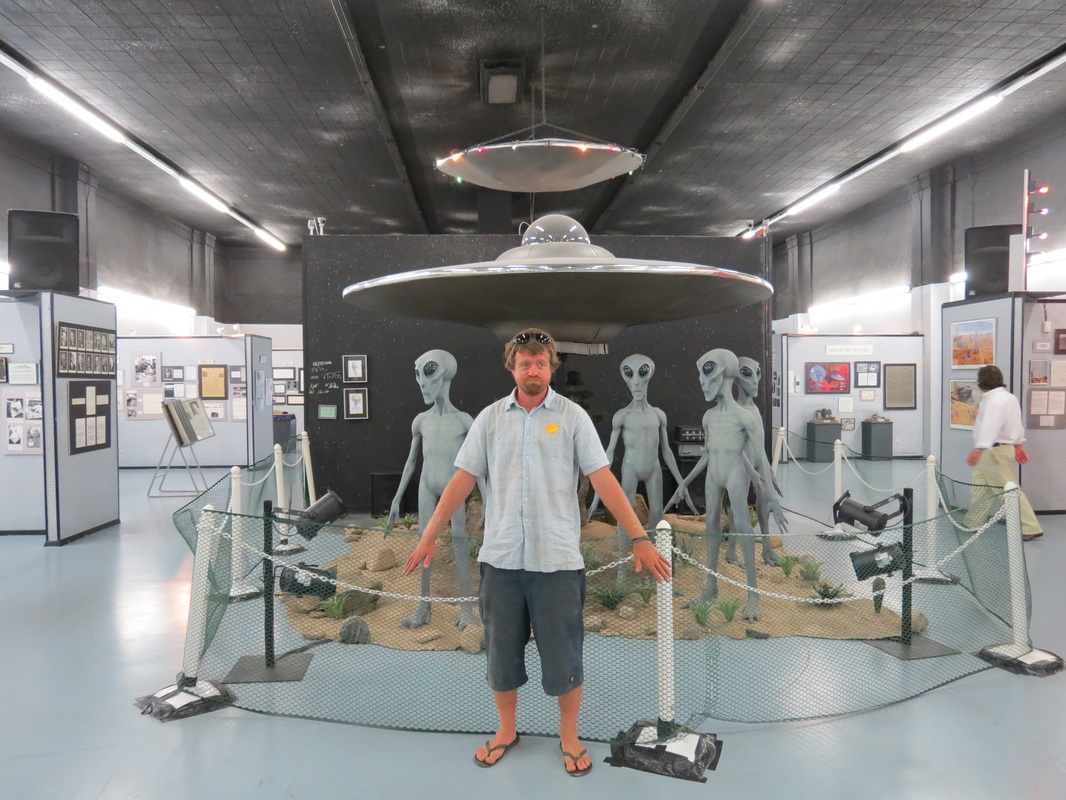
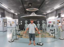 _ We rolled into Roswell significantly later than planned, arriving at the International UFO Museum and Research Center with only twenty minutes left until closing. While we didn’t have time to read all of the newspaper clippings, letters, and other information in the exhibit, we still learned a lot about the “Roswell Incident” and close encounters of the first, second, and third kinds. Perhaps the best part of our visit there was when a fog machine came on, filling the center room with a cloud while the flying saucer started spinning and the aliens started communicating(?).
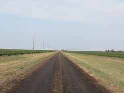
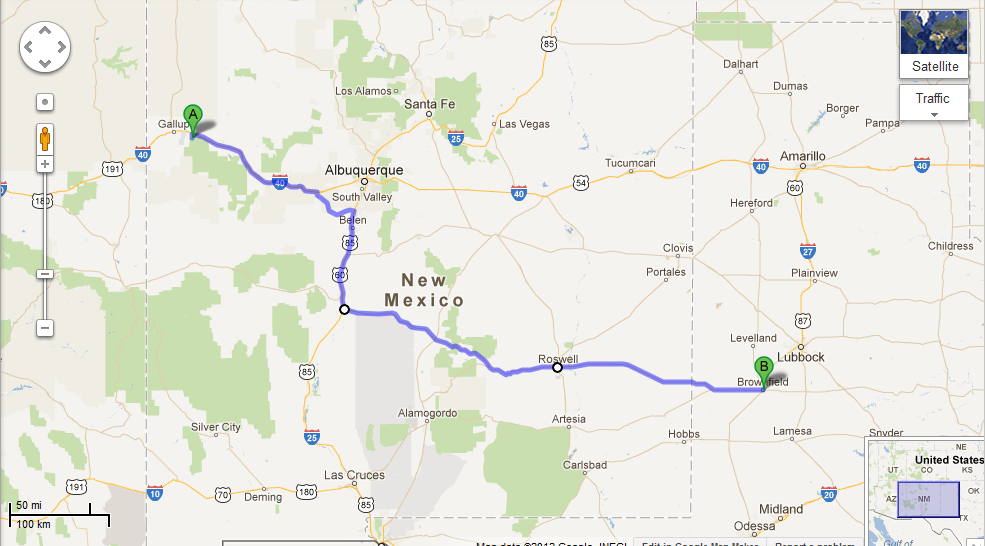
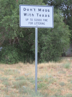 _ After the museum closed, there was not a lot to do in Roswell, according to both the museum attendant who suggested going to the local cinema and to the gift shop clerk/novelist/alien enthusiast who suggested checking out the town library. So, we got out of there faster than the little green guys back in 1947 (or faster than the military cover-up, if you choose to believe that chain of events). Back on Highway 380 East, we crossed the border into Texas and started scoping out a place to throw up our tent for the night. Our search led us to the Glenn Howell Park in Brownfield, where we were able to make a delicious pasta dinner, watch the stars, and sleep by the peaceful lake.
Wednesday, August 15th
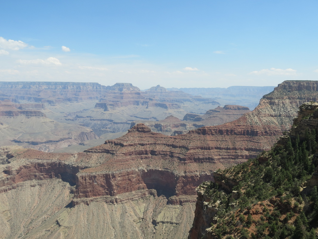
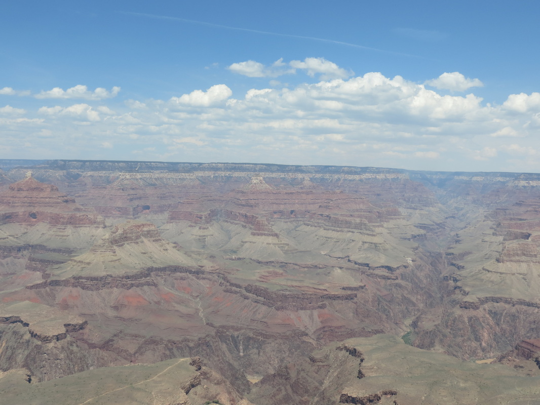
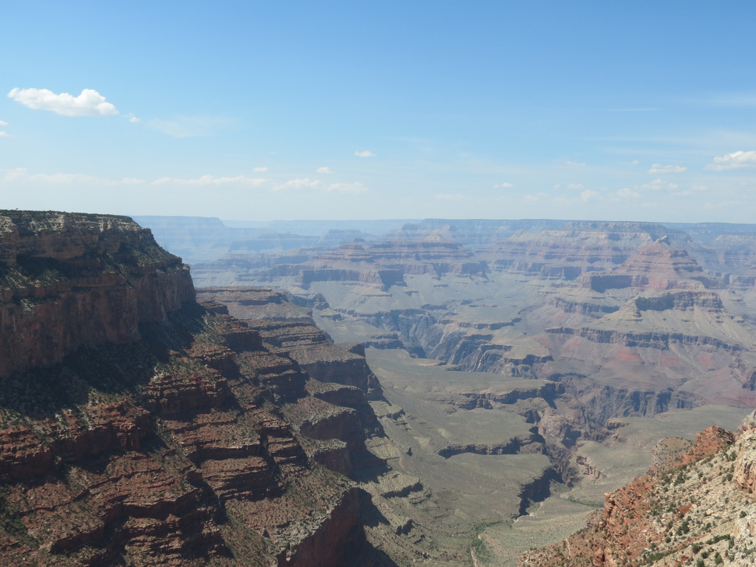
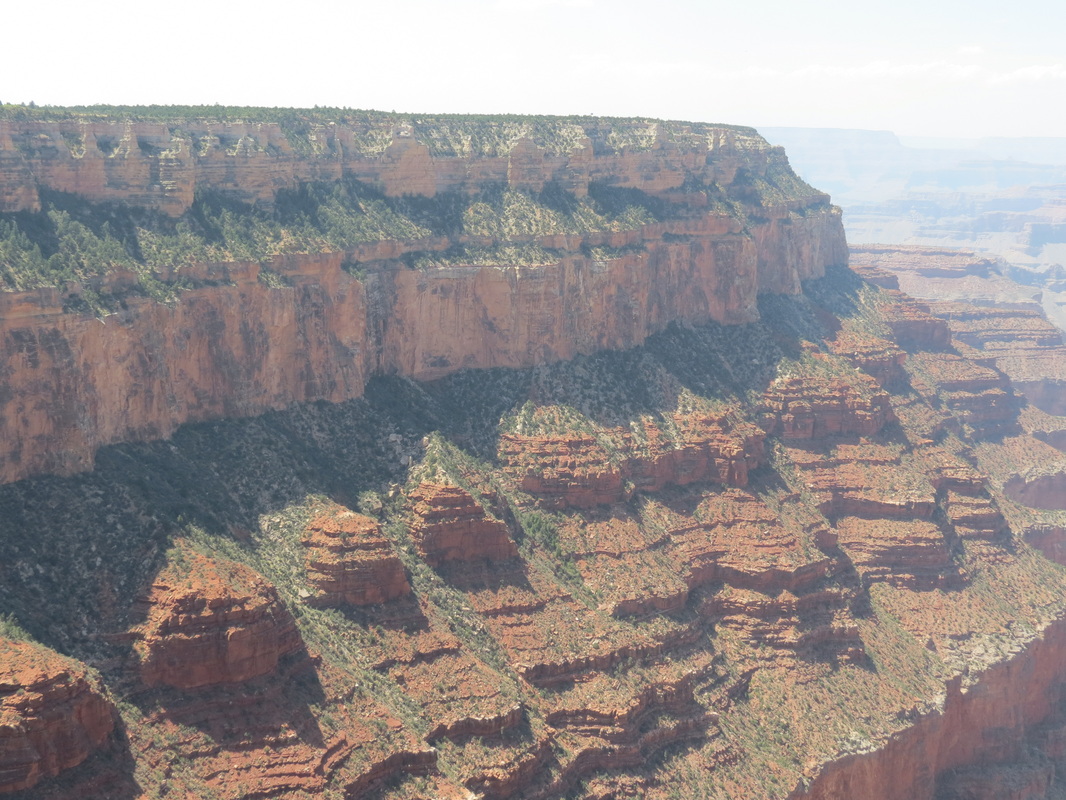
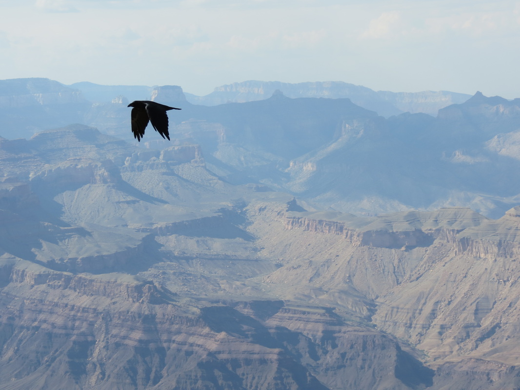
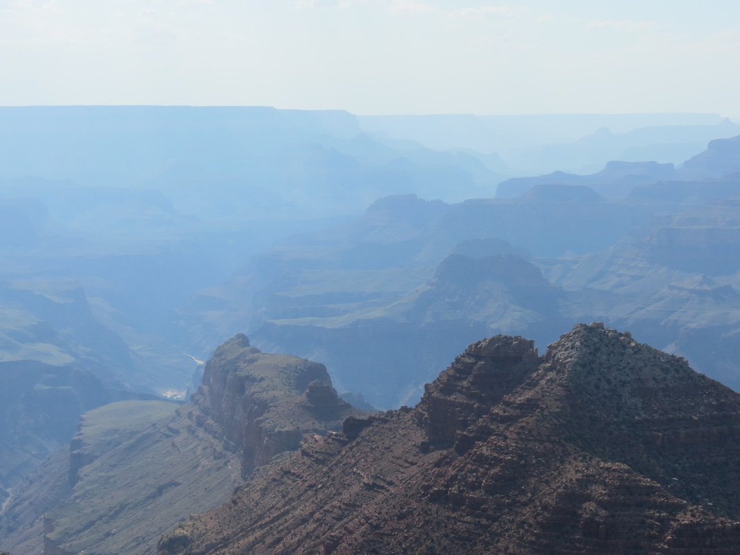
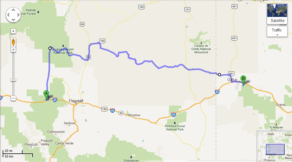
_ Our day started with a walk around downtown Williams along Route 66, which was not quite as happening during the morning as it was the night before, most likely because all of the tourists had already headed out to the Grand Canyon. So, after picking up a few things from Safeway, we followed in their footsteps, ahem, road tracks. Since Chase had spent four months working in the canyon in 2009, he acted as tour guide for the day. We stopped at several scenic viewpoints, but we avoided the overcrowded first view of the canyon at Mather Point and instead spent a while at Yavapai Point and the geology museum there. After cruising around the village, we stopped in at Yavapai Lodge, the hotel where Chase used to work. Luckily, we were able to catch Amy, Chase’s former manager, before she had to run to a Safety Committee meeting. It was great to see Amy again for a couple minutes, but it certainly wasn’t enough time; and ironically, next month she’ll be in Talkeetna while we are both in Tallahassee. 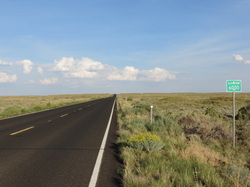 _ At Yavapai, we had to make a decision regarding which route to take: to retrace our morning journey and quickly get back on I-40 or to spend more time driving east in the canyon and take the back roads through the Navajo Nation Reservation. We checked out a few more viewpoints along the rim of the canyon, including Moran Point, the Tusayan Ruins and Museum, the Desert View and Watchtower, and one unnamed overlook where we spent most of the day (at the overlook, we also had the pleasure of overhearing a few conversations, most notably a teenager who wanted to cut down all of the trees so he could see more). Leaving the canyon, we passed a couple of smaller canyons, which were beautiful but certainly not Grand. The roads through Cameron and Tuba City led us past red rocks and into the high plains, which peaked at elevation 7750, not only the highest elevation for the day's drive but also the highest point we have reached on our trip.
 _ We had stopped in Tuba City for gas, and the gas station attendant had told Chase that highway 264 was a straight shot out into the desert wilderness and camping would be easy along the road. Unfortunately, much to the contrary, the road was notably twisty and curvy around rock formations; this prevented us from making good time and made it harder to eat the ice cream we had bought in Tuba City. Furthermore, the road was very highly populated, with towns every few miles and nowhere to pull off and camp. Because of that we drove later than we normally do, passing into New Mexico after dark to camp in the Cibola National Forest.
 _ “Later” is kind of relative though, because we didn’t exactly have a clear idea of what time it was. Arizona is in Pacific time, though the state does not follow Daylight Savings Time, though the Navajo Nation Reservation does follow Daylight Savings Time, though some towns in the reservation don’t, and then New Mexico is in Mountain Time and is different altogether! Rather than trying to keep it straight, we just set up camp and slept when we were tired.
Tuesday, August 14th
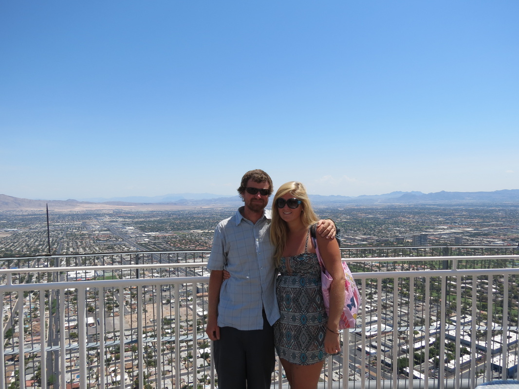
 _ After seeing the view from the tower last night, we wanted to return one more time during the day so that we could see more than just the lights from the Strip. The red mountains surrounding the city and limiting the growth of its sprawl were beautiful juxtaposed against the blue sky, and they are very different from the white mountains Chase is used to seeing in Alaska.
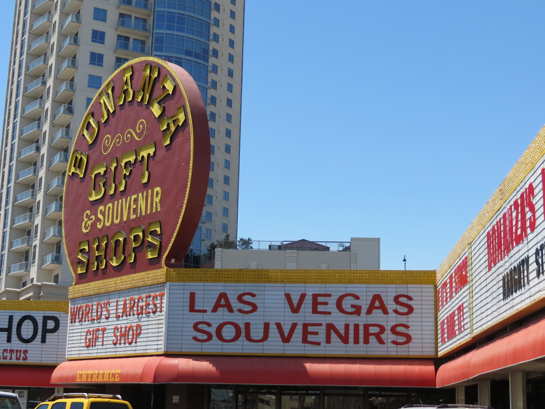
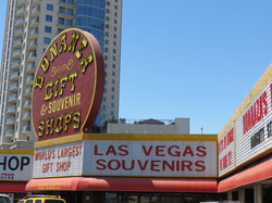 _ Once we finally left our hotel, Charla created a fun challenge for us to attempt. Near the hotel was Bonanza Gifts, the tackiest-looking gift shop on the Strip. We were each going to spend 15 minutes shopping, with a $5 maximum, to buy the other the tackiest item we could find, and we’d have to wear the other’s “gift” at some point during the road trip. Much to our dismay, though the shop was incredibly tacky, it was also shockingly expensive, and we realized that a $5 maximum would not provide for more than a glittery keychain flask. Sadly enough, we decided to scrap the challenge and must rely on our own already tacky wardrobe for the rest of the trip.
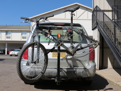 _ Unfortunately, while parked in a lot on the strip, we were approached by our parking lot attendant who notified us that someone had stolen the tire and wheel off of Chase’s bicycle, which was mounted on a bike rack on the Pilot. The parking lot attendant had attempted to stop the man and had called the police, who arrived shortly thereafter. Even more unfortunate, we had seen a man riding a bicycle carrying an extra bicycle wheel a few minutes earlier, but didn’t think much of it. Las Vegas Metro Police have a shockingly quick response time, dispatching two police cars and two police motorcycles to the parking lot, but a brief search failed to turn up the suspect or the wheel. Oddly enough, one of the responding officers notified us that they had recently raised the minimum for petty larceny to $650, which means that in effect it is not a crime to steal tires off of bicycles; if they ever caught the suspect, they’d give him a ticket on par with a ticket for jaywalking. Even so, we filed a police report and the police took pictures, noting the brand and size of the wheel and tire. We can only hope that the wheel happens to find its way into police custody in the next few days, or Chase will be buying a new one in Florida. (In reality, we think that if the motorcycle cops didn’t spot the guy in the first few minutes, the odds of it ever turning up are remarkably slim.)
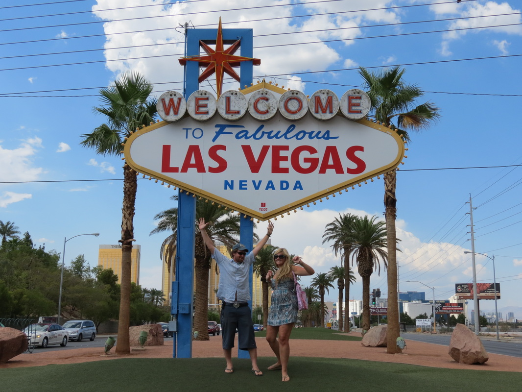
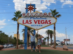 _ Finally making our way out of town, we stopped at the Welcome to Fabulous Las Vegas sign, something we probably would have done a couple days before if it were not on the opposite end of the Strip from where we were staying. We said a quick hello and goodbye to the city of sin (and to an Elvis impersonator taking tourist photos there) and got out. Before we were too far away, we spotted a Jack in the Box, which was offering free chicken nuggets for the people of Las Vegas. We counted ourselves among that crowd for a hot second and took the chicken nuggets to go.
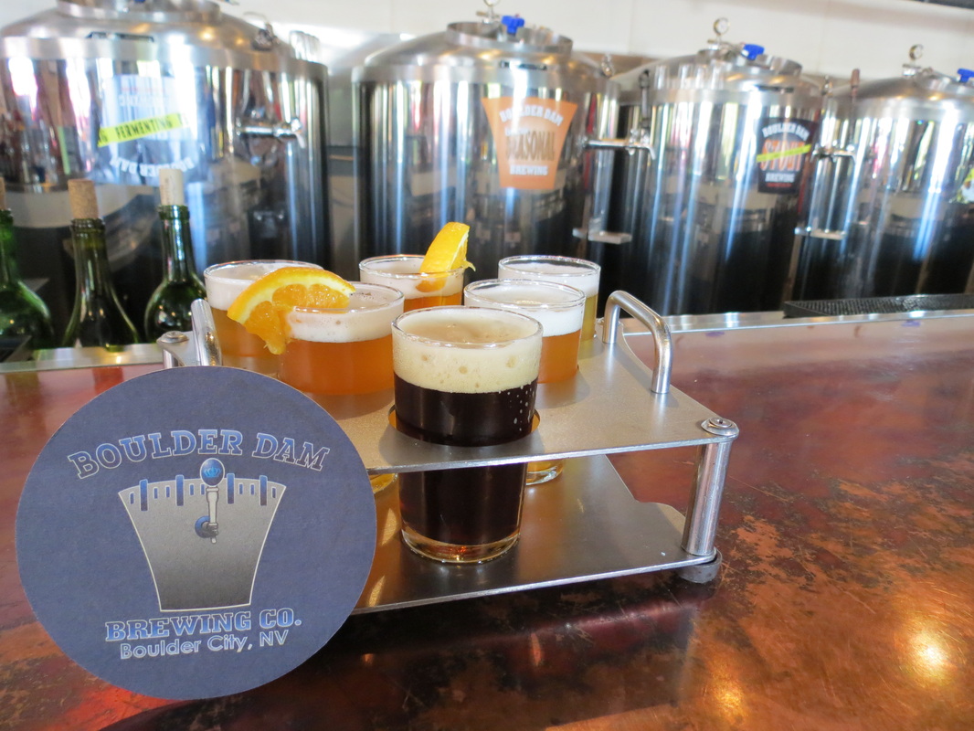
 _ As we made our way to Hoover Dam, a small brewery in Boulder City caught our eyes, so we stopped at the Boulder Dam Brewing Company to try their sample flight, conveniently arranged in the shape of the dam.
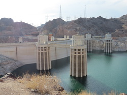 _ Leaving Boulder City, we soon arrived at the Hoover Dam, and the trusty Pilot once again had the pleasure of driving over a massive dam. We stopped for photos on the far side of the dam, as we crossed the Arizona state line, and then we parked the Pilot to walk back into Nevada over the dam.
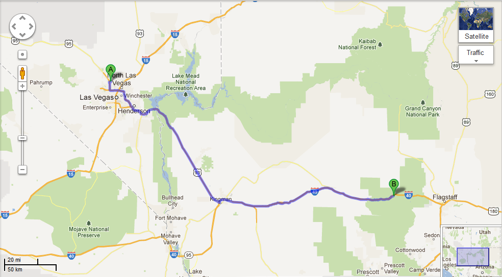
 _ From Hoover Dam, we traveled Highway 93 to I-40 and into the quaint town of Williams, whose main street is the famous Route 66 (we got our kicks!). We had planned to go all the way to the Grand Canyon that night, but Williams captured us, and we decided to stay.
|


 RSS Feed