Wednesday, August 15th
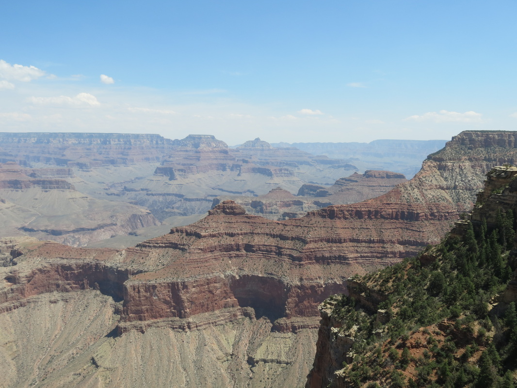
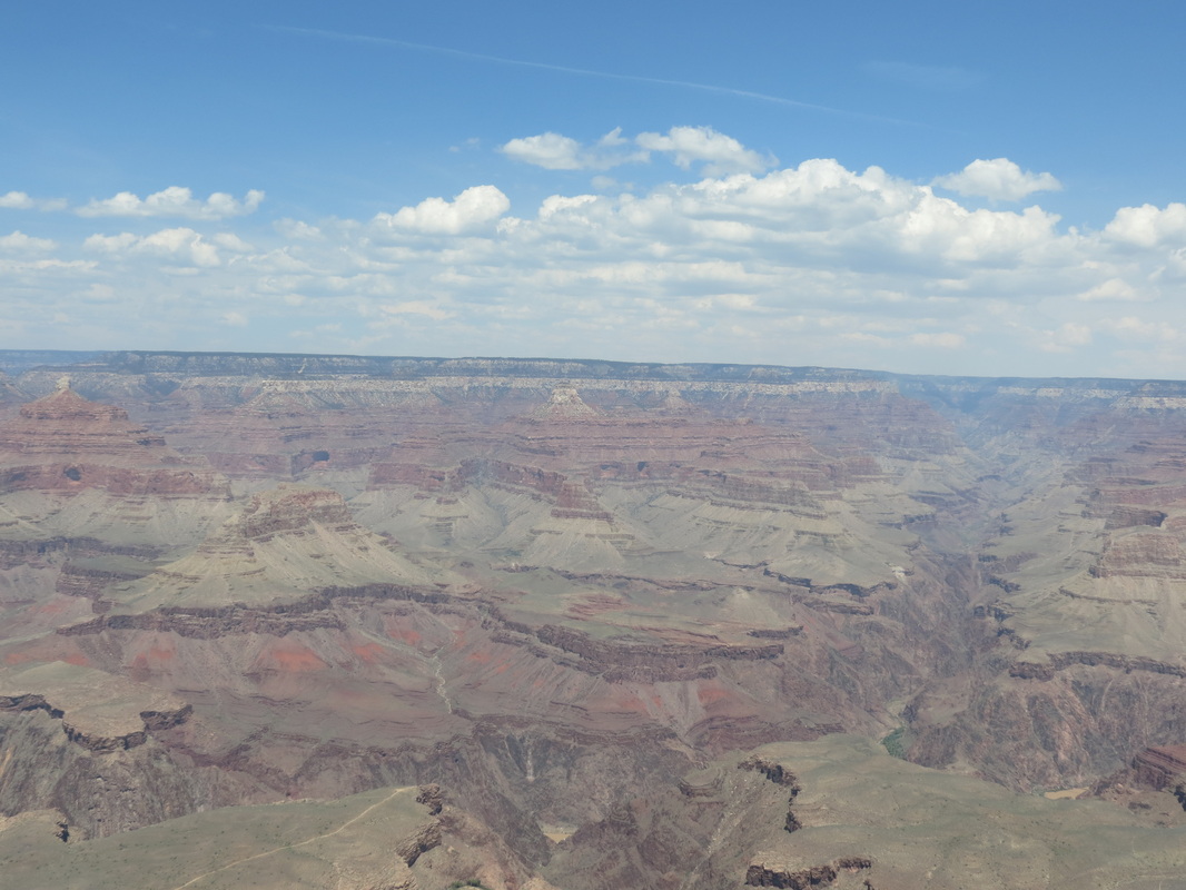
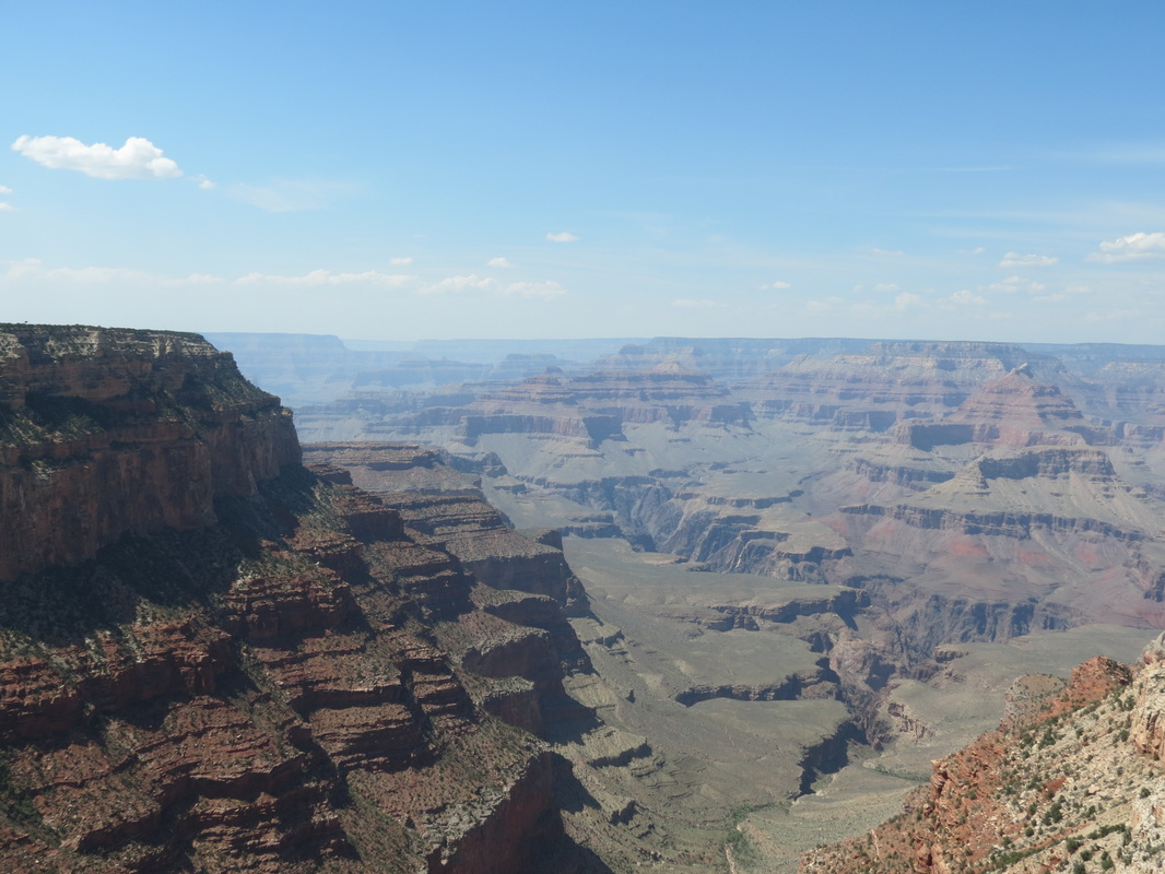
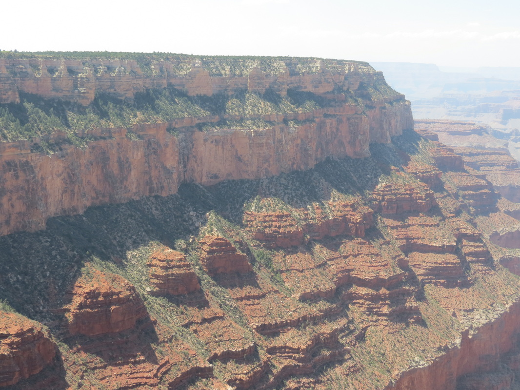
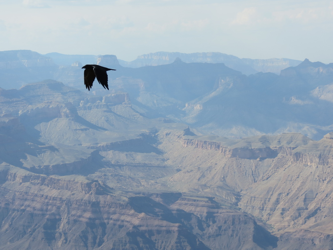
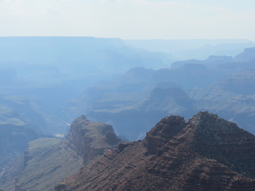
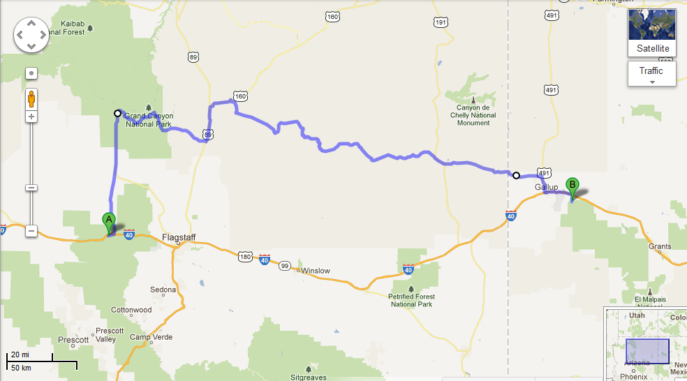
_ Our day started with a walk around downtown Williams along Route 66, which was not quite as happening during the morning as it was the night before, most likely because all of the tourists had already headed out to the Grand Canyon. So, after picking up a few things from Safeway, we followed in their footsteps, ahem, road tracks. Since Chase had spent four months working in the canyon in 2009, he acted as tour guide for the day. We stopped at several scenic viewpoints, but we avoided the overcrowded first view of the canyon at Mather Point and instead spent a while at Yavapai Point and the geology museum there. After cruising around the village, we stopped in at Yavapai Lodge, the hotel where Chase used to work. Luckily, we were able to catch Amy, Chase’s former manager, before she had to run to a Safety Committee meeting. It was great to see Amy again for a couple minutes, but it certainly wasn’t enough time; and ironically, next month she’ll be in Talkeetna while we are both in Tallahassee. 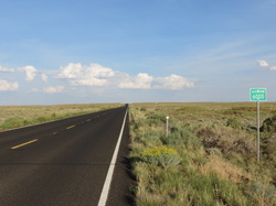 _ At Yavapai, we had to make a decision regarding which route to take: to retrace our morning journey and quickly get back on I-40 or to spend more time driving east in the canyon and take the back roads through the Navajo Nation Reservation. We checked out a few more viewpoints along the rim of the canyon, including Moran Point, the Tusayan Ruins and Museum, the Desert View and Watchtower, and one unnamed overlook where we spent most of the day (at the overlook, we also had the pleasure of overhearing a few conversations, most notably a teenager who wanted to cut down all of the trees so he could see more). Leaving the canyon, we passed a couple of smaller canyons, which were beautiful but certainly not Grand. The roads through Cameron and Tuba City led us past red rocks and into the high plains, which peaked at elevation 7750, not only the highest elevation for the day's drive but also the highest point we have reached on our trip.
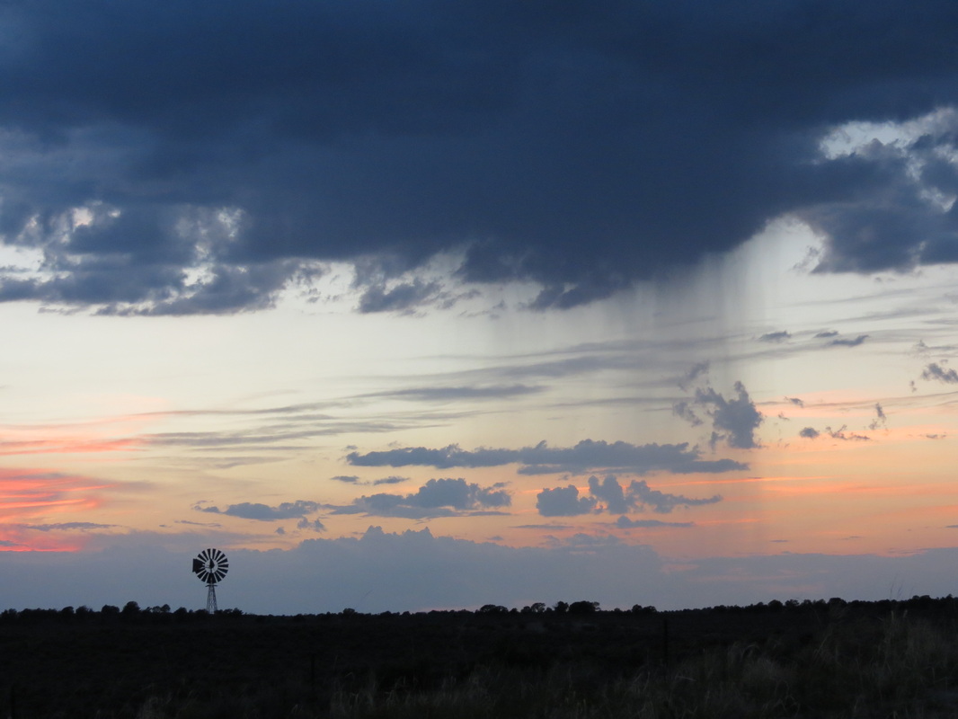
 _ We had stopped in Tuba City for gas, and the gas station attendant had told Chase that highway 264 was a straight shot out into the desert wilderness and camping would be easy along the road. Unfortunately, much to the contrary, the road was notably twisty and curvy around rock formations; this prevented us from making good time and made it harder to eat the ice cream we had bought in Tuba City. Furthermore, the road was very highly populated, with towns every few miles and nowhere to pull off and camp. Because of that we drove later than we normally do, passing into New Mexico after dark to camp in the Cibola National Forest.
 _ “Later” is kind of relative though, because we didn’t exactly have a clear idea of what time it was. Arizona is in Pacific time, though the state does not follow Daylight Savings Time, though the Navajo Nation Reservation does follow Daylight Savings Time, though some towns in the reservation don’t, and then New Mexico is in Mountain Time and is different altogether! Rather than trying to keep it straight, we just set up camp and slept when we were tired.
Saturday, August 11th
 _ Like many other mornings on this trip, we started out today with breakfast sandwiches; this time from the Great Harvest Bread Company in downtown Bend. (Tomato and spinach were only a dollar extra, but well worth it.) After breakfast we made our way to the Deschutes Brewery, hoping to enjoy the visitor center and a tour. Surprisingly, we arrived 45 minutes before they opened. That gave us time to talk to the bartenders, who gave us a Bend Ale Trail map and sent us on our way. We had no idea that Bend had nine breweries!
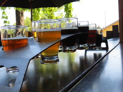
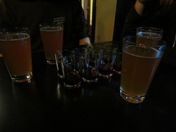
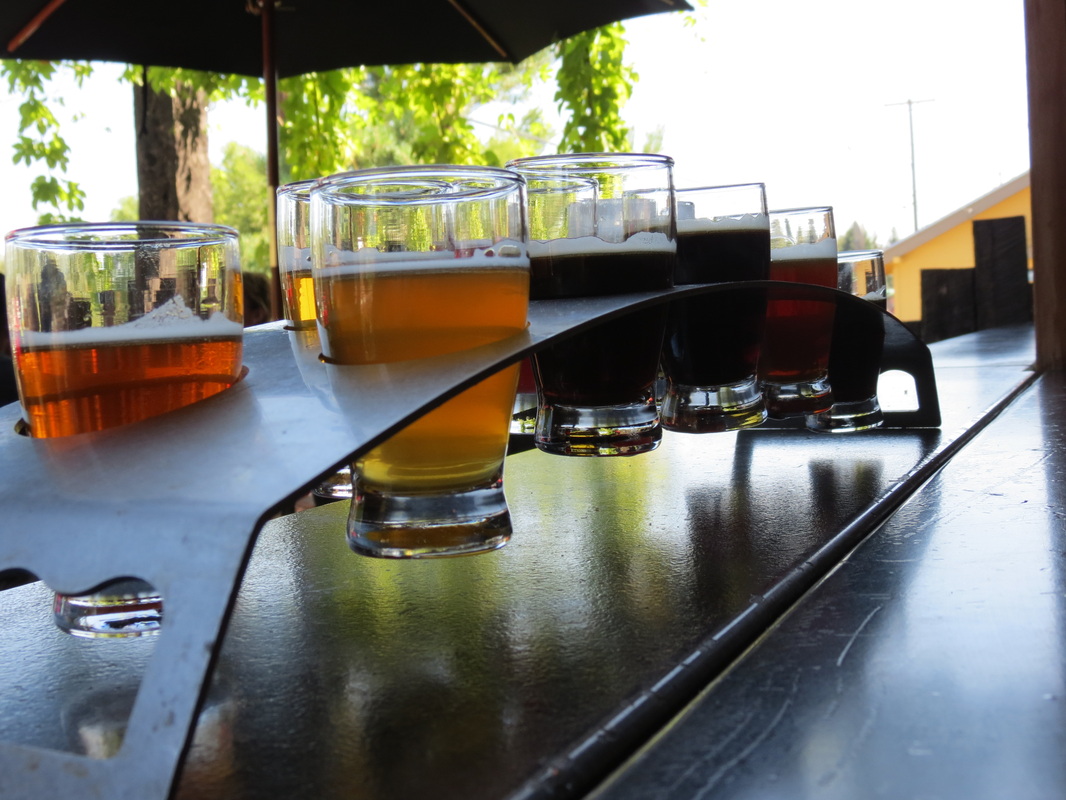
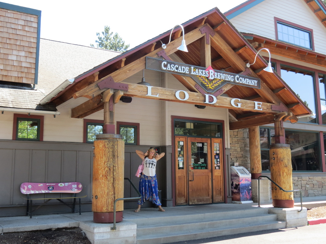
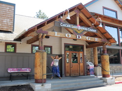 _ We first went to 10 Barrel Brewing Company, where we started off the day with a sampler flight of ten of their beers. We really enjoyed the beer, though we were disappointed that the flight wasn’t actually arranged from light to dark, in the order that they should be sampled. Our favorites were the Northwest Red and the S1nist0r Black ale, which was uniquely refreshing for a beer that dark. We then rushed to Cascade Lakes Brewing Company to sample their Blonde Bomb Shell and their IRA (India Red Ale).
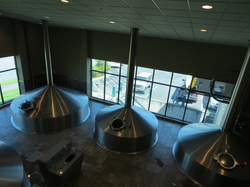 _ Finally, it was time to return to Deschutes for our much anticipated brewery tour and samples. Between the two of us, we tried the Chainbreaker WIPA, Twilight Summer Ale, Mirror Pond Pale Ale, Zymerge, and Black Butte XXIV. We also joined a 45-minute tour of the brewing facility, where they make all the beer that they distribute to all the western states and provinces. We enjoyed perusing the label gallery at the end of the tour, specifically the labels for the seasonal Jubelale which Deschutes commissions from a different local Northwest artist each winter. On our way out of town we stumbled upon Silver Moon Brewing to sample the Life Guard Blonde (“A blonde for a blonde,” according to the bartender) and Hopnob IPA, as well some well deserved lunch.
 _ After a quick gas fill-up, we were on our way out of town heading east on Highway 20. We once again entered the crazy high desert terrain from yesterday. We agreed that we never imagined this kind of topography would exist in Oregon, as it instead conjures ideas of the Southwest. Another gas top off in Burns (because you never know where the next station will be in the desert) and we were heading south on Highway 78. Our friend Chris, from Talkeetna, had told us to be on the lookout for hot springs in this area, and we quickly came to Crystal Crane Hot Springs. We were looking for something natural, not commercial, but we soon changed our mind on hot springs entirely; when the air temperature is this hot, 101 degree water just doesn’t feel pleasant.
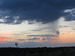
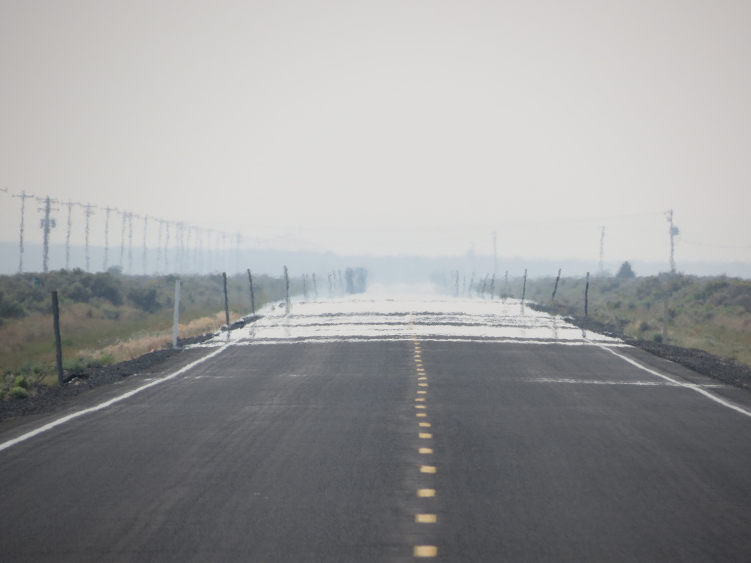
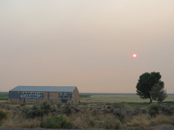 _ Pulling away from Crystal Crane the sky acquired a pink hue and the sun began to turn red. Apparently there is a forest fire burning in Fields, and the smoke from the fire is creating a haze throughout the eastern reaches of the state. As the haze caused dusk to come earlier than normal, we pulled off the road and found a great spot to camp on top of a butte overlooking the Steens Mountains. Once again from the top of our butte we were able to enjoy some amazing stargazing and watch the Perseid meteor show. In other news, we finally found the most elusive license plate for our license plate game: Hawaii! It was on a car just sitting there in downtown Bend. (Click here to see how the game is progressing.) Coincidentally, before we even said anything about it, the gas station attendant in Burns also mentioned that he had seen a Hawaii license plate pull through today for the first time in a long while. Maybe there are some Hawaiians out there doing the same drive we are, at least from Portland to Las Vegas. If you see the silver Honda Pilot with the Alaska tag and the bike on the back, honk your horn!
Note: While touring the Bend Ale Trail, we shared small size samples over the course of several hours and with two meals. Please enjoy the Ale Trail responsibly and don't drink and drive!
Wednesday, August 8th
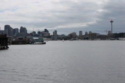 _ We woke up rocked by the waves of floatplanes taking off beside Noelle’s floating home on Lake Union. We hung out with Noelle while she made us a delicious breakfast, and then we walked around her dock to check out the different floating homes in her “community.” After a late start out of Seattle, we rocketed down to Portland on I-5.
 _ We arrived at Elliot and Brad’s apartment and our hosts gave us a nice tour of historic Irvington, the neighborhood in which they live. The four of us shared a “bucket,” a delicious concoction whose recipe we brought back from Southeast Asia earlier this summer. Once we had had our bucket and were ready for a fun evening we jumped on the MAX train for a trip downtown into Portland. Portland is known for its variety of food carts and casual street food, and we decided to go for the real local experience by devouring Egyptian food. The Egyptian food made us thirsty, so Elliot brought us to Momo’s, his regular after-work watering hole, where we were met by some of his co-workers for a few drinks and a lot of laughs.
The tour of Portland continued after Momo’s as we were brought to public squares and historic areas downtown. One of the most interesting was a square where if you stood in a specific spot within a circular brick structure you could hear your echo even though those standing around you could only hear your regular voice. From there, a quick MAX ride brought us back to Irvington and a comfortable bed.
Tuesday, August 7th
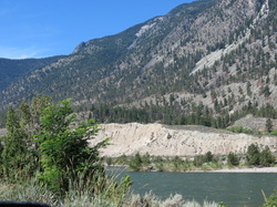
 _ Once again, we had the pleasure of packing up camp in the rain; we went to sleep with a nice lightning show above and assume the rain started shortly afterward. The benefit of a rainy morning is that it got us on the road nice and early! After a couple of hours we drove out of the rain and stopped at an overlook near Big Bar Lake to cook up some breakfast. After passing through British Columbia’s agricultural district for a couple hours, we made it off Highway 29 and onto the Trans-Canada Highway to drive through the Fraser Canyon. The Fraser Canyon is a narrow, rocky canyon cut by the Fraser River, and the two-lane road follows the path of the river while clinging to the side of the cliff.
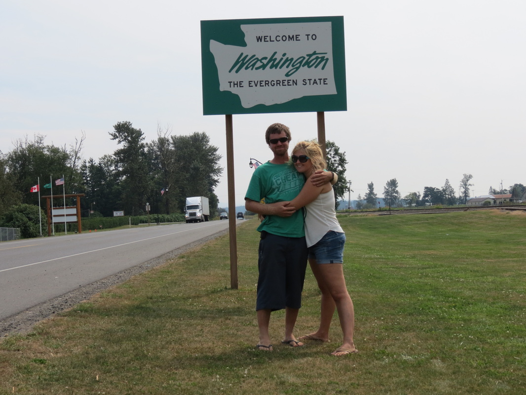
 _ Once through the Canyon we had one last Canadian stop in Chilliwack, by far our most successful shopping attempt of the trip. We were able to do a last-minute stop for Canadian chocolates and beer not available south of the border, as well as some other errands that needed to be run. We sped immediately from Chilliwack to Abbotsford, where we crossed the border for the last time into the Lower 48! Another easy border crossing (where we did declare our Timbits, or donut holes from Tim Horton’s), we found ourselves in Sumas, Washington.
 _ Two hours of interstate travel later we stopped in Kirkland, Washington, to visit our friend Alison. It was great to reconnect, and we took a walk through beautiful Kirkland past the Wilde Rover, the scene of past adventures of Charla and Allison. Our destination this evening was just next door at Hanuman Thai Café, Charla’s first Thai food since leaving Thailand earlier this summer. The prices were a little higher than Bangkok street-food (though also significantly lower than prices in Talkeetna), but Charla still approved of the cuisine. Later that evening we headed into Seattle to visit Noelle, one of Chase’s friends from Talkeetna. We quickly all became friends and slept soundly that night rocked by the waves of Lake Union.
Saturday, August 4th
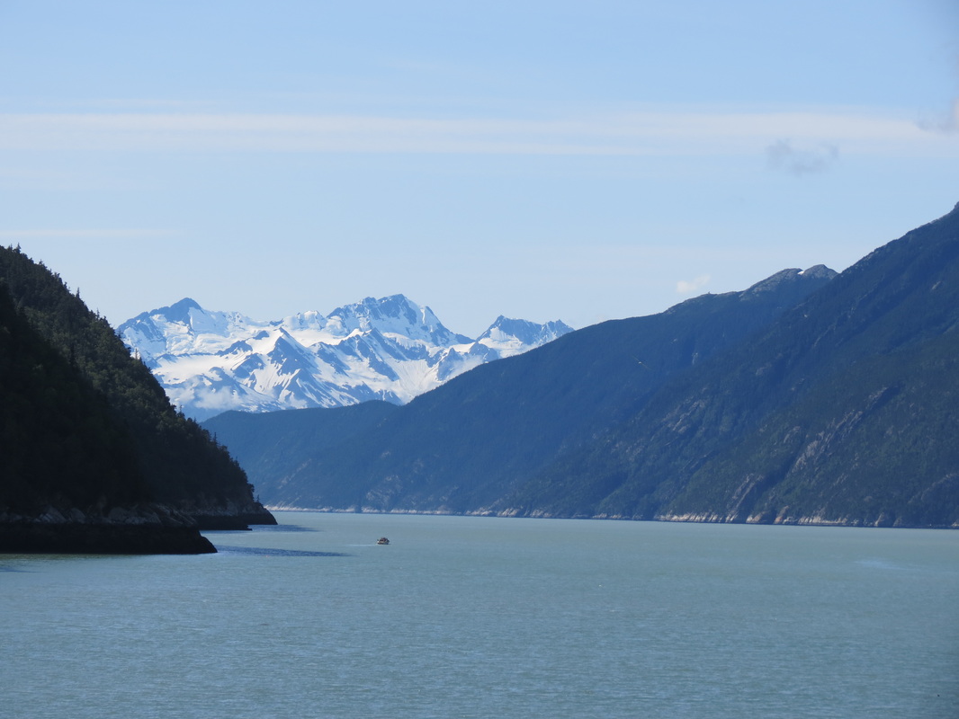
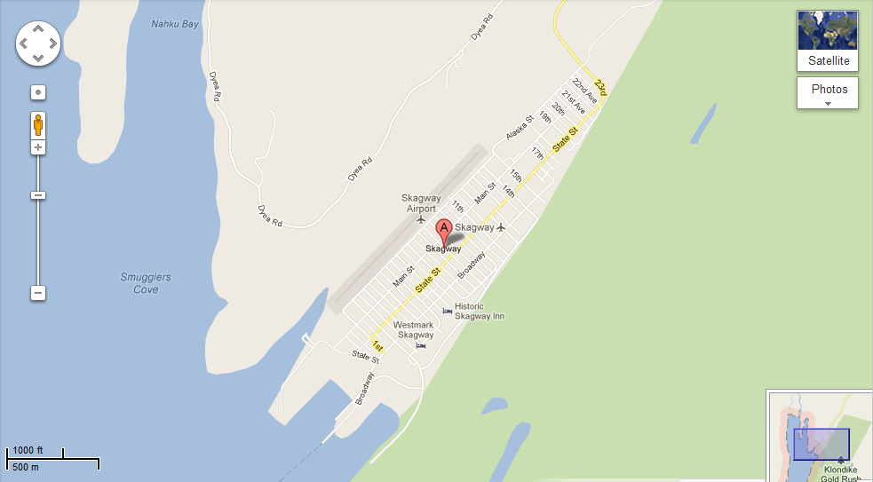
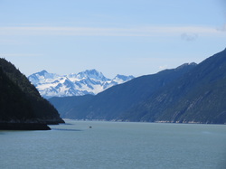 _ Much to everyone’s surprise (especially the local Skagwegians), we woke up to a beautiful sunny day! We explored town a bit more, including a walk down to the cruise ship dock, where a new boat had unloaded its happy passengers earlier that morning. From the dock, we had some sweet views of the Tracy Arm. Then, we made our way back into town for some pan au chocolate at Glacial Smoothies and Espresso. Noticing an ad in the Skaguay Alaskan paper in the coffee shop, we stopped in a store nearby for a free train whistle with the purchase of some snazzy bear socks. In times of radio silence while driving through massive British Columbia, the train whistle certainly came in useful (without much success, we both attempted playing songs ranging from Lady Gaga’s “Born This Way” and a smattering from Lonely Island).
 _ After much hugging and a few high fives at the Attic, we started the scenic drive out of Skagway through White Pass, climbing some 3,000 feet in just nine miles and crossing the Canadian-America border one more time.
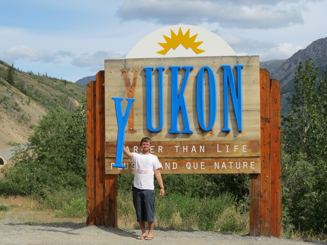
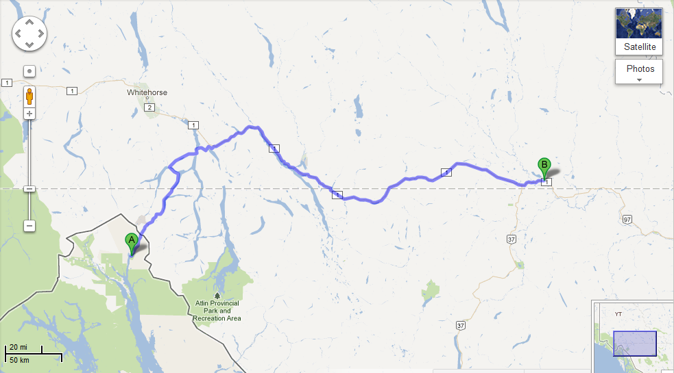
 _ We crossed from BC into the Yukon, where we happened upon the deserted Venus Mill mining structure on Tutshi Lake. Built in 1908, it was meant as a last-ditch effort to try to mine silver from the lake, but it was unsuccessful. Later on we crossed through Carcross (from the original town’s name CARibou CROSSing) and then the Tagish Road onto the Alaska Highway for the third and longest stretch of our trip.
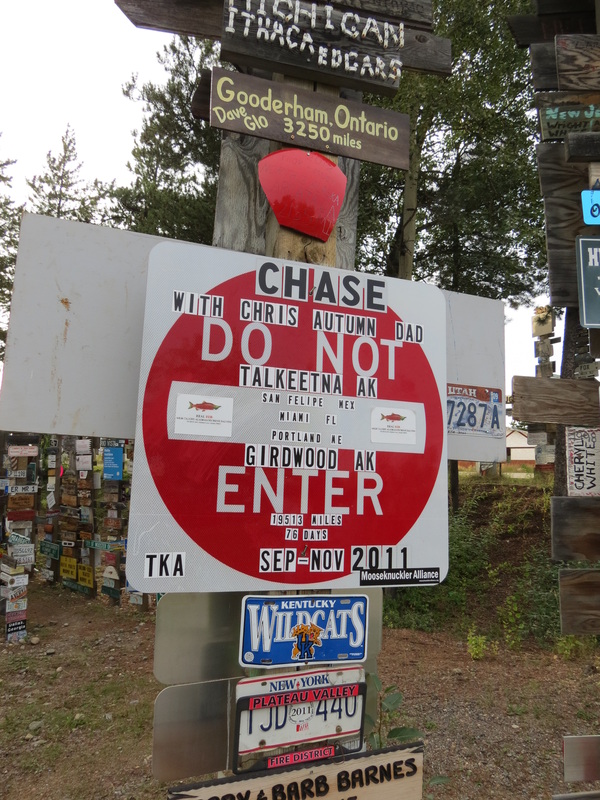
 _ We made a quick stop in Teslin for gas and groceries before making a nice lunch overlooking Nisultin Bay just outside of town. With a full tank in the trusty Pilot and full stomachs, we covered a lot of ground before reaching the Watson Lake Signpost Forest. We meandered around a bit and made the necessary stops to check up on Chase’s two signs there. We skipped out on the Northern Lights Centre, deciding that we would just have to wait until our return to Alaska to see them again in the sky and not on film. From there, we drove for a bit and started seeking out a place to rest for the night. Our first stop was place we will forever call mosquito land. We took a turnoff, hopeful for a nice spot, but it looped around back towards the Highway. We found what appeared a nice spot in the back of the loop, but after a few minutes of setting up the tent, we were swarmed with plaque-like quantities of mosquitoes and quickly decided to pack it all in and search for something better. We stopped in a rock quarry a few miles down the road that was still fairly mosquito-infested but a much better option for a place to make dinner and get some rest.
Friday, August 3rd
 _ We woke up among the Klondike gold rush-era facades of the Attic, as Freddie’s apartment complex is known among the residents. Once again it was time for more blueberry pancakes using Charla’s blueberries from Talkeetna! (Readers might have noticed that by now they’ve been smuggled across a second international border, so we should get around to eating them.)
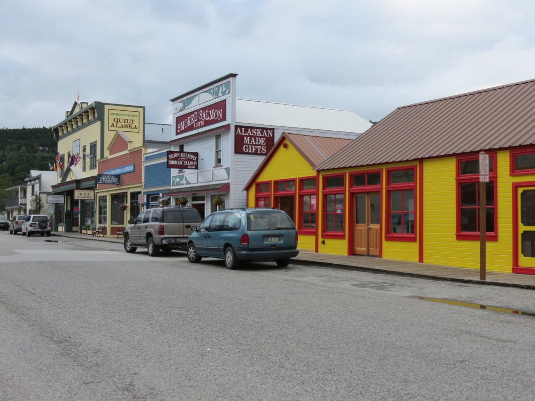
 _ After filling up on pancakes we ventured into town to discover that Skagway receives a lot of rain. And wind. And clouds. And 600,000 cruise ship visitors a year in a town of 900 people. Like the cruise ship people, though far more appreciative of their services, we visited the National Parks Service visitors’ center to start our day. After exploring town (which essentially constitutes walking from one end of Broadway to the other) we returned to the Attic for lunch and were pleasantly surprised when Freddie got off of work early and came back to join us.
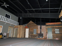
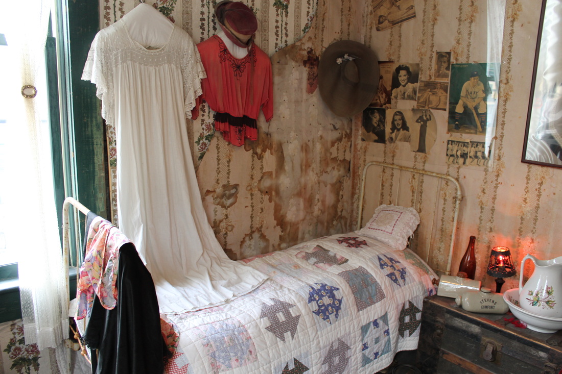
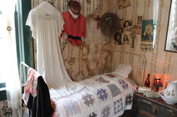 _ We spent the rainy afternoon getting to know Freddie’s roommates and coworkers, and then ventured back into town for a stop at the local brothel. The Red Onion was Skagway’s brothel back during the gold rush days of the 1890s (and a post office, telegram station, military barracks, etc., before becoming the museum it is today; hence, the 1940's and 50's pinups on the walls), and the fully-functional bar gives tours of the upstairs where the girls never missed a trick. Today it costs $5 to get upstairs for 15 minutes, which is the exact same that it cost in 1899.
 _ Before departing on the trip we had become accustomed to Burger & Brew at the West Rib Pub in Talkeetna on Friday nights, where you get a burger and a PBR for $6.95. We were adrift in Skagway without our Friday night staple, until a whispered rumor sent us to Jewell Gardens for Friday night Hippie Hour where the burgers are $5 and the PBRs are $2. Though an extra nickel changed hands, we were able to keep up the Friday night tradition!
 _ After dinner, we started up a new Friday night tradition at the Skagway Brewing Company. Well, perhaps not a tradition since it won’t happen again, but we all wish it was a tradition. The BrewCo was offering 75 Cent Mystery Shot night, which we descended upon with Freddie and a couple of his roommates. In addition to 75 cent shots, the BrewCo also had its signature Spruce Tip Blonde back on tap, a favorite of ours after sampling a brown and an IPA the night before. After a wild time at the BrewCo (where we were the only table ordering mystery shots and also the only table being wild) we made a quick stop back at the Red Onion. A lowly brothel by day, the RO turns into a dance club at night, luring in the likes of a bachelorette party all the way from Whitehorse.
Tuesday, July 31st
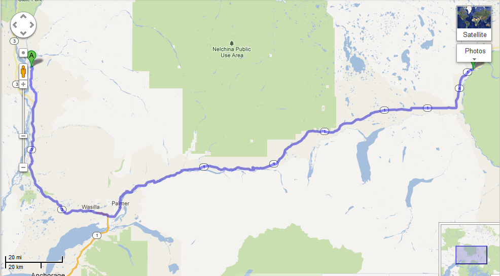
 _We got a late start out of Talkeetna after a rush job of packing all of Chase’s worldly possessions into the back of a Honda Pilot. Luckily, Alex and Paul were also hanging out at the cabin for company and moral support (and loading some of Chase’s stuff that wouldn’t fit into Mugly, Alex’s truck, to take home to Seward). Once everything was loaded and ready to go, it was time for one last run into town. Ostensibly, the run into town was for a growler of beer from Denali Brewing Company and bag of baked goods from the Talkeetna Roadhouse, but you can’t make it on to Main Street without running into everyone you know. After a hearty round of goodbyes (as well as a growler and some baked deliciousness) we were finally on the Talkeetna Spur Road heading out of town. Once on the Spur, we started our epic game of “finding license plates from every state and province.” (Click here for updates on how the game is going and where we’re finding the different plates.) We got a bunch of them right away heading south on the Parks Highway.
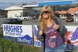 _After the requisite and dreaded stop at Fred Meyer in Wasilla for supplies and a stop in Palmer for gas, we were on our way! (And look who decided to run for office at the gas station! No, no, the sign’s actually for Shelley Hughes who’s running for the State House.)
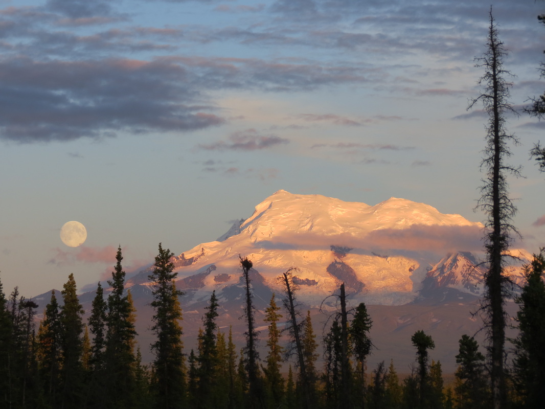
 _ A nice drive east on the Glenn Highway led us through the Chugach Mountains and past Matanuska Glacier. After taking the left to Canada in Glenallen on the Richardson Highway, the full moon started rising over Mount St. Elias and the mountains exhibited an amazing alpenglow. Twenty-one miles into the Tok Cut-Off we found a great spot to hunker down for the night with bathrooms and picnic tables and all!
|


 RSS Feed