Wednesday, August 15th
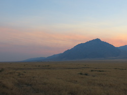
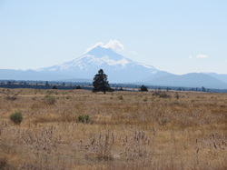
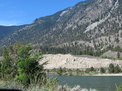
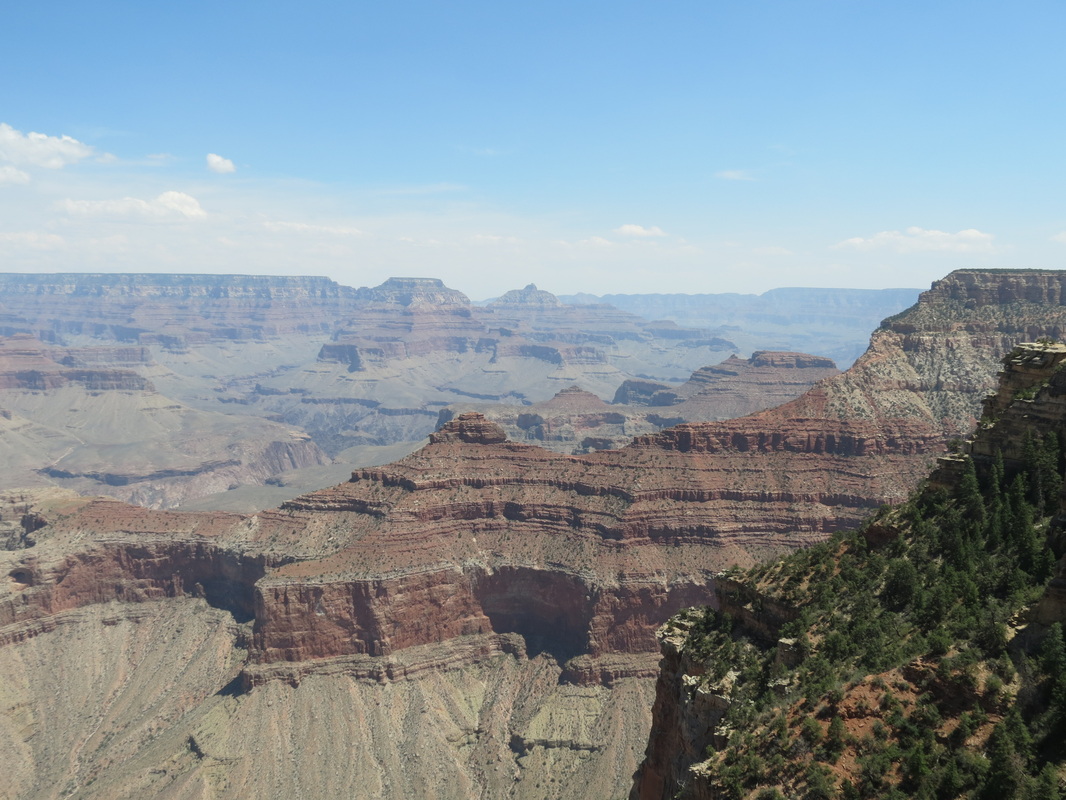
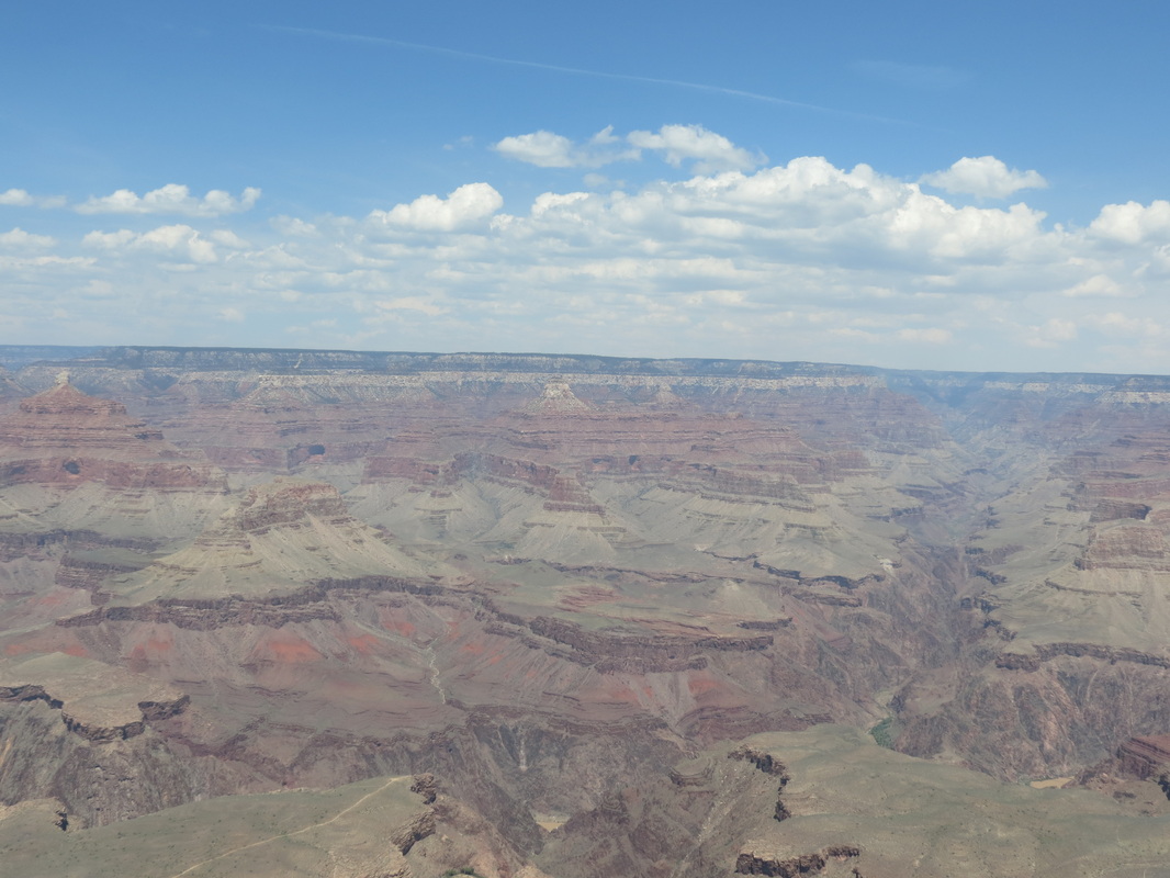
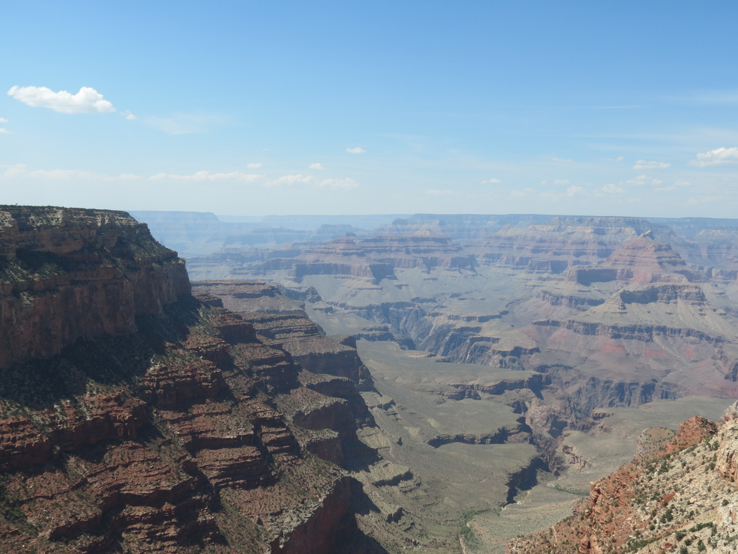
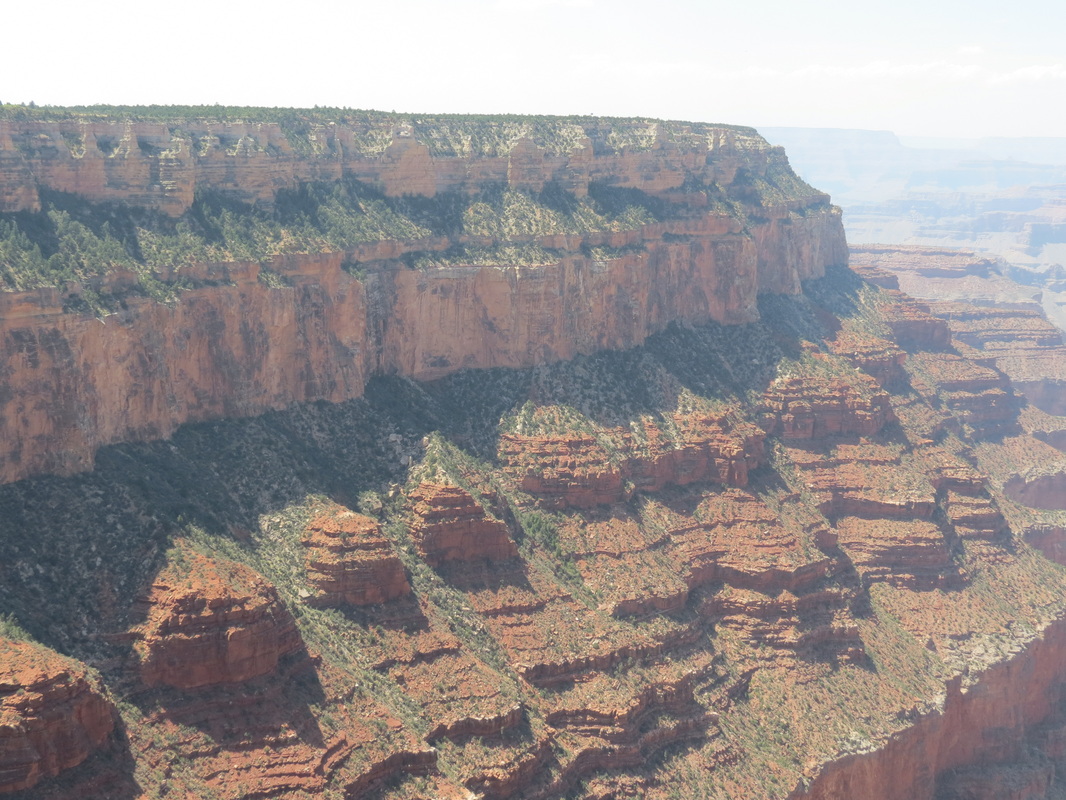
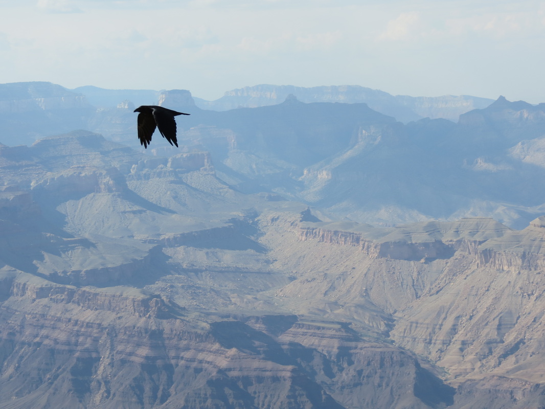
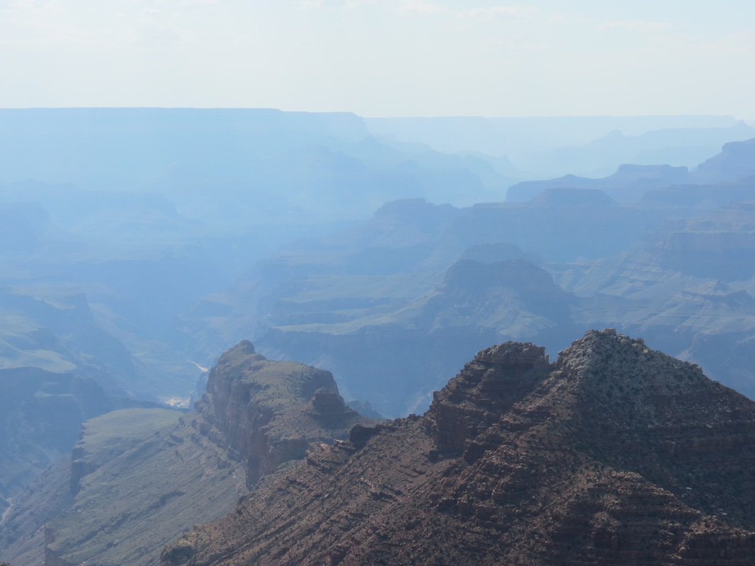
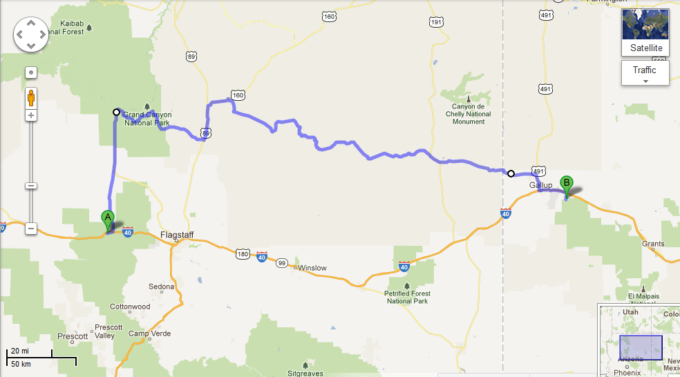
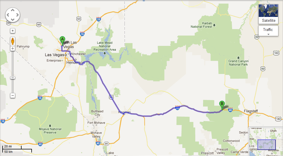
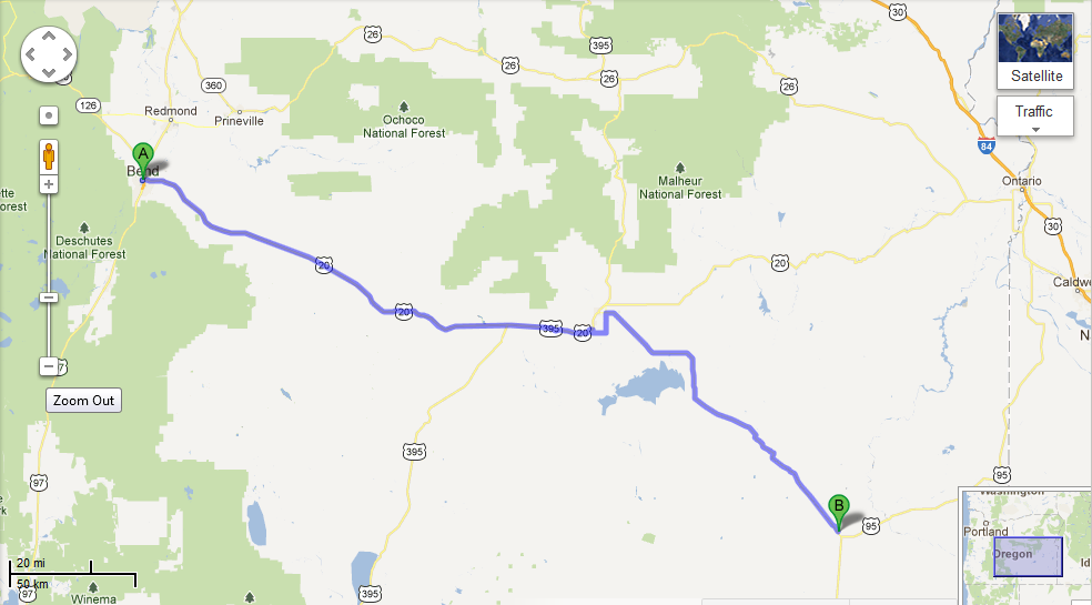
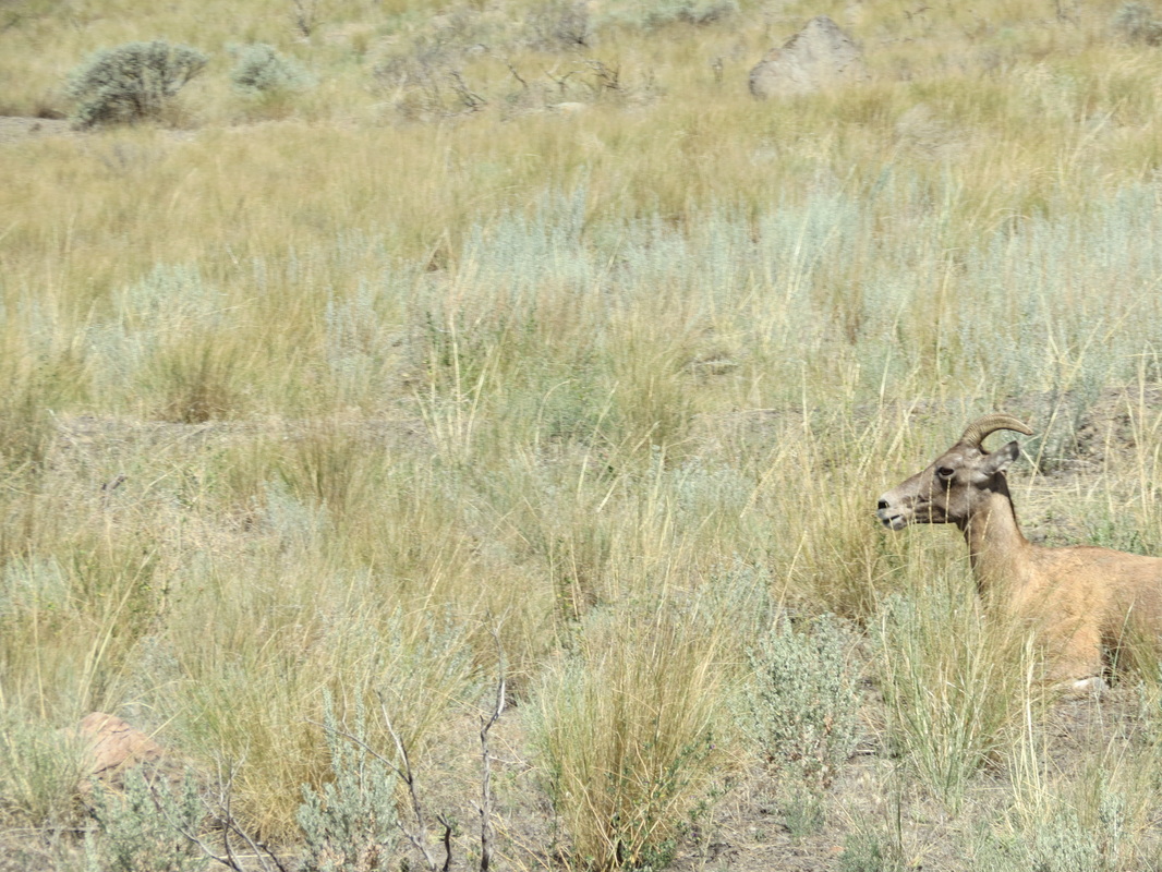
_ Our day started with a walk around downtown Williams along Route 66, which was not quite as happening during the morning as it was the night before, most likely because all of the tourists had already headed out to the Grand Canyon. So, after picking up a few things from Safeway, we followed in their footsteps, ahem, road tracks. Since Chase had spent four months working in the canyon in 2009, he acted as tour guide for the day. We stopped at several scenic viewpoints, but we avoided the overcrowded first view of the canyon at Mather Point and instead spent a while at Yavapai Point and the geology museum there. After cruising around the village, we stopped in at Yavapai Lodge, the hotel where Chase used to work. Luckily, we were able to catch Amy, Chase’s former manager, before she had to run to a Safety Committee meeting. It was great to see Amy again for a couple minutes, but it certainly wasn’t enough time; and ironically, next month she’ll be in Talkeetna while we are both in Tallahassee. 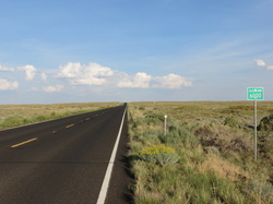 _ At Yavapai, we had to make a decision regarding which route to take: to retrace our morning journey and quickly get back on I-40 or to spend more time driving east in the canyon and take the back roads through the Navajo Nation Reservation. We checked out a few more viewpoints along the rim of the canyon, including Moran Point, the Tusayan Ruins and Museum, the Desert View and Watchtower, and one unnamed overlook where we spent most of the day (at the overlook, we also had the pleasure of overhearing a few conversations, most notably a teenager who wanted to cut down all of the trees so he could see more). Leaving the canyon, we passed a couple of smaller canyons, which were beautiful but certainly not Grand. The roads through Cameron and Tuba City led us past red rocks and into the high plains, which peaked at elevation 7750, not only the highest elevation for the day's drive but also the highest point we have reached on our trip.
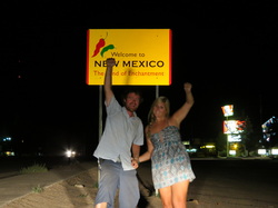
 _ We had stopped in Tuba City for gas, and the gas station attendant had told Chase that highway 264 was a straight shot out into the desert wilderness and camping would be easy along the road. Unfortunately, much to the contrary, the road was notably twisty and curvy around rock formations; this prevented us from making good time and made it harder to eat the ice cream we had bought in Tuba City. Furthermore, the road was very highly populated, with towns every few miles and nowhere to pull off and camp. Because of that we drove later than we normally do, passing into New Mexico after dark to camp in the Cibola National Forest.
 _ “Later” is kind of relative though, because we didn’t exactly have a clear idea of what time it was. Arizona is in Pacific time, though the state does not follow Daylight Savings Time, though the Navajo Nation Reservation does follow Daylight Savings Time, though some towns in the reservation don’t, and then New Mexico is in Mountain Time and is different altogether! Rather than trying to keep it straight, we just set up camp and slept when we were tired.
Tuesday, August 14th
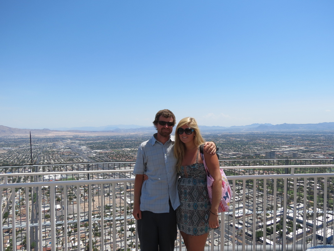
 _ After seeing the view from the tower last night, we wanted to return one more time during the day so that we could see more than just the lights from the Strip. The red mountains surrounding the city and limiting the growth of its sprawl were beautiful juxtaposed against the blue sky, and they are very different from the white mountains Chase is used to seeing in Alaska.
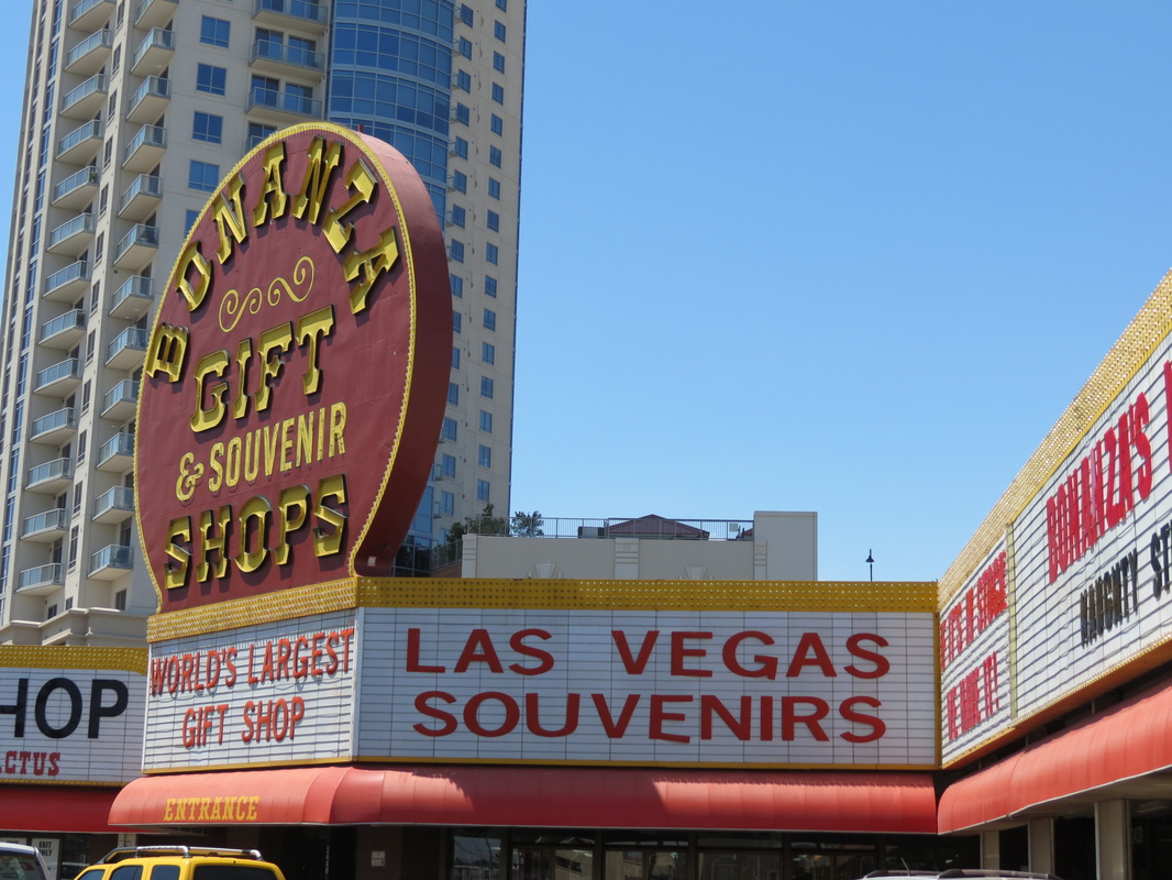
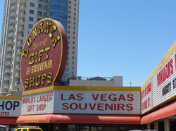 _ Once we finally left our hotel, Charla created a fun challenge for us to attempt. Near the hotel was Bonanza Gifts, the tackiest-looking gift shop on the Strip. We were each going to spend 15 minutes shopping, with a $5 maximum, to buy the other the tackiest item we could find, and we’d have to wear the other’s “gift” at some point during the road trip. Much to our dismay, though the shop was incredibly tacky, it was also shockingly expensive, and we realized that a $5 maximum would not provide for more than a glittery keychain flask. Sadly enough, we decided to scrap the challenge and must rely on our own already tacky wardrobe for the rest of the trip.
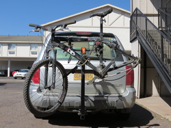 _ Unfortunately, while parked in a lot on the strip, we were approached by our parking lot attendant who notified us that someone had stolen the tire and wheel off of Chase’s bicycle, which was mounted on a bike rack on the Pilot. The parking lot attendant had attempted to stop the man and had called the police, who arrived shortly thereafter. Even more unfortunate, we had seen a man riding a bicycle carrying an extra bicycle wheel a few minutes earlier, but didn’t think much of it. Las Vegas Metro Police have a shockingly quick response time, dispatching two police cars and two police motorcycles to the parking lot, but a brief search failed to turn up the suspect or the wheel. Oddly enough, one of the responding officers notified us that they had recently raised the minimum for petty larceny to $650, which means that in effect it is not a crime to steal tires off of bicycles; if they ever caught the suspect, they’d give him a ticket on par with a ticket for jaywalking. Even so, we filed a police report and the police took pictures, noting the brand and size of the wheel and tire. We can only hope that the wheel happens to find its way into police custody in the next few days, or Chase will be buying a new one in Florida. (In reality, we think that if the motorcycle cops didn’t spot the guy in the first few minutes, the odds of it ever turning up are remarkably slim.)
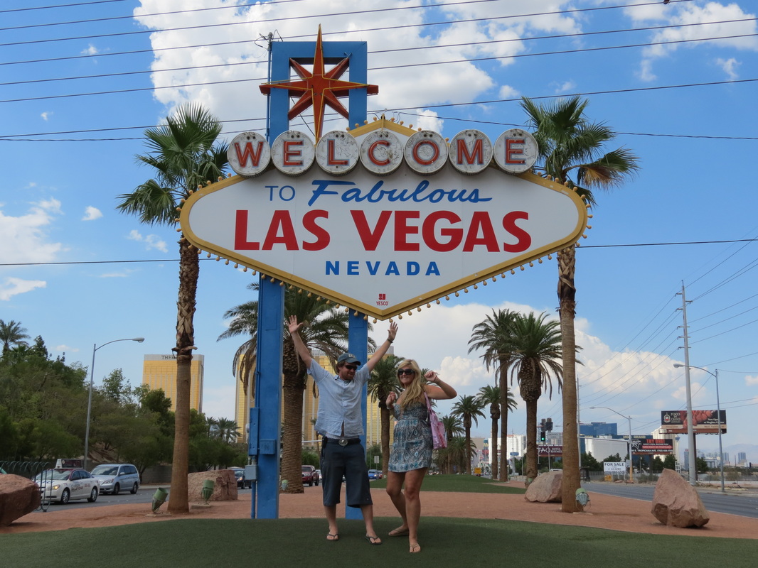
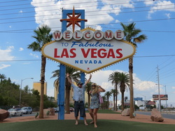 _ Finally making our way out of town, we stopped at the Welcome to Fabulous Las Vegas sign, something we probably would have done a couple days before if it were not on the opposite end of the Strip from where we were staying. We said a quick hello and goodbye to the city of sin (and to an Elvis impersonator taking tourist photos there) and got out. Before we were too far away, we spotted a Jack in the Box, which was offering free chicken nuggets for the people of Las Vegas. We counted ourselves among that crowd for a hot second and took the chicken nuggets to go.
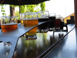
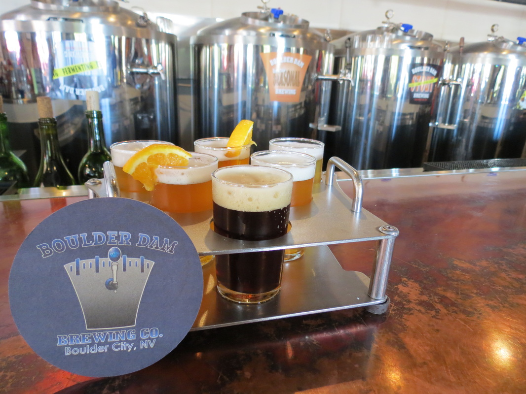
 _ As we made our way to Hoover Dam, a small brewery in Boulder City caught our eyes, so we stopped at the Boulder Dam Brewing Company to try their sample flight, conveniently arranged in the shape of the dam.
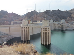 _ Leaving Boulder City, we soon arrived at the Hoover Dam, and the trusty Pilot once again had the pleasure of driving over a massive dam. We stopped for photos on the far side of the dam, as we crossed the Arizona state line, and then we parked the Pilot to walk back into Nevada over the dam.
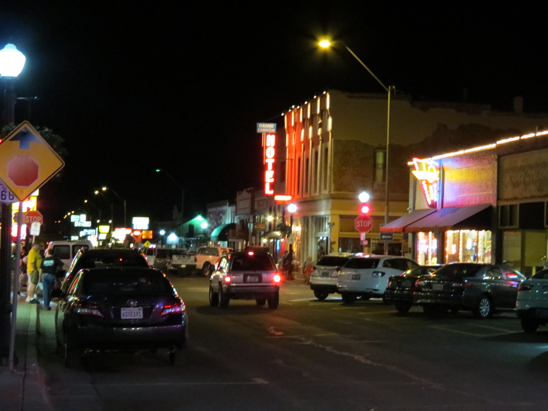
 _ From Hoover Dam, we traveled Highway 93 to I-40 and into the quaint town of Williams, whose main street is the famous Route 66 (we got our kicks!). We had planned to go all the way to the Grand Canyon that night, but Williams captured us, and we decided to stay.
Sunday, August 12th
 _ Today was an early day, as we started out hours before the sun rose. We knew it would be a long day of driving, plus we knew it would get hot quick, so there was no reason to dillydally in the tent. A couple hours later we finally hit the Nevada border, right at sunrise.
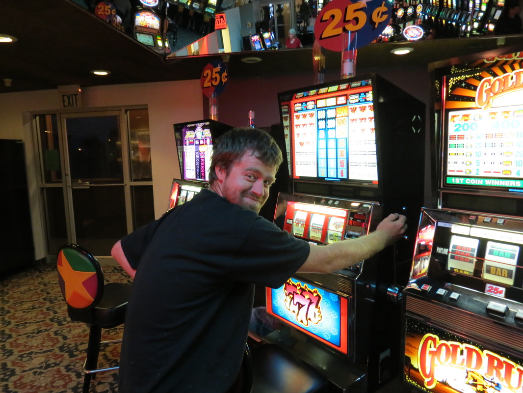
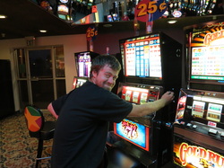 _ . And, as is the state custom in Nevada, there was a scuzzy little gambling hall called the Say When Casino located just feet over the border. The Say When is open 24 hours, and it has 25 cent slots, so to celebrate getting to Nevada we stopped. Even at 6:30 in the morning there was a crowd inside. We walked to the closest slot machines to the door and dropped in our quarters; with Chase’s quarter he won back 50 cents, and is probably the only person in the state of Nevada who is currently 100% ahead in gambling winnings.
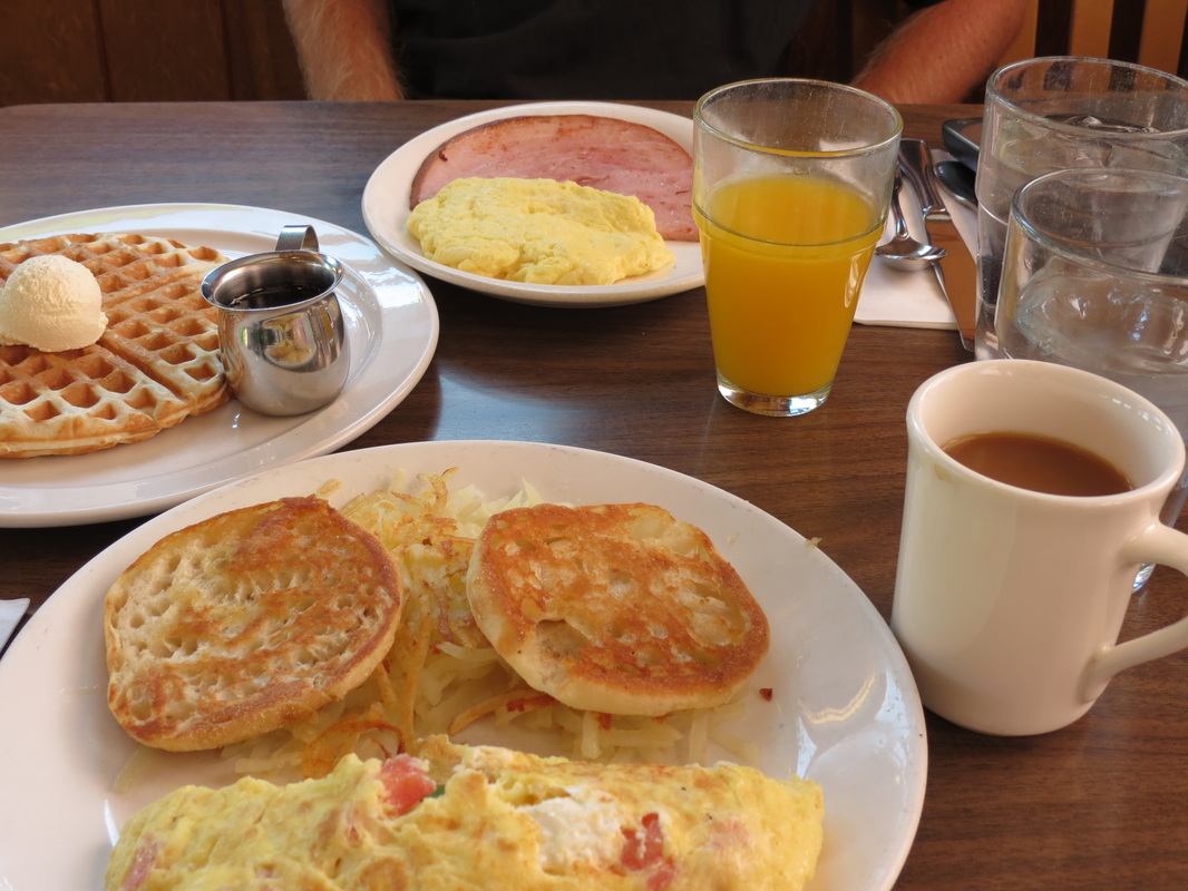
 _ Leaving the Say When we drove for a while as the sun rose, creating a beautiful light in the northern Nevada mountains, until we happened upon The Griddle in Winnemucca. The Griddle was a great old-style American breakfast place, with fresh-squeezed orange juice and great food. We had never thought of mixing up cream cheese in eggs before, but after Charla’s breakfast, it’s definitely an idea we’ll be borrowing.
 _ From Winnemucca we jumped on the I-80 for a short hop to Battle Mountain and then took Highway 305 south to Austin. Highway 305 felt like an extremely lonely road, and it didn’t seem that there was any reason for someone to drive it unless they lived or worked out there; and despite a couple ranches and mines, we can only assume very few people lived or worked out there. Ironically, Highway 305 dead-ended into Highway 50, which is billed as the Loneliest Highway in America (despite having more tourist traffic). Highway 50, though, is an amazing road. We immediately entered the town of Austin, which is a quaint little mountain town. Steeped in gold rush (and oddly enough, Pony Express) history, the town was situated at 6,600 feet elevation and when we pulled in the air temperature was exactly 100 degrees. We did the only obvious thing, and stopped at the Toiyabe Café for ice cream.
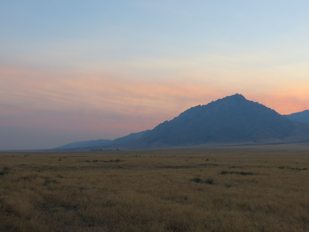
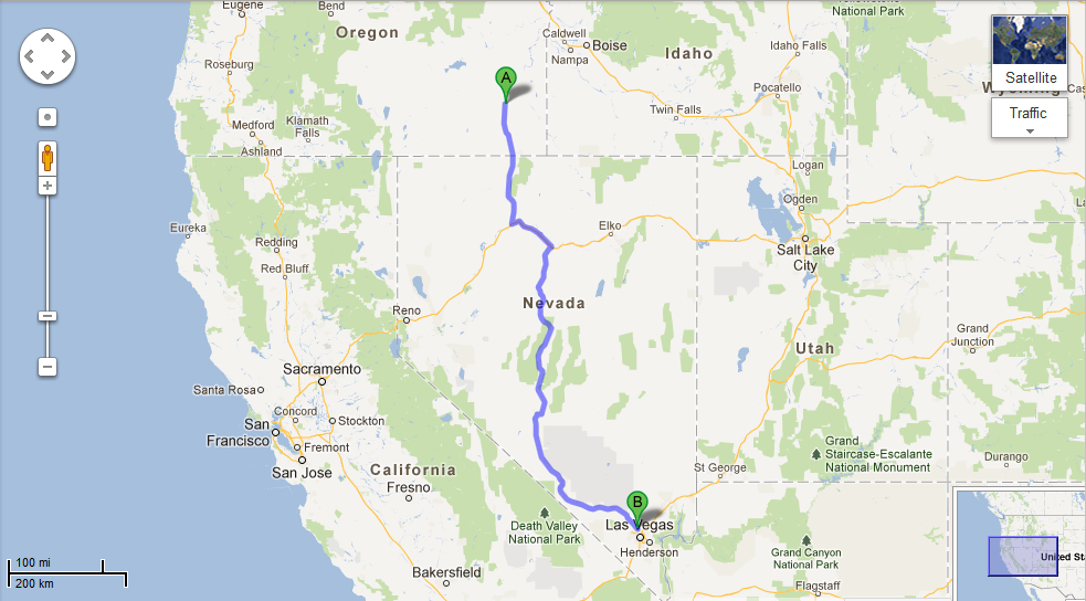
 _ On our way out of Austin the road started climbing, and climbing, and climbing, until we finally reached Austin Summit at 7,484 feet, which has been our highest elevation of the trip. From there it was all downhill. (Las Vegas is all the way down at 2,181 feet elevation.) Highway 50 to Highway 376 to Tonopoh to Highway 95 to Las Vegas! On the way we passed some sketchy-looking military outposts in the desert, including the alleged Area 51; we also passed Angel’s Ladies, a legal brothel in the desert, though we didn’t want to investigate the quality of the ladies who would choose to work in the rural desert when Las Vegas was less than hour away. Managing to avoid military security, aliens, and prostitutes, we soon found ourselves driving down Las Vegas Boulevard, more popularly known as The Strip.
 _ Pulling into the Stratosphere, we commented that neither one of us could remember the last time we had been in a parking structure so large. The hotel has more than 2,800 rooms, making it approximately ten times the size of the Hotel Alyeska, where Chase works in the winter. Exiting from the parking garage, guests must drag all of their luggage with them from one end of the casino to the other to check-in for the room before dragging all their belongings back across the casino to get to the elevator. There are three elevator banks, depending on which part of the hotel your room is in. We finally found our elevator bank, and sped up to the sixteenth floor for our mountain-view room. We barely left the room, instead relaxing and reveling in the fact that for the first time since July we had walls, electricity, air conditioning, a shower, and a bed.
Saturday, August 11th
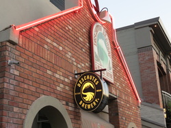
 _ Like many other mornings on this trip, we started out today with breakfast sandwiches; this time from the Great Harvest Bread Company in downtown Bend. (Tomato and spinach were only a dollar extra, but well worth it.) After breakfast we made our way to the Deschutes Brewery, hoping to enjoy the visitor center and a tour. Surprisingly, we arrived 45 minutes before they opened. That gave us time to talk to the bartenders, who gave us a Bend Ale Trail map and sent us on our way. We had no idea that Bend had nine breweries!
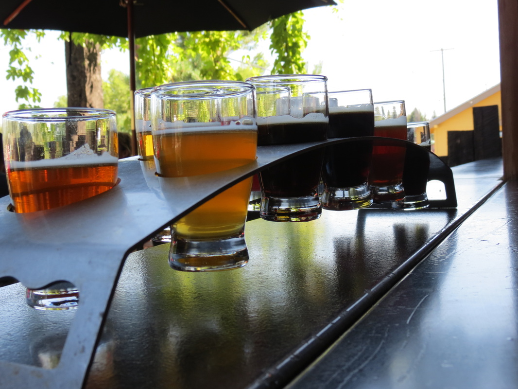
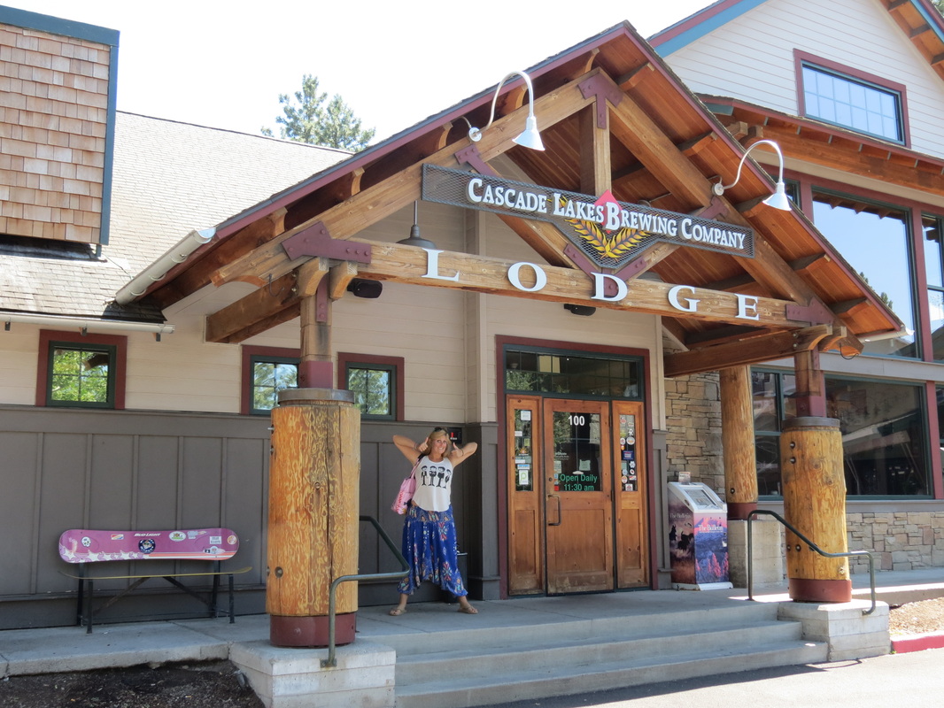
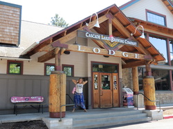 _ We first went to 10 Barrel Brewing Company, where we started off the day with a sampler flight of ten of their beers. We really enjoyed the beer, though we were disappointed that the flight wasn’t actually arranged from light to dark, in the order that they should be sampled. Our favorites were the Northwest Red and the S1nist0r Black ale, which was uniquely refreshing for a beer that dark. We then rushed to Cascade Lakes Brewing Company to sample their Blonde Bomb Shell and their IRA (India Red Ale).
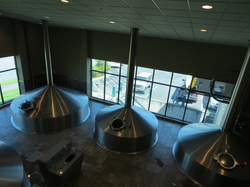 _ Finally, it was time to return to Deschutes for our much anticipated brewery tour and samples. Between the two of us, we tried the Chainbreaker WIPA, Twilight Summer Ale, Mirror Pond Pale Ale, Zymerge, and Black Butte XXIV. We also joined a 45-minute tour of the brewing facility, where they make all the beer that they distribute to all the western states and provinces. We enjoyed perusing the label gallery at the end of the tour, specifically the labels for the seasonal Jubelale which Deschutes commissions from a different local Northwest artist each winter. On our way out of town we stumbled upon Silver Moon Brewing to sample the Life Guard Blonde (“A blonde for a blonde,” according to the bartender) and Hopnob IPA, as well some well deserved lunch.
 _ After a quick gas fill-up, we were on our way out of town heading east on Highway 20. We once again entered the crazy high desert terrain from yesterday. We agreed that we never imagined this kind of topography would exist in Oregon, as it instead conjures ideas of the Southwest. Another gas top off in Burns (because you never know where the next station will be in the desert) and we were heading south on Highway 78. Our friend Chris, from Talkeetna, had told us to be on the lookout for hot springs in this area, and we quickly came to Crystal Crane Hot Springs. We were looking for something natural, not commercial, but we soon changed our mind on hot springs entirely; when the air temperature is this hot, 101 degree water just doesn’t feel pleasant.
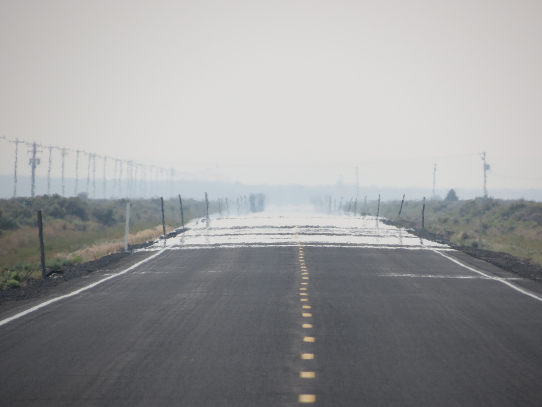
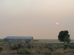 _ Pulling away from Crystal Crane the sky acquired a pink hue and the sun began to turn red. Apparently there is a forest fire burning in Fields, and the smoke from the fire is creating a haze throughout the eastern reaches of the state. As the haze caused dusk to come earlier than normal, we pulled off the road and found a great spot to camp on top of a butte overlooking the Steens Mountains. Once again from the top of our butte we were able to enjoy some amazing stargazing and watch the Perseid meteor show. In other news, we finally found the most elusive license plate for our license plate game: Hawaii! It was on a car just sitting there in downtown Bend. (Click here to see how the game is progressing.) Coincidentally, before we even said anything about it, the gas station attendant in Burns also mentioned that he had seen a Hawaii license plate pull through today for the first time in a long while. Maybe there are some Hawaiians out there doing the same drive we are, at least from Portland to Las Vegas. If you see the silver Honda Pilot with the Alaska tag and the bike on the back, honk your horn!
Note: While touring the Bend Ale Trail, we shared small size samples over the course of several hours and with two meals. Please enjoy the Ale Trail responsibly and don't drink and drive!
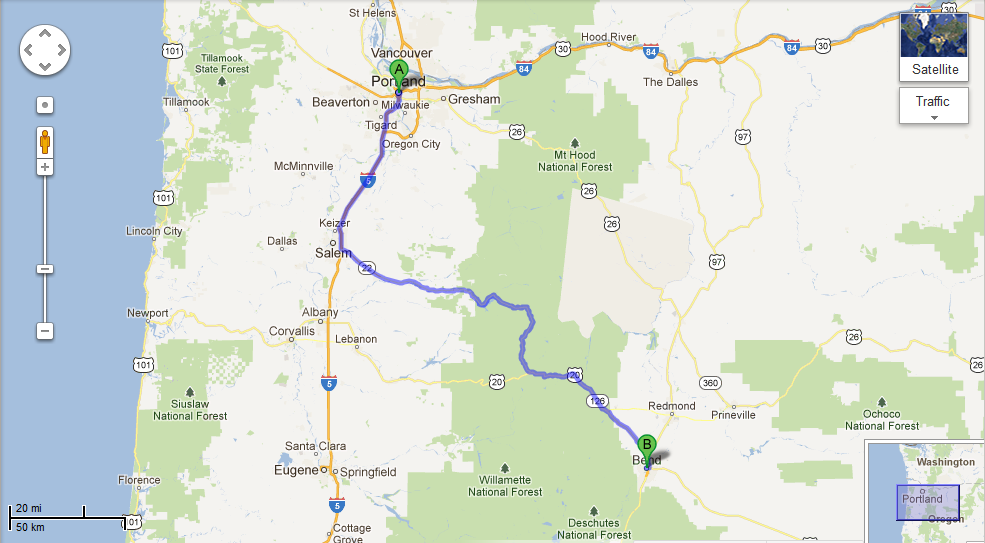
Friday, August 10th 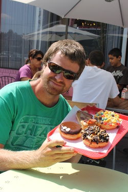 We started our day at Tiny’s, a trendy little coffee shop near Elliot and Brad’s apartment that featured delicious breakfast sandwiches and good coffee. There, we said good bye to Brad and made moves to our last stop in Portland, the city’s staple where good things come in pink boxes. We could not possibly leave without trying Voodoo Doughnut (Too)! When we pulled into the parking lot, Charla spotted a Voodoo Doughnut tuk tuk. She didn’t even need to try one of their creations before she was in love. We waited in the short line (much shorter than the one wrapping around the block in front of the original Voodoo shop we had checked out on our first night) and then faced a difficult decision: what to order? Chase settled on the Portland Cream and the Maple Bacon Bar (yes, that’s bacon on a doughnut!) while Charla went the sweet route with a Captain My Captain, covered in Cap’n Crunch cereal, and an Oreo King, topped with Oreo crumbles and chocolate.
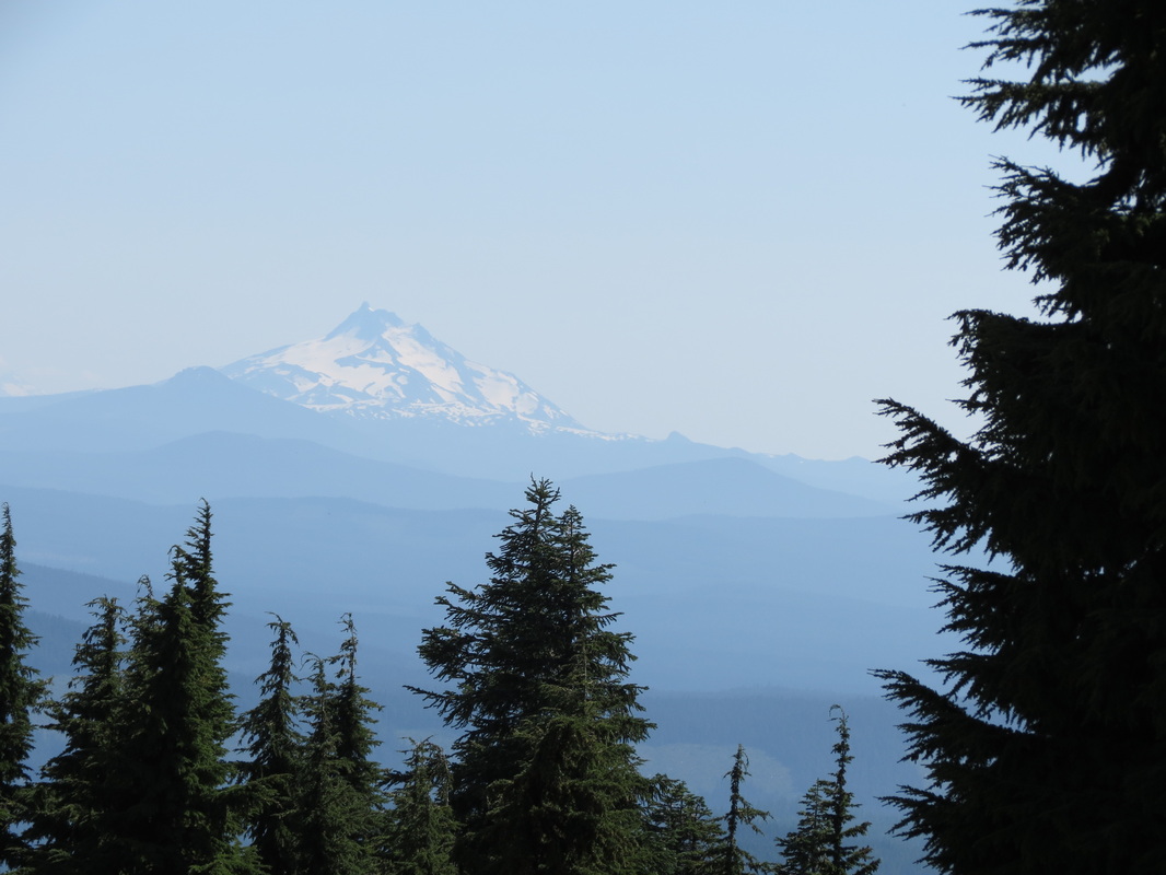
 A few miles on I-84 led us to Highway 26, a scenic road that took us through Mt. Hood National Forest. To get an even better view of the snow topped mountain, we cruised up to Timberline Lodge. There were skiers and riders walking around the lodge, and Chase started aching for a ride. If only the winter gear were more accessible in the Pilot right now! Meanwhile, Charla was channeling her inner film buff and getting a little scared just thinking of The Shining, which filmed its outside shots here.
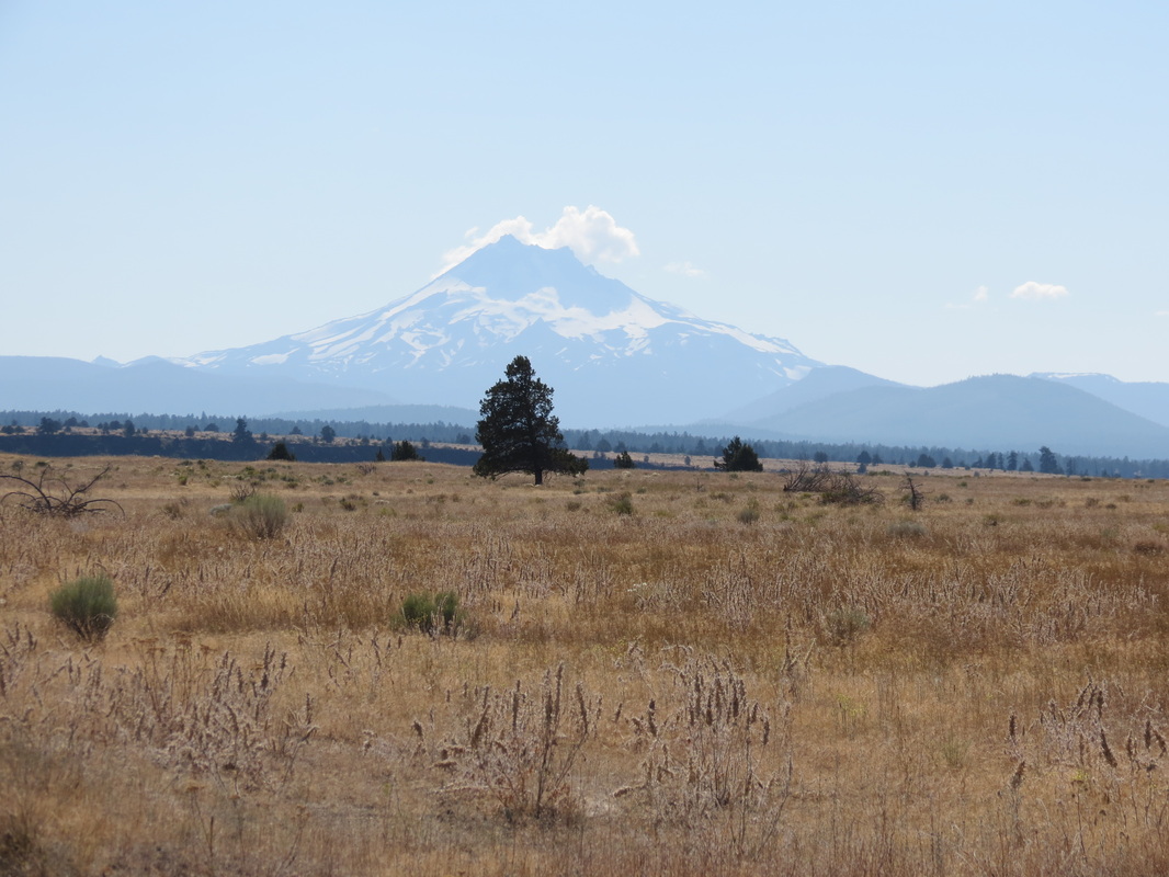
 After leaving Timberline and driving southeast, we started to experience a dramatic change of topography and temperature. From the cool mountain climes that promoted the growth of much greenery, we entered into the hot and dry high desert where the only green we saw grew up around irrigation systems. Coming into Bend, we came back into a lot of vegetation, as the Deschutes River and National Forest are nearby.
 Miles back, in Kirkland, Washington, Charla spotted her first Jimmy John’s since returning from Southeast Asia, but we went out for a great Thai meal with Alison instead. The craving had not gone away, so we went straight to Jimmy’s when we arrived in Bend. After loading up on sandwiches, we walked around downtown and the riverside before going to the Deschutes Brew Pub to sample the local brews. In addition to the Chainbreaker White IPA and Spencer’s Gold Ale, the bar staff gave us directions to a camping spot in the National Forest. We ended up pulling off the road a bit before their favorite locale by Tumalo Creek for a good place to watch the Perseid meteor shower that was just getting into swing.
Tuesday, August 7th
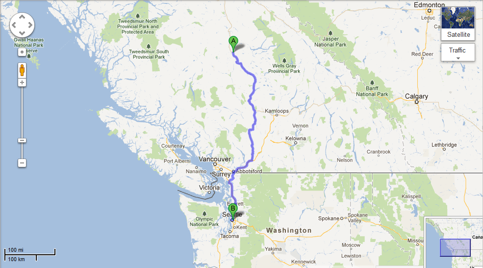
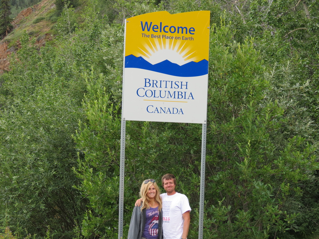
 _ Once again, we had the pleasure of packing up camp in the rain; we went to sleep with a nice lightning show above and assume the rain started shortly afterward. The benefit of a rainy morning is that it got us on the road nice and early! After a couple of hours we drove out of the rain and stopped at an overlook near Big Bar Lake to cook up some breakfast. After passing through British Columbia’s agricultural district for a couple hours, we made it off Highway 29 and onto the Trans-Canada Highway to drive through the Fraser Canyon. The Fraser Canyon is a narrow, rocky canyon cut by the Fraser River, and the two-lane road follows the path of the river while clinging to the side of the cliff.
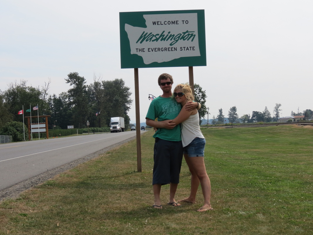
 _ Once through the Canyon we had one last Canadian stop in Chilliwack, by far our most successful shopping attempt of the trip. We were able to do a last-minute stop for Canadian chocolates and beer not available south of the border, as well as some other errands that needed to be run. We sped immediately from Chilliwack to Abbotsford, where we crossed the border for the last time into the Lower 48! Another easy border crossing (where we did declare our Timbits, or donut holes from Tim Horton’s), we found ourselves in Sumas, Washington.
 _ Two hours of interstate travel later we stopped in Kirkland, Washington, to visit our friend Alison. It was great to reconnect, and we took a walk through beautiful Kirkland past the Wilde Rover, the scene of past adventures of Charla and Allison. Our destination this evening was just next door at Hanuman Thai Café, Charla’s first Thai food since leaving Thailand earlier this summer. The prices were a little higher than Bangkok street-food (though also significantly lower than prices in Talkeetna), but Charla still approved of the cuisine. Later that evening we headed into Seattle to visit Noelle, one of Chase’s friends from Talkeetna. We quickly all became friends and slept soundly that night rocked by the waves of Lake Union.
Saturday, August 4th
 _ Much to everyone’s surprise (especially the local Skagwegians), we woke up to a beautiful sunny day! We explored town a bit more, including a walk down to the cruise ship dock, where a new boat had unloaded its happy passengers earlier that morning. From the dock, we had some sweet views of the Tracy Arm. Then, we made our way back into town for some pan au chocolate at Glacial Smoothies and Espresso. Noticing an ad in the Skaguay Alaskan paper in the coffee shop, we stopped in a store nearby for a free train whistle with the purchase of some snazzy bear socks. In times of radio silence while driving through massive British Columbia, the train whistle certainly came in useful (without much success, we both attempted playing songs ranging from Lady Gaga’s “Born This Way” and a smattering from Lonely Island).
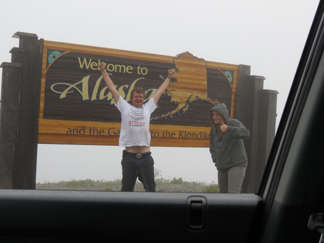
 _ After much hugging and a few high fives at the Attic, we started the scenic drive out of Skagway through White Pass, climbing some 3,000 feet in just nine miles and crossing the Canadian-America border one more time.
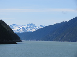
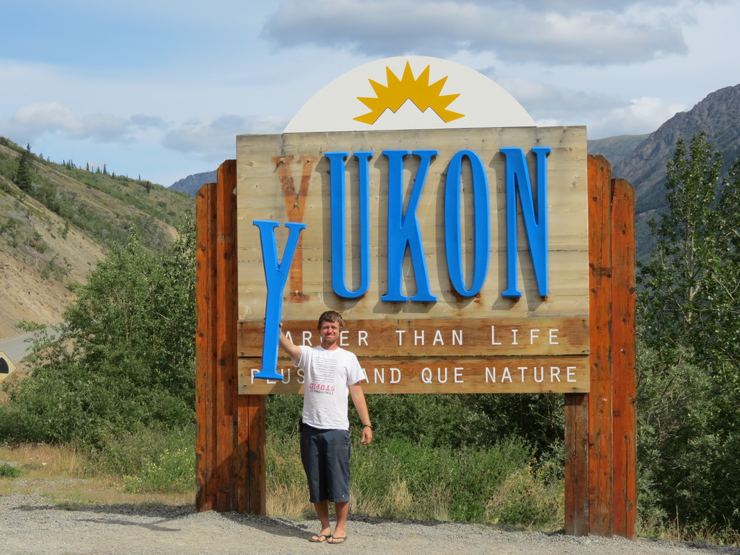
 _ We crossed from BC into the Yukon, where we happened upon the deserted Venus Mill mining structure on Tutshi Lake. Built in 1908, it was meant as a last-ditch effort to try to mine silver from the lake, but it was unsuccessful. Later on we crossed through Carcross (from the original town’s name CARibou CROSSing) and then the Tagish Road onto the Alaska Highway for the third and longest stretch of our trip.
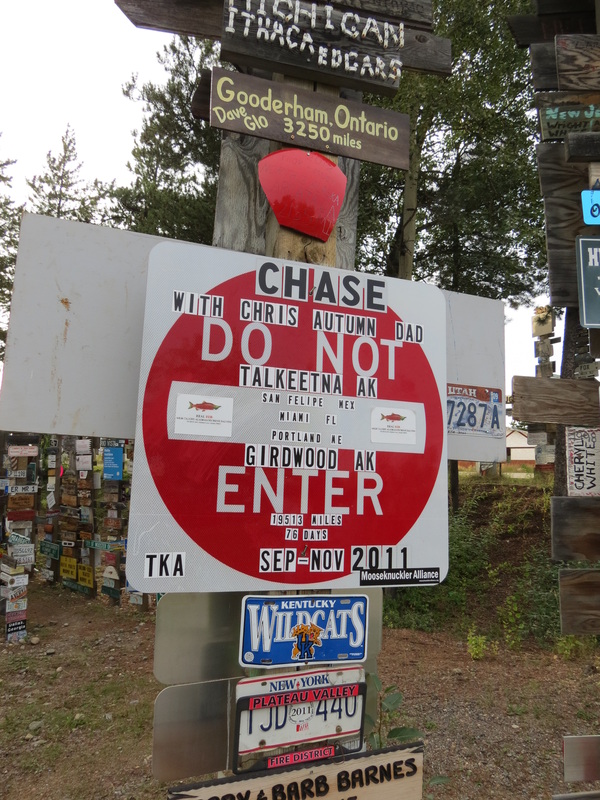
 _ We made a quick stop in Teslin for gas and groceries before making a nice lunch overlooking Nisultin Bay just outside of town. With a full tank in the trusty Pilot and full stomachs, we covered a lot of ground before reaching the Watson Lake Signpost Forest. We meandered around a bit and made the necessary stops to check up on Chase’s two signs there. We skipped out on the Northern Lights Centre, deciding that we would just have to wait until our return to Alaska to see them again in the sky and not on film. From there, we drove for a bit and started seeking out a place to rest for the night. Our first stop was place we will forever call mosquito land. We took a turnoff, hopeful for a nice spot, but it looped around back towards the Highway. We found what appeared a nice spot in the back of the loop, but after a few minutes of setting up the tent, we were swarmed with plaque-like quantities of mosquitoes and quickly decided to pack it all in and search for something better. We stopped in a rock quarry a few miles down the road that was still fairly mosquito-infested but a much better option for a place to make dinner and get some rest.
Thursday, August 2nd
 We started day three by packing up wet gear thanks to a Dawson morning rain shower. Once we got all of our wet gear stowed away for the trip, we got to once again jump on the ferry for our final water crossing of the Yukon River. The ladies at the Visitor Center directed us to the cheapest gas in town, at an industrial Alberta Fuels cardlock system in a mining part of town. After figuring out how to use the most obscure cardlock system in the world, we were finally zooming out of town on the Klondike Highway. We stopped for lunch at Moose Creek, a nice campground though it was lacking the running water that it had advertised. Without rinsing our dishes we were back on the road again. We continued on to Carmacks for a gas stop, and much more excitingly, a Cadbury’s Dairy Milk Mint Chocolate bar that was hiding in the gas station! We stopped to enjoy some morsels of chocolate at Little Fox Lake, the scene of a catastrophic forest fire in 1998. The landscape is still charred and recovering to this day.
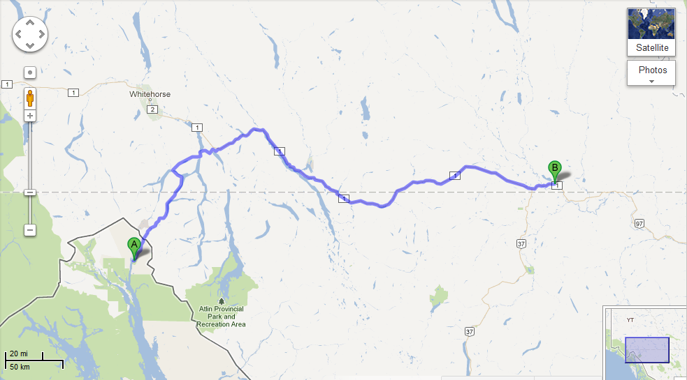
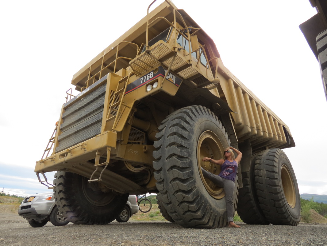
A few miles down the road we arrived at Lake Laberge. We were on an overlook, not quite a marge, but it was still appropriate to have a reading of Robert Service's “The Cremation of Sam McGee.” After the dramatic reading, we took a look around to discover we weren’t merely at an overlook, but we had somehow ventured into a Public Use Quarry, complete with three Caterpillar 776Bs with keys in the ignitions! However tempted we were to rally, we settled with a photo shoot. (Who knows how good the steering would be on a vehicle whose tires are taller than the trusty Pilot?!)_
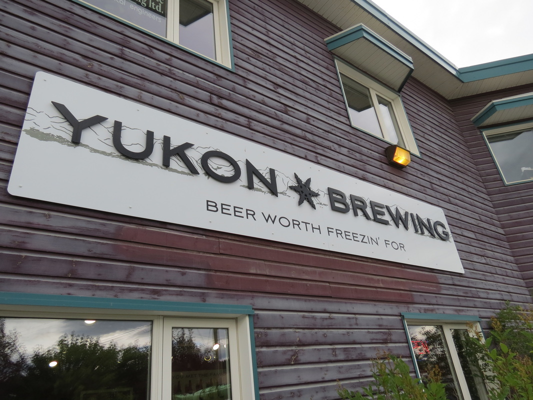
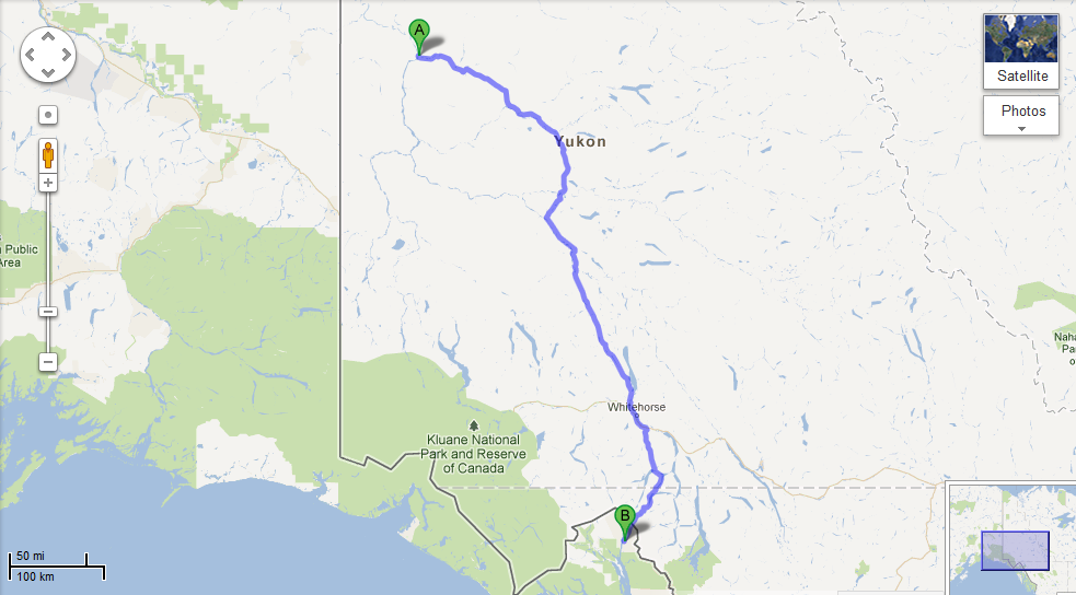
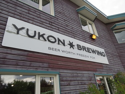 _ Our quarry was quite close to Whitehorse, which features the Yukon Brewery (“Beer Worth Freezin' For”). Unbeknownst to us we had stopped in on International IPA Day, a day we should all be celebrating. After a bit of sampling we decided on a growler of Discovery Honey Ale and bottles of Ice Fog IPA and Midnight Sun Espresso Stout.
_ Leaving Whitehorse led to our second jaunt of the trip on the Alaska Highway for a few miles until the turn off for the South Klondike Highway to Skagway. For the first time of the trip it was uncharted territory for both of us, but it was a great trip. In addition to the mountains and lakes, we also spotted a fox and a bear on the roadside. Though, in just 35 miles or so between the British Columbia/Yukon border and the BC/Alaska border, conditions changed drastically. After what started as a beautiful trip, we summitted the Pass and descended into Skagway in zero-visibility conditions. The situation quickly improved when we located the Skagway Brewing Company, and improved even further when Freddie got off work just minutes later to join us. Freddie showed us the plush accommodations where he lives with his coworkers, and then we all headed to the Bonanza for a fun-filled Mystery Meat Night at the bar to the sounds of songs that somehow Charla was the only one in the bar to know.
Wednesday, August 1st
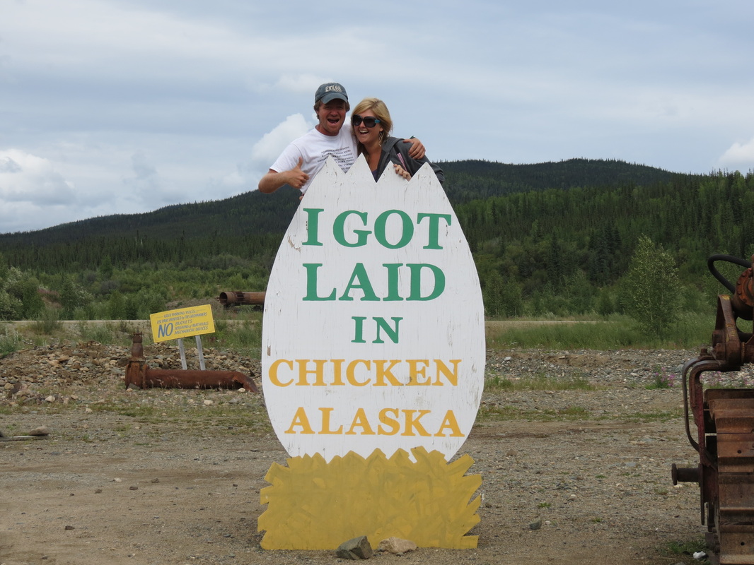
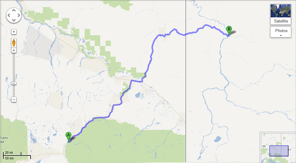
 _ We started the second day of our trip with pancakes made with fresh blueberries and strawberries that Charla picked with Sarah and Logan on Monday afternoon. While Charla was busy at the camp stove, Chase re-packed the Pilot so what we needed was easy to reach and what we didn’t need on this trip (like a snowboard and winter gear) was organized and out of the way. We drove into Tok for gas and some errands, including phone calls before our service cut out (even though Tok is 80 miles from Canada, there isn’t a lot going on in the space between the small town and the border). On the way to Tok, we had a nice surprise and saw a lynx! After ten miles on the Alaska Highway out of Tok, we got on the Taylor Highway to Chicken. Our journey into Chicken started with a big disappointment, as the “Chicken Community” sign formerly covered in an assortment of stickers from travelers had recently been replaced. It was brand spanking new, with the Department of Transportation laminate still peeling off on the corners. Things got better once we got into town, and we got laid in Chicken! We also picked up free chickens that we had earned and met a couple Romanian motorcyclists who were journeying across North America on their own bikes from home. We had one last stop at Downtown Chicken for gas, and luckily for us we paid up and were ready to leave just as two busloads of Princess tourists pulled up to Downtown. The tourists slowly waddled off the bus, cameras in hand, to invade Chicken as we sped out of town.
 _ But we didn’t speed too quickly, as the Taylor Highway ascended up into the mountains and grew increasingly hairy. Just a short time before we passed, a large RV motorcoach with a car in tow had rolled off the side of the mountain and come to rest approximately 150 feet below the road. The Troopers had already cordoned off the scene so we didn’t stop to investigate ourselves, but it didn’t look like a rollercoaster ride we’d have wanted to experience.
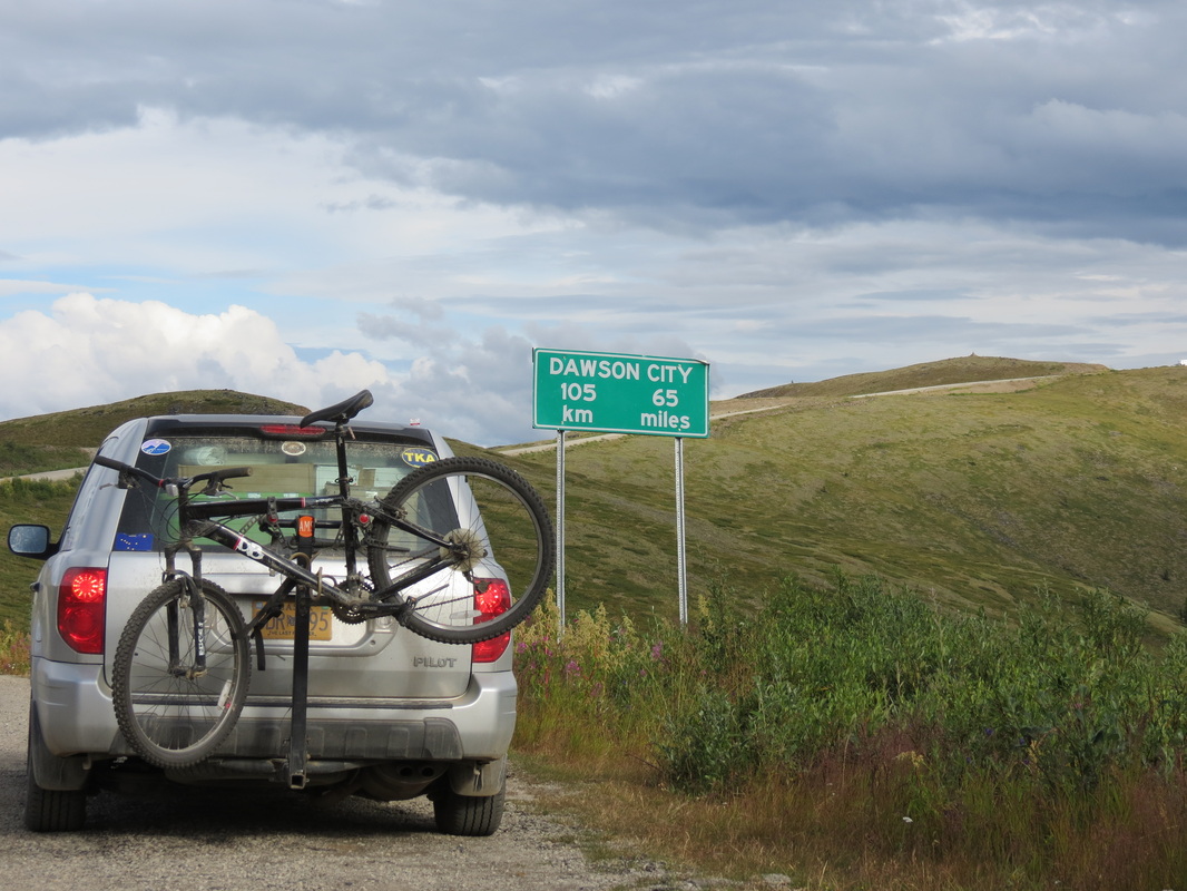
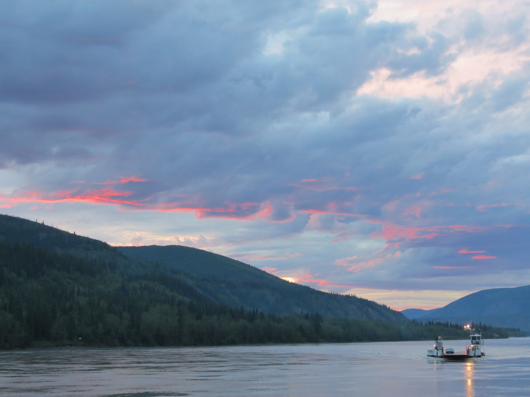
 _ The Taylor Highway becomes the Top of the World Highway as the road becomes Canadian. Luckily we were let across the border without too hard a time from the Canadian Border Security Agent on duty (even though we were smuggling some more of Charla’s freshly-picked berries). We had been foolishly using our time earlier in the day, so we cautiously drove as fast as we dared along the beautiful and treacherous road to Dawson City. Arriving just in time to jump on the George Black, the free ferry across the Yukon River (because the Yukon territorial government hasn’t yet gotten around to building a bridge) we made it to Diamond Tooth Gertie’s just in time for their first can-can show of the evening. Gertie’s is Canada’s oldest casino from before casinos were legal in the Klondike gold rush of the 1890s, and today in addition to gambling Gertie’s offers shows throughout the evening. Told by Diamond Tooth Gertie (the actual proprietor in the 1890s, who actually did have diamonds in her teeth at the time) and her dancing girls, the show tells us how she met Phineas and all the hilarity that ensues. After a dinner between shows at the Triple J Hotel, and the second show at Gertie’s, it was time for one last hop across the ferry to camp in West Dawson.
Tuesday, July 31st
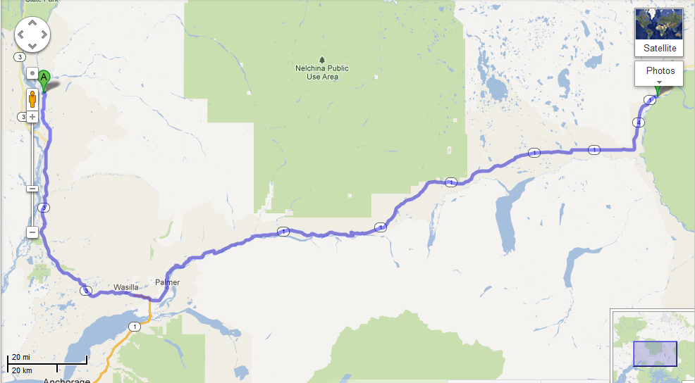
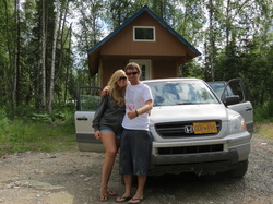 _We got a late start out of Talkeetna after a rush job of packing all of Chase’s worldly possessions into the back of a Honda Pilot. Luckily, Alex and Paul were also hanging out at the cabin for company and moral support (and loading some of Chase’s stuff that wouldn’t fit into Mugly, Alex’s truck, to take home to Seward). Once everything was loaded and ready to go, it was time for one last run into town. Ostensibly, the run into town was for a growler of beer from Denali Brewing Company and bag of baked goods from the Talkeetna Roadhouse, but you can’t make it on to Main Street without running into everyone you know. After a hearty round of goodbyes (as well as a growler and some baked deliciousness) we were finally on the Talkeetna Spur Road heading out of town. Once on the Spur, we started our epic game of “finding license plates from every state and province.” (Click here for updates on how the game is going and where we’re finding the different plates.) We got a bunch of them right away heading south on the Parks Highway.
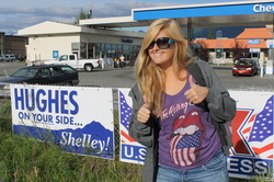 _After the requisite and dreaded stop at Fred Meyer in Wasilla for supplies and a stop in Palmer for gas, we were on our way! (And look who decided to run for office at the gas station! No, no, the sign’s actually for Shelley Hughes who’s running for the State House.)
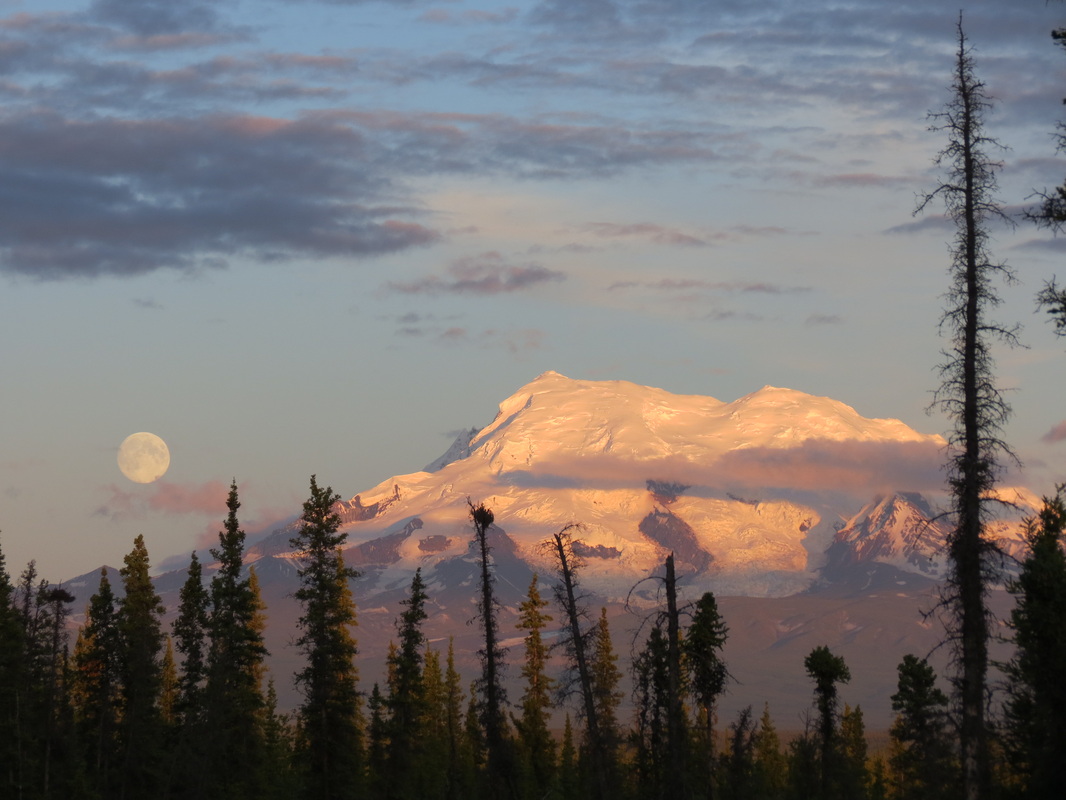
 _ A nice drive east on the Glenn Highway led us through the Chugach Mountains and past Matanuska Glacier. After taking the left to Canada in Glenallen on the Richardson Highway, the full moon started rising over Mount St. Elias and the mountains exhibited an amazing alpenglow. Twenty-one miles into the Tok Cut-Off we found a great spot to hunker down for the night with bathrooms and picnic tables and all!
|


 RSS Feed