Monday, August 13th
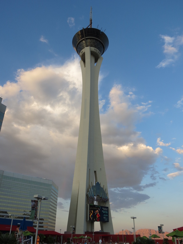
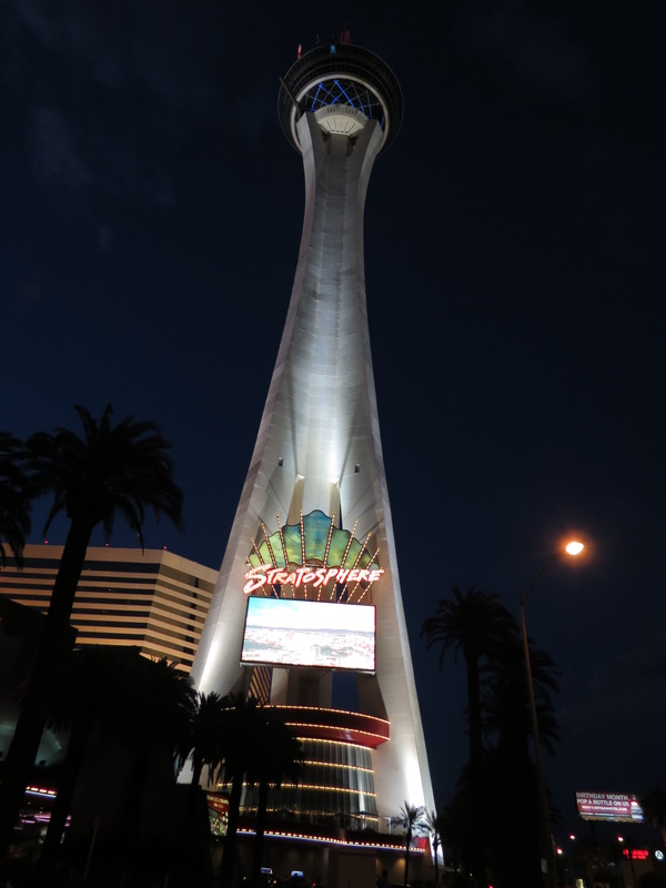
 _ After Tim Horton’s and Voodoo Doughnut Too, it seems that doughnuts have become a trend for our road trip, and this Monday morning was no exception. Finding free wireless internet is a bit of a challenge in Las Vegas, and our search led us to the Krispy Kreme at the Excalibur Hotel and Casino. While the Excalibur was much was you would expect in Vegas and similar to what we had already experienced (people gambling at 9:00 in the morning, rotund tourists stuffing their faces and gobbling up kitschy souvenirs, etc.), going there made us see the Stratosphere in a new light and like it all the more, despite not having a doughnut shop with free wifi.
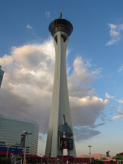
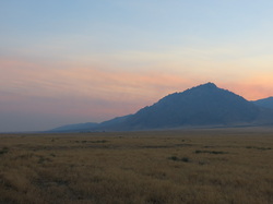
 _ Doughnuts eaten, coffee enjoyed, and internet business taken care of, we returned to the Stratosphere to take advantage of the beautiful sunny weather at the Level 8 rooftop pool. In just a few hours at the pool, Charla managed to become more tan than she did over the three months she spent traveling in Southeast Asia before her arrival in Talkeetna. The desert sun on the rooftop was incredibly strong thanks to the elevation, and the heat was relentless—for most of the day, it was 105-110 degrees. Needless to say, the pool was perfectly refreshing. It was not only a great place to escape the craziness of the Strip below, but it was also a good spot to watch the jumpers from the Stratosphere tower, who braved the world’s tallest decelerating sky jump, some 850 feet. The pool area had everything we could need for the day, including a bar and grill with a friendly staff and outstanding Caesar salads. As the sun set over the mountains in the distance, we packed up for the day and got ready for the night ahead.
 _ Our evening started with all you can eat sushi at Rock & Roll Sushi. Like the tattoo guy on the casino level of our hotel, the sushi was surprisingly pretty good as a result of the mass of guests that they see. We ordered quite a few of the specialty rolls, like the Hot Crunch with spicy tuna and tempura shrimp, and some old favorites, like the Philadelphia roll with salmon, avocado, and cream cheese. Even coming from salmon season in Alaska, the salmon at Rock & Roll was delicious! We finished our sushi just in time to make it to back to the Stratosphere to see Bite, a revue featuring Vegas vampires dancing to classic rock. A bit cheesy at times and a bit reminiscent of True Blood at others, the show was nonetheless impressive, particularly the tapestry performers who tumbled and posed high above the crowd.
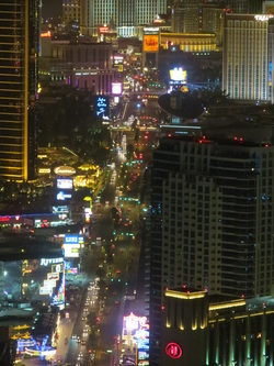
 _ Our night ended with hanging out at level 108 of the Stratosphere tower, taking in the bright lights of the city below from Fremont Street to the Strip as well as the suburban sprawl of North Vegas.
Sunday, August 12th
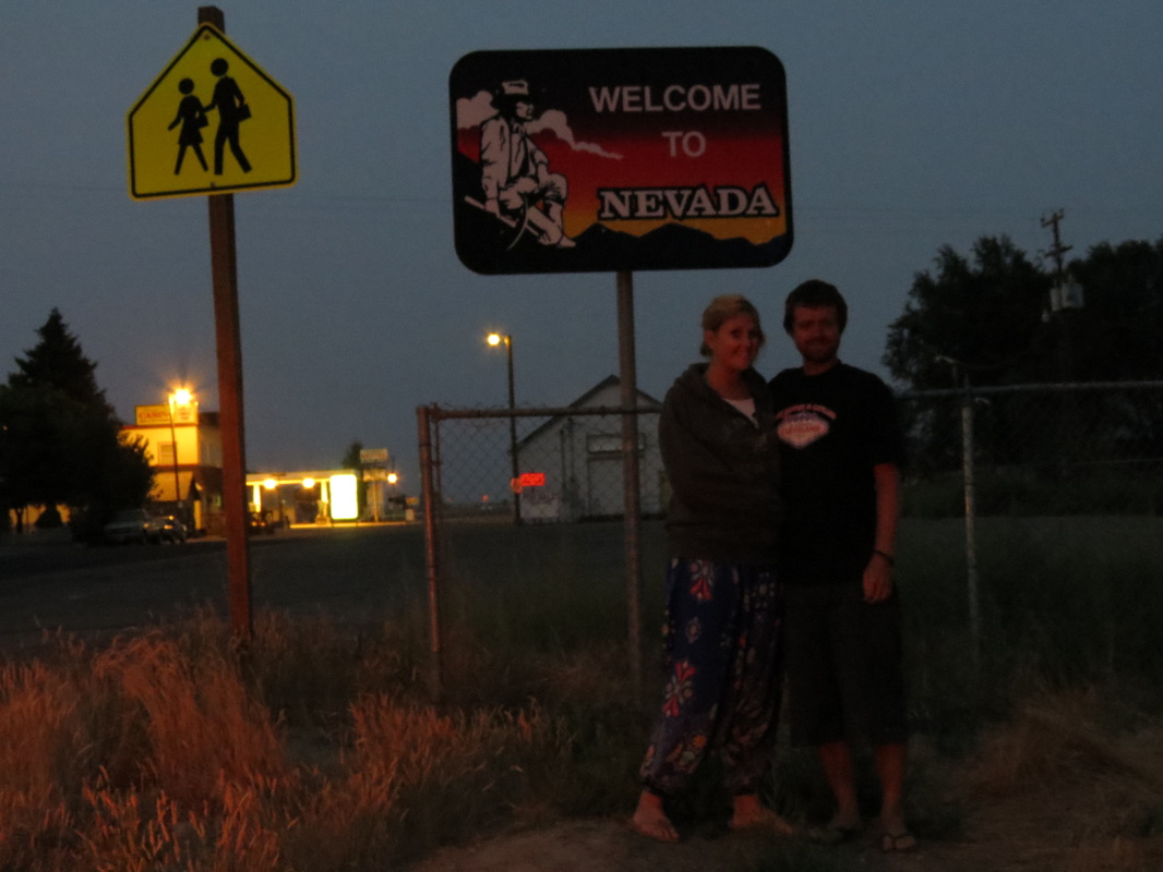
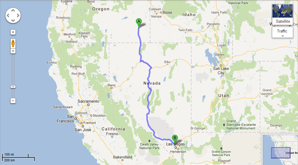
 _ Today was an early day, as we started out hours before the sun rose. We knew it would be a long day of driving, plus we knew it would get hot quick, so there was no reason to dillydally in the tent. A couple hours later we finally hit the Nevada border, right at sunrise.
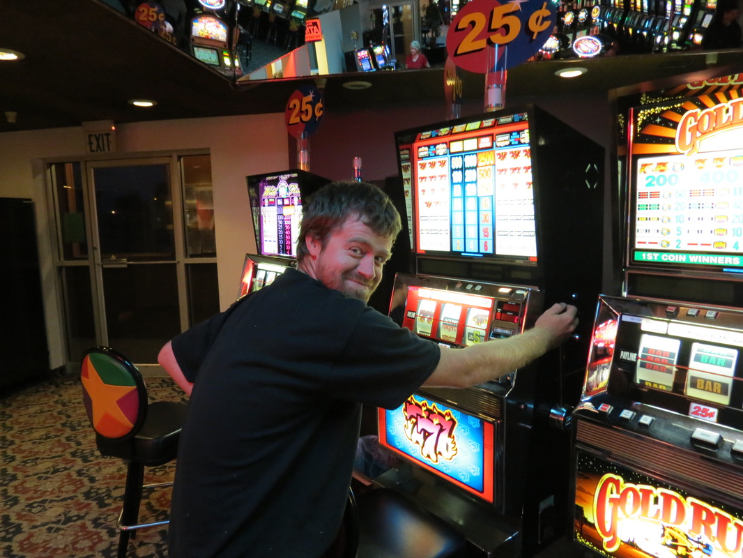
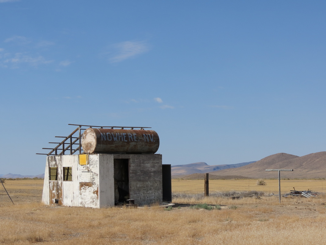
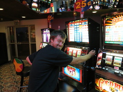 _ . And, as is the state custom in Nevada, there was a scuzzy little gambling hall called the Say When Casino located just feet over the border. The Say When is open 24 hours, and it has 25 cent slots, so to celebrate getting to Nevada we stopped. Even at 6:30 in the morning there was a crowd inside. We walked to the closest slot machines to the door and dropped in our quarters; with Chase’s quarter he won back 50 cents, and is probably the only person in the state of Nevada who is currently 100% ahead in gambling winnings.
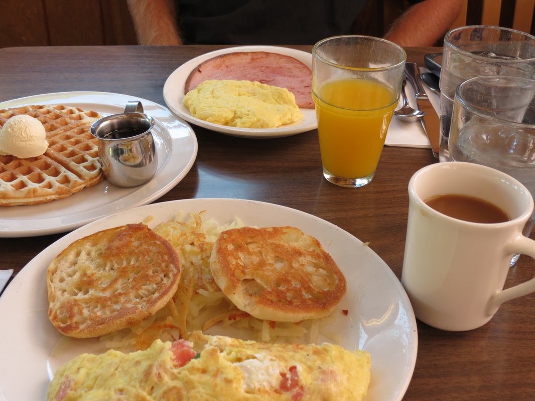
 _ Leaving the Say When we drove for a while as the sun rose, creating a beautiful light in the northern Nevada mountains, until we happened upon The Griddle in Winnemucca. The Griddle was a great old-style American breakfast place, with fresh-squeezed orange juice and great food. We had never thought of mixing up cream cheese in eggs before, but after Charla’s breakfast, it’s definitely an idea we’ll be borrowing.
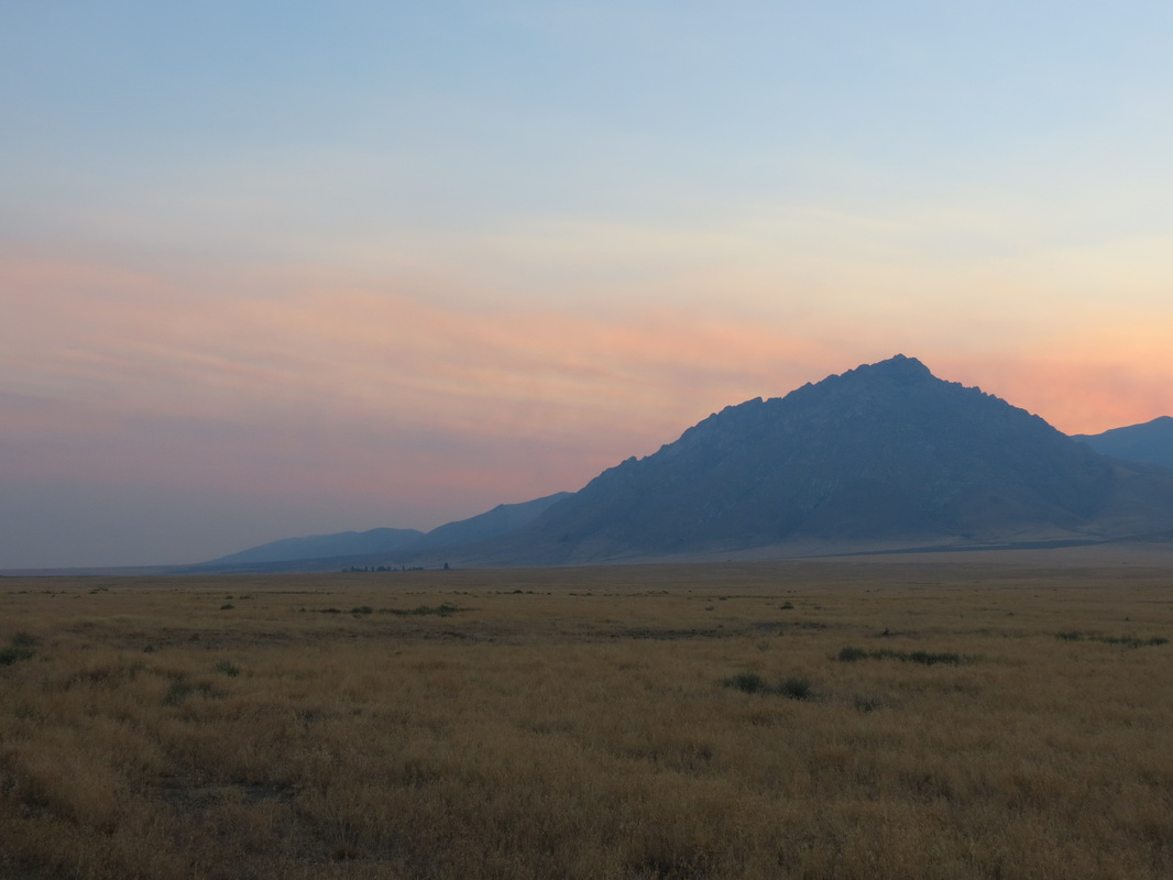
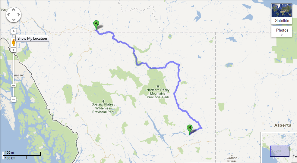
 _ From Winnemucca we jumped on the I-80 for a short hop to Battle Mountain and then took Highway 305 south to Austin. Highway 305 felt like an extremely lonely road, and it didn’t seem that there was any reason for someone to drive it unless they lived or worked out there; and despite a couple ranches and mines, we can only assume very few people lived or worked out there. Ironically, Highway 305 dead-ended into Highway 50, which is billed as the Loneliest Highway in America (despite having more tourist traffic). Highway 50, though, is an amazing road. We immediately entered the town of Austin, which is a quaint little mountain town. Steeped in gold rush (and oddly enough, Pony Express) history, the town was situated at 6,600 feet elevation and when we pulled in the air temperature was exactly 100 degrees. We did the only obvious thing, and stopped at the Toiyabe Café for ice cream.
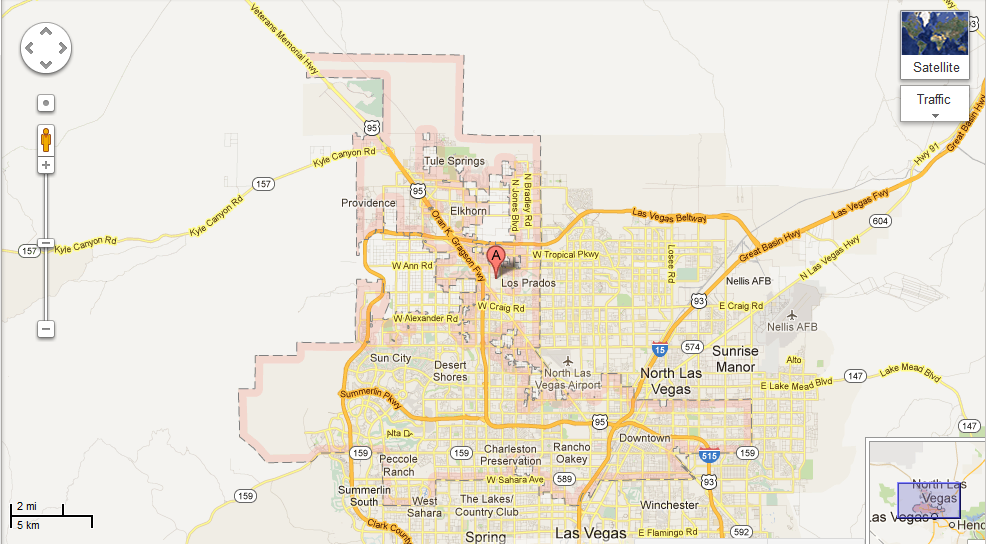
 _ On our way out of Austin the road started climbing, and climbing, and climbing, until we finally reached Austin Summit at 7,484 feet, which has been our highest elevation of the trip. From there it was all downhill. (Las Vegas is all the way down at 2,181 feet elevation.) Highway 50 to Highway 376 to Tonopoh to Highway 95 to Las Vegas! On the way we passed some sketchy-looking military outposts in the desert, including the alleged Area 51; we also passed Angel’s Ladies, a legal brothel in the desert, though we didn’t want to investigate the quality of the ladies who would choose to work in the rural desert when Las Vegas was less than hour away. Managing to avoid military security, aliens, and prostitutes, we soon found ourselves driving down Las Vegas Boulevard, more popularly known as The Strip.
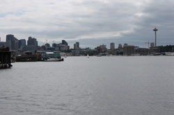
 _ Pulling into the Stratosphere, we commented that neither one of us could remember the last time we had been in a parking structure so large. The hotel has more than 2,800 rooms, making it approximately ten times the size of the Hotel Alyeska, where Chase works in the winter. Exiting from the parking garage, guests must drag all of their luggage with them from one end of the casino to the other to check-in for the room before dragging all their belongings back across the casino to get to the elevator. There are three elevator banks, depending on which part of the hotel your room is in. We finally found our elevator bank, and sped up to the sixteenth floor for our mountain-view room. We barely left the room, instead relaxing and reveling in the fact that for the first time since July we had walls, electricity, air conditioning, a shower, and a bed.
Saturday, August 11th
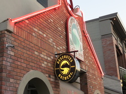
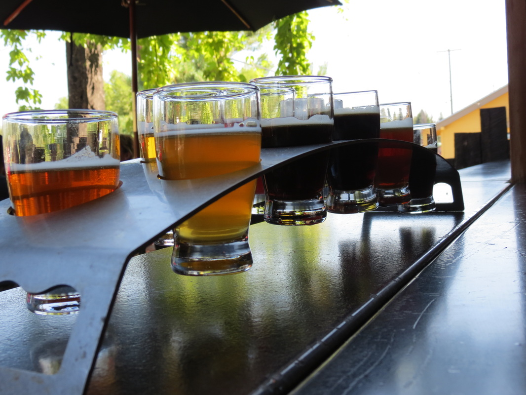
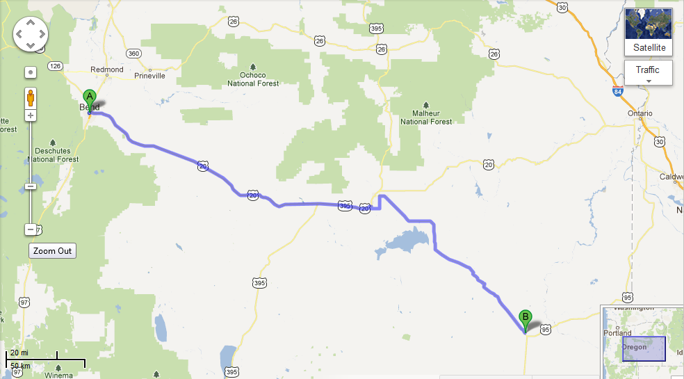
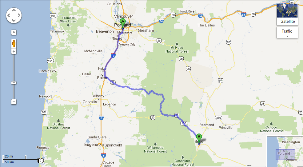
 _ Like many other mornings on this trip, we started out today with breakfast sandwiches; this time from the Great Harvest Bread Company in downtown Bend. (Tomato and spinach were only a dollar extra, but well worth it.) After breakfast we made our way to the Deschutes Brewery, hoping to enjoy the visitor center and a tour. Surprisingly, we arrived 45 minutes before they opened. That gave us time to talk to the bartenders, who gave us a Bend Ale Trail map and sent us on our way. We had no idea that Bend had nine breweries!
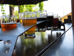
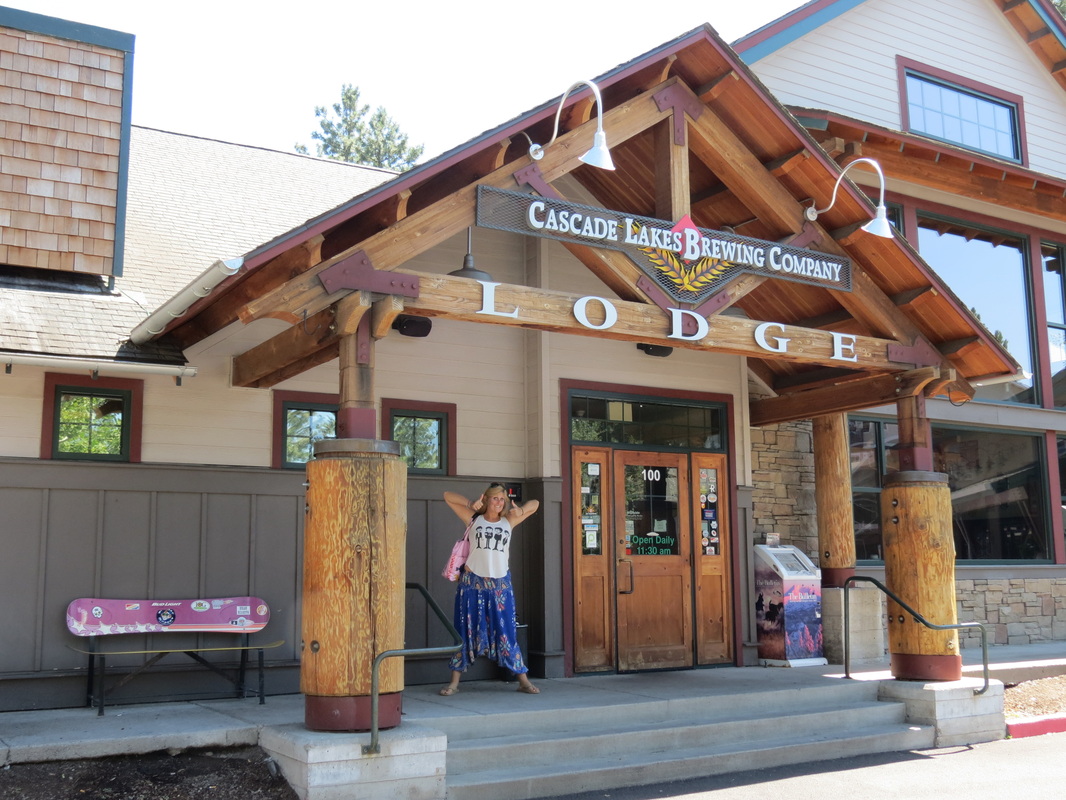
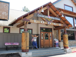 _ We first went to 10 Barrel Brewing Company, where we started off the day with a sampler flight of ten of their beers. We really enjoyed the beer, though we were disappointed that the flight wasn’t actually arranged from light to dark, in the order that they should be sampled. Our favorites were the Northwest Red and the S1nist0r Black ale, which was uniquely refreshing for a beer that dark. We then rushed to Cascade Lakes Brewing Company to sample their Blonde Bomb Shell and their IRA (India Red Ale).
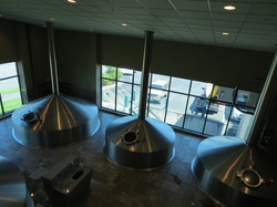 _ Finally, it was time to return to Deschutes for our much anticipated brewery tour and samples. Between the two of us, we tried the Chainbreaker WIPA, Twilight Summer Ale, Mirror Pond Pale Ale, Zymerge, and Black Butte XXIV. We also joined a 45-minute tour of the brewing facility, where they make all the beer that they distribute to all the western states and provinces. We enjoyed perusing the label gallery at the end of the tour, specifically the labels for the seasonal Jubelale which Deschutes commissions from a different local Northwest artist each winter. On our way out of town we stumbled upon Silver Moon Brewing to sample the Life Guard Blonde (“A blonde for a blonde,” according to the bartender) and Hopnob IPA, as well some well deserved lunch.
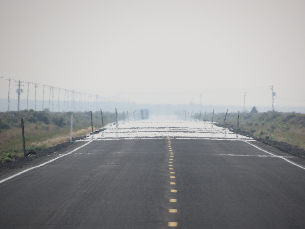
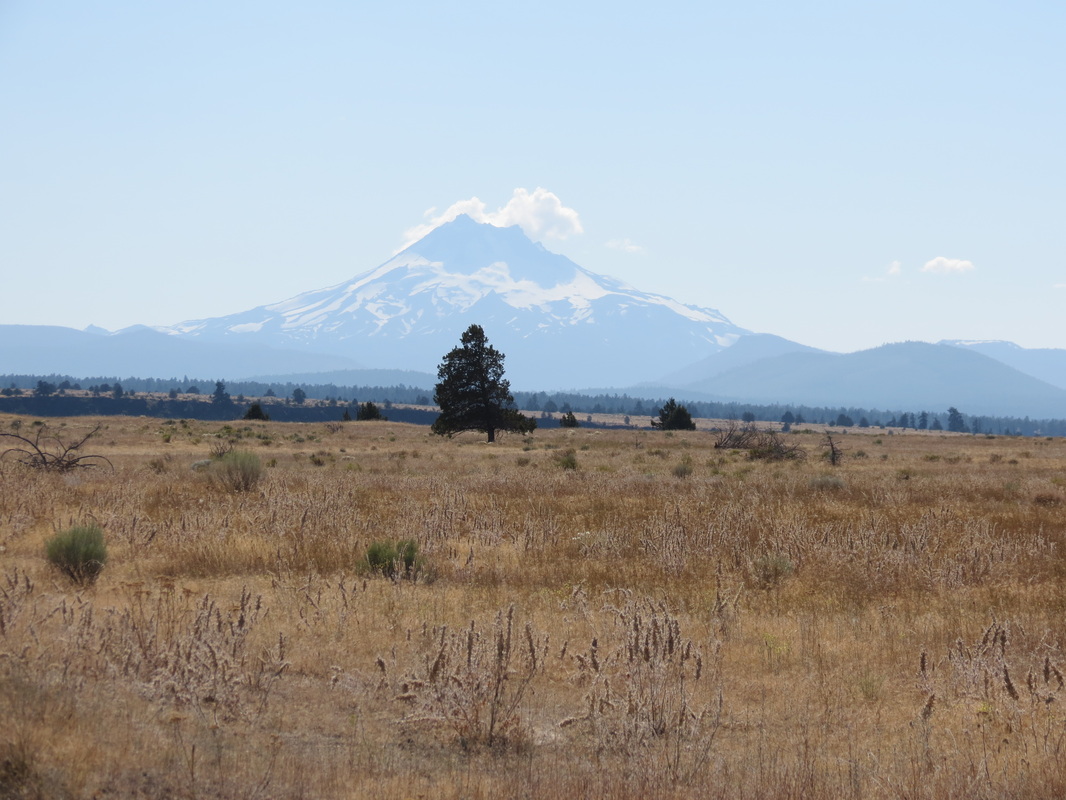
 _ After a quick gas fill-up, we were on our way out of town heading east on Highway 20. We once again entered the crazy high desert terrain from yesterday. We agreed that we never imagined this kind of topography would exist in Oregon, as it instead conjures ideas of the Southwest. Another gas top off in Burns (because you never know where the next station will be in the desert) and we were heading south on Highway 78. Our friend Chris, from Talkeetna, had told us to be on the lookout for hot springs in this area, and we quickly came to Crystal Crane Hot Springs. We were looking for something natural, not commercial, but we soon changed our mind on hot springs entirely; when the air temperature is this hot, 101 degree water just doesn’t feel pleasant.
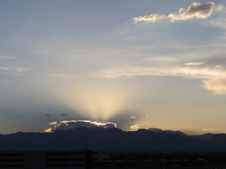
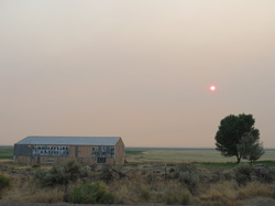 _ Pulling away from Crystal Crane the sky acquired a pink hue and the sun began to turn red. Apparently there is a forest fire burning in Fields, and the smoke from the fire is creating a haze throughout the eastern reaches of the state. As the haze caused dusk to come earlier than normal, we pulled off the road and found a great spot to camp on top of a butte overlooking the Steens Mountains. Once again from the top of our butte we were able to enjoy some amazing stargazing and watch the Perseid meteor show. In other news, we finally found the most elusive license plate for our license plate game: Hawaii! It was on a car just sitting there in downtown Bend. (Click here to see how the game is progressing.) Coincidentally, before we even said anything about it, the gas station attendant in Burns also mentioned that he had seen a Hawaii license plate pull through today for the first time in a long while. Maybe there are some Hawaiians out there doing the same drive we are, at least from Portland to Las Vegas. If you see the silver Honda Pilot with the Alaska tag and the bike on the back, honk your horn!
Note: While touring the Bend Ale Trail, we shared small size samples over the course of several hours and with two meals. Please enjoy the Ale Trail responsibly and don't drink and drive!
Friday, August 10th 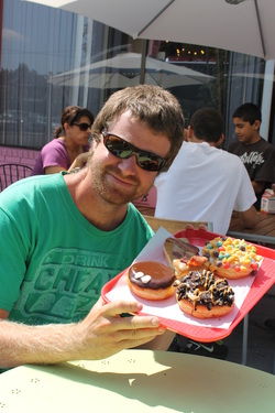 We started our day at Tiny’s, a trendy little coffee shop near Elliot and Brad’s apartment that featured delicious breakfast sandwiches and good coffee. There, we said good bye to Brad and made moves to our last stop in Portland, the city’s staple where good things come in pink boxes. We could not possibly leave without trying Voodoo Doughnut (Too)! When we pulled into the parking lot, Charla spotted a Voodoo Doughnut tuk tuk. She didn’t even need to try one of their creations before she was in love. We waited in the short line (much shorter than the one wrapping around the block in front of the original Voodoo shop we had checked out on our first night) and then faced a difficult decision: what to order? Chase settled on the Portland Cream and the Maple Bacon Bar (yes, that’s bacon on a doughnut!) while Charla went the sweet route with a Captain My Captain, covered in Cap’n Crunch cereal, and an Oreo King, topped with Oreo crumbles and chocolate.
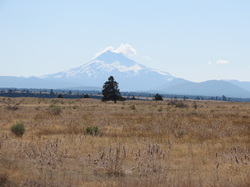
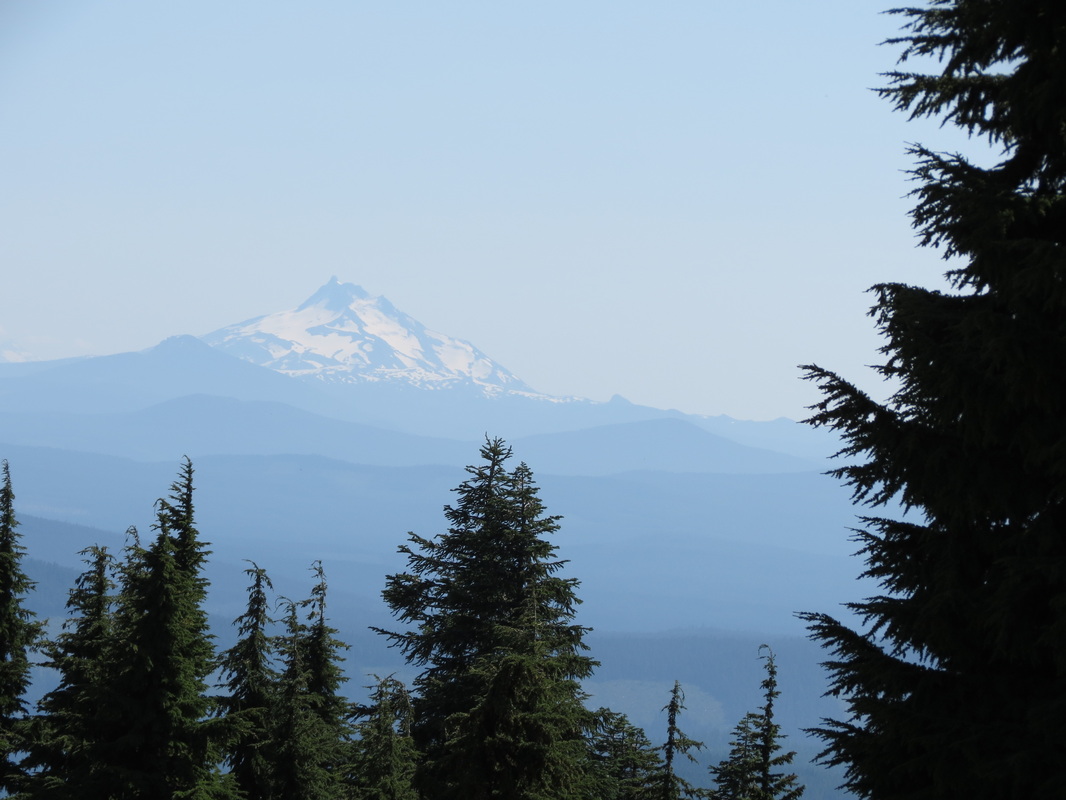
 A few miles on I-84 led us to Highway 26, a scenic road that took us through Mt. Hood National Forest. To get an even better view of the snow topped mountain, we cruised up to Timberline Lodge. There were skiers and riders walking around the lodge, and Chase started aching for a ride. If only the winter gear were more accessible in the Pilot right now! Meanwhile, Charla was channeling her inner film buff and getting a little scared just thinking of The Shining, which filmed its outside shots here.
 After leaving Timberline and driving southeast, we started to experience a dramatic change of topography and temperature. From the cool mountain climes that promoted the growth of much greenery, we entered into the hot and dry high desert where the only green we saw grew up around irrigation systems. Coming into Bend, we came back into a lot of vegetation, as the Deschutes River and National Forest are nearby.
 Miles back, in Kirkland, Washington, Charla spotted her first Jimmy John’s since returning from Southeast Asia, but we went out for a great Thai meal with Alison instead. The craving had not gone away, so we went straight to Jimmy’s when we arrived in Bend. After loading up on sandwiches, we walked around downtown and the riverside before going to the Deschutes Brew Pub to sample the local brews. In addition to the Chainbreaker White IPA and Spencer’s Gold Ale, the bar staff gave us directions to a camping spot in the National Forest. We ended up pulling off the road a bit before their favorite locale by Tumalo Creek for a good place to watch the Perseid meteor shower that was just getting into swing.
Thursday, August 9th
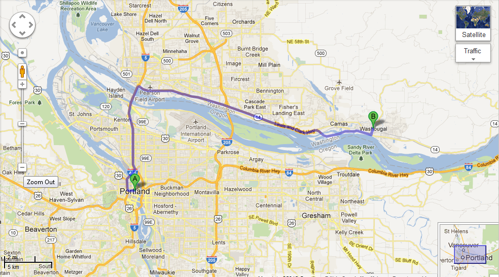
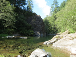 _ Our day began with texts from Elliot: “Make me a breakfast sammich!” Over egg sammiches, we made plans for the day to go to “the river,” a Portlander term for any river surrounding the city. After making friends with Grace and Benji, we followed them to the Washougal River just over the Washington border. We were on I-5 for just a few minutes before taking a state road that led to the dusty, gravel Forest Service roads. Grace led us to a spot perfect for swimming and catching some sun, a place where the current slowed around the rocks scattered throughout the middle of the river. Just upriver was a large swimming hole surrounded by rock faces perfect for jumping. The sun dipped below the surrounding mountains in the mid-afternoon, so we moved from our secluded spot to Dougan Falls, a more populated spot but one that had better sun. Dougan Falls was a series of short waterfalls that you could swim under, climb up, and play around. Unfortunately, it was nearing time for Benji to go to work, so the whole crew returned to the city to drop him off.
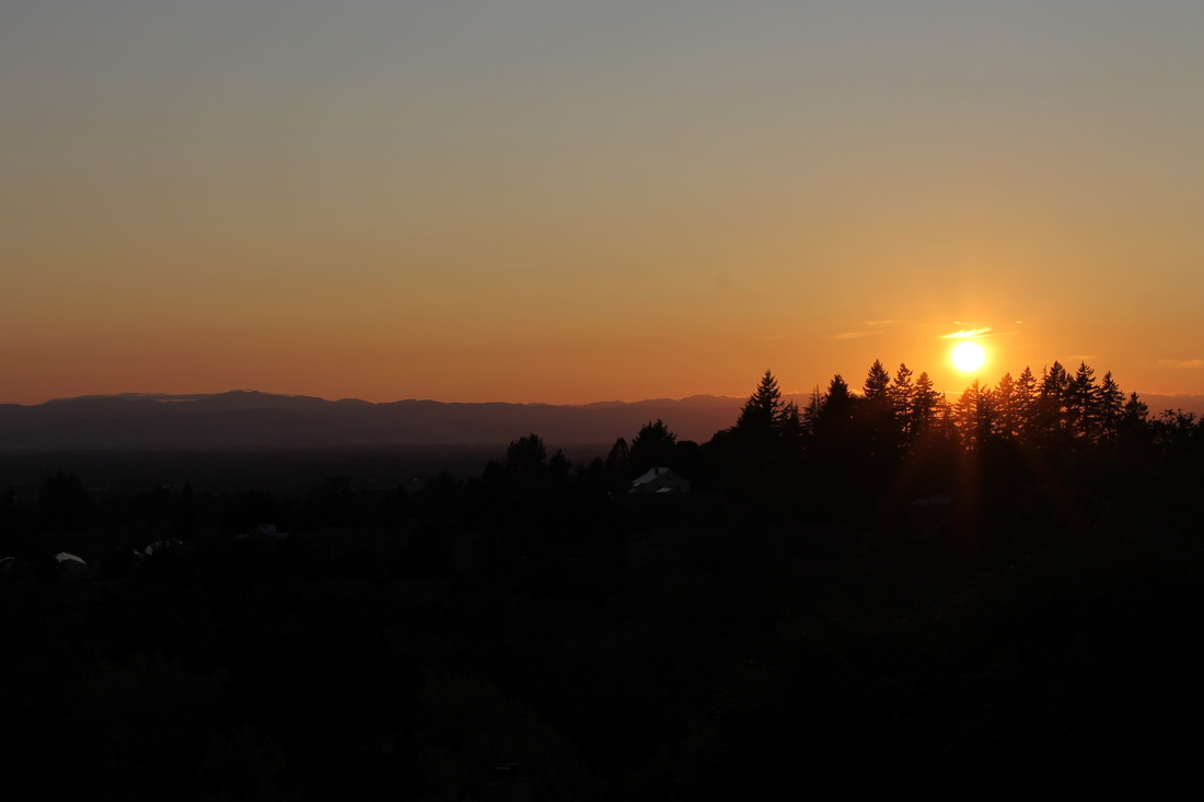
 _ Back in Portland, we made a stop for some groceries for a quick dinner at sunset overlooking the Coast Range from a beautiful apartment that Grace was housesitting. After dinner, we retreated to the complex’s pool and hot tub. We expected the river water to be cold, but even though the pool was relatively warm, it felt cold to us and we stayed in the hot tub.
At Elliot and Brad’s, we caught up on the day’s Olympic events. It has been interesting watching the Olympics while traveling; each day that we are able to hear Olympics news it is biased by our location. While driving through Canada we were listening to results of Canadian athletes, and we listened to some of the controversial Olympics moments involving Canadian teams. The Canadian badminton team (Bruce-Li, Michelle Bruce and Alexandra Li) was thrust into the international spotlight after a host of other teams were disqualified, while the Canadian women’s soccer team lost their semi-final to the US by a questioned call to the ref. Once we crossed the border these stories were never focused upon again, and this evening in particular the big story was that the US team had 40 athletes with Oregon ties (including Ashton Eaton, who had just won the gold in the decathlon). Overall, we haven’t been able to keep up with the Olympics as much as we would’ve liked, but the local flavor definitely has made it more interesting when we are able.
Wednesday, August 8th
 _ We woke up rocked by the waves of floatplanes taking off beside Noelle’s floating home on Lake Union. We hung out with Noelle while she made us a delicious breakfast, and then we walked around her dock to check out the different floating homes in her “community.” After a late start out of Seattle, we rocketed down to Portland on I-5.
 _ We arrived at Elliot and Brad’s apartment and our hosts gave us a nice tour of historic Irvington, the neighborhood in which they live. The four of us shared a “bucket,” a delicious concoction whose recipe we brought back from Southeast Asia earlier this summer. Once we had had our bucket and were ready for a fun evening we jumped on the MAX train for a trip downtown into Portland. Portland is known for its variety of food carts and casual street food, and we decided to go for the real local experience by devouring Egyptian food. The Egyptian food made us thirsty, so Elliot brought us to Momo’s, his regular after-work watering hole, where we were met by some of his co-workers for a few drinks and a lot of laughs.
The tour of Portland continued after Momo’s as we were brought to public squares and historic areas downtown. One of the most interesting was a square where if you stood in a specific spot within a circular brick structure you could hear your echo even though those standing around you could only hear your regular voice. From there, a quick MAX ride brought us back to Irvington and a comfortable bed.
Tuesday, August 7th
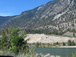
 _ Once again, we had the pleasure of packing up camp in the rain; we went to sleep with a nice lightning show above and assume the rain started shortly afterward. The benefit of a rainy morning is that it got us on the road nice and early! After a couple of hours we drove out of the rain and stopped at an overlook near Big Bar Lake to cook up some breakfast. After passing through British Columbia’s agricultural district for a couple hours, we made it off Highway 29 and onto the Trans-Canada Highway to drive through the Fraser Canyon. The Fraser Canyon is a narrow, rocky canyon cut by the Fraser River, and the two-lane road follows the path of the river while clinging to the side of the cliff.
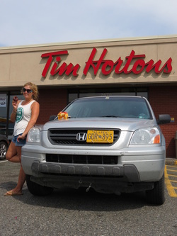
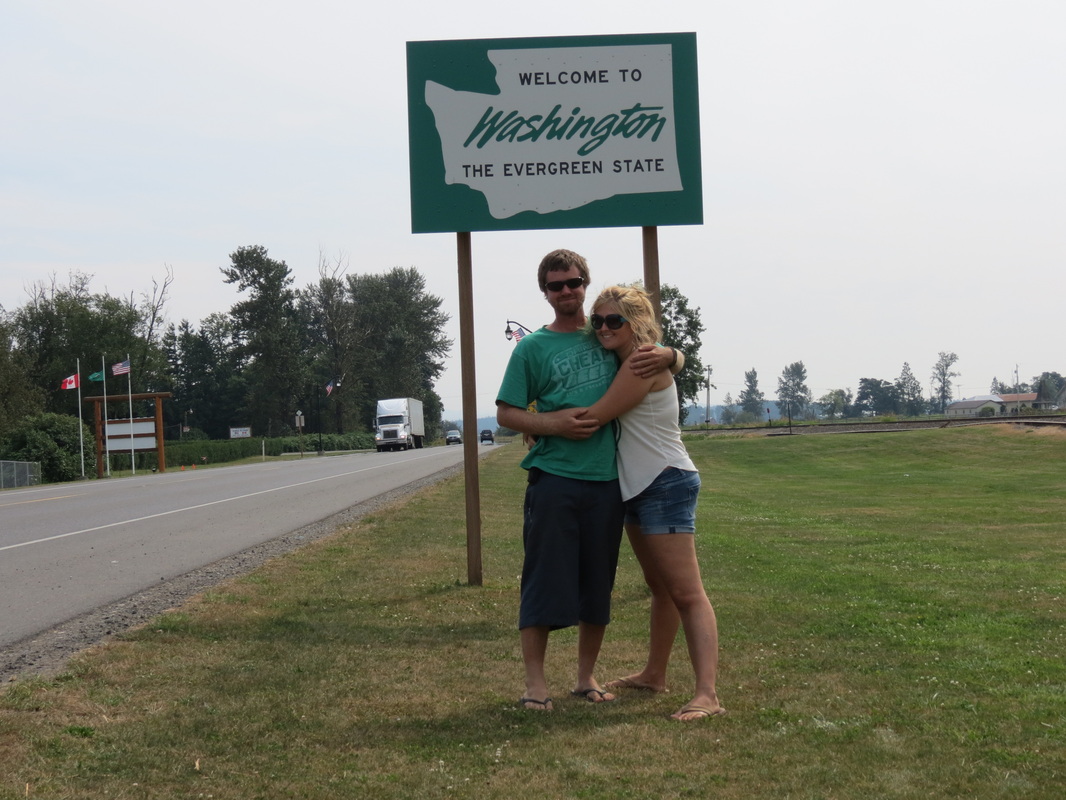
 _ Once through the Canyon we had one last Canadian stop in Chilliwack, by far our most successful shopping attempt of the trip. We were able to do a last-minute stop for Canadian chocolates and beer not available south of the border, as well as some other errands that needed to be run. We sped immediately from Chilliwack to Abbotsford, where we crossed the border for the last time into the Lower 48! Another easy border crossing (where we did declare our Timbits, or donut holes from Tim Horton’s), we found ourselves in Sumas, Washington.
 _ Two hours of interstate travel later we stopped in Kirkland, Washington, to visit our friend Alison. It was great to reconnect, and we took a walk through beautiful Kirkland past the Wilde Rover, the scene of past adventures of Charla and Allison. Our destination this evening was just next door at Hanuman Thai Café, Charla’s first Thai food since leaving Thailand earlier this summer. The prices were a little higher than Bangkok street-food (though also significantly lower than prices in Talkeetna), but Charla still approved of the cuisine. Later that evening we headed into Seattle to visit Noelle, one of Chase’s friends from Talkeetna. We quickly all became friends and slept soundly that night rocked by the waves of Lake Union.
Monday, August 6th
BC Day!
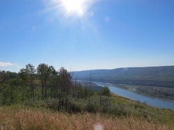 _ We woke up early as we experienced a HOT morning in the tent for the first time on the trip. The sun was baking down on our overlook, and our tent, but it was also creating a magical view overlooking the entire Peace River Valley. We had a simple “eat-it-before-it-goes-bad” breakfast of yogurt and cereal with milk before packing up our camp. While we were packing up, our overlook became a very popular rest stop. A motorcyclist from Grande Prairie was taking in the view and chatting up a local lady, meanwhile four support vehicles pulled into the overlook. Curiosity got the best of us, and we discovered that we were about to be a checkpoint on an 800-kilometer bicycle journey called Bikers for Bibles who were raising money to translate Bibles into local First Nation languages. We decided we should get out of there before we got swarmed with sweaty bicyclists.
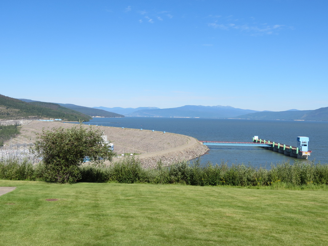
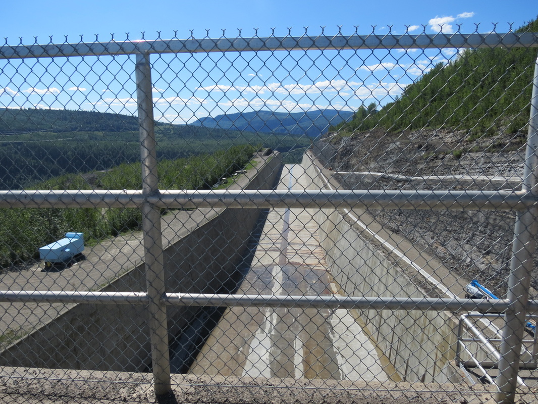
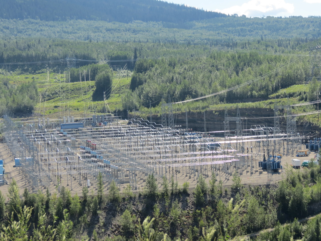
_ Our first stop was at the W.A.C. Bennett Dam, the most massive earthfill structure in the world, operated by BC Hydro. We took an underground bus tour into the dam itself, where we found ourselves 500 feet underground inside a dam. Luckily for us, one of the turbines was out of commission for maintenance, and it was on our tour route. The entire turbine was taken apart and we got to see all of the massive parts and pieces. And we mean massive; the underground chamber holding the turbines was as long as three football fields and as tall as the observation deck of the Eiffel Tower. The next stop on the tour was the dam manifold, roughly equivalent in purpose and use as a massive version of the manifold on a car’s exhaust. Once the water was done producing electricity, all the turbines spat the water into the same manifold, along with the seepage water that was naturally coming through the earthen structure of the dam. Interestingly, the seepage water reinforces the strength of the earthen fill of the dam, much like building a sand castle with wet sand rather than dry sand. (They didn’t allow cameras on the tour, so you’ll just have to trust us on how cool it was.) After the tour we discovered that it was possible to drive across the crest of the dam itself, so of course we took advantage of that opportunity. 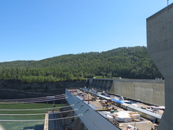 _ Our next stop was the Bennett’s baby sister dam, the Peace Canyon Dam. Though there was no way to get into the dam itself, we were able to watch a fascinating video called “Wide Load North” about transporting a nine-meter-wide, 250-ton steel turbine runner from Leningrad to Vancouver and up to the Peace River. They constructed a 21-axle, 130-wheel, two-engine Mack truck to haul it 600 kilometers over road, most of which was built specifically for this project as nothing that large had ever traveled through northeastern British Columbia before. After the Peace Canyon Dam we got to see some of the less-than-awesome elements of dams. We had lunch by lovely Dinosaur Lake, which was a beautiful spot teeming with locals. Hudson’s Hope’s two claims to fame are dinosaurs and dams. They had discovered a brand new species of dinosaur, as well as 1,700 dinosaur tracks in over 150 different trackways. The very next thing they did was bury all evidence of dinosaurs under a lake created by the Peace Canyon Dam; luckily they did at least name it Dinosaur Lake in honor of the footprints hundreds of feet under water.
 _ We were also pleasantly surprised to discover that today is apparently a major holiday in British Columbia: BC Day. We happened to arrive at the W.A.C. Bennett Dam to be told that all dam tours were half price; then we stopped at a Post Office that was mysteriously closed; then we had lunch at a very crowded park for a Monday. It wasn’t until hours later that we heard on CBC that it was BC Day today, and it all made sense. (We also learned from CBC that today is the 50th anniversary of the day Jamaica gained its freedom from England; a little late compared to us, but happy 50th birthday anyway Jamaica!)
From Dinosaur Lake we really hit the road and made it all the way to Prince George, “the capitol of Northern BC.” (Though Charla was quick to point out that seeing as how we had been driving south through BC for two days now, this should hardly count as “north.”) Prince George is really where the drive returns to civilization, for better or for worse. There are traffic lights and four-lane highways, as well as big box stores with names such as Canadian Tire (which has much more than just tires) and The Great Canadian Superstore (which seems to have every product imaginable with the notable exception of beer). In better news, Prince George also featured Tim Horton’s, the Canadian staple of fast-food donut eateries. Since Charla had never eaten at a Tim Horton’s before, we of course had to stop. After snacking on donuts and coffee, it was time to be back on the road heading south to our roadside stop in McLeese Lake for the night.
Sunday, August 5th
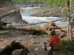 _ We woke up early and packed up camp before the mosquitoes had a chance to catch us again. Not too far down the road, we found a perfect place to make breakfast (that we wish we had found the night before!) at Whirlpool Canyon. The Liard River makes a screaming right turn, and during spring break-up, the ice floes take out a lot of trees along the river and deposit them on the shore here as they cannot make the turn with the very fast-moving water. The shape of the rocks below the scattered trees also reflects the power of the water and ice during break-up over the years, as the layers of shale, too, are broken up at harsh angles.
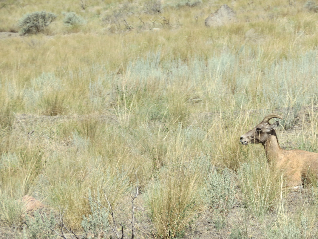
 _ On our drive to Liard Hotsprings down the river, we were lucky to glimpse a lot of wildlife from the road—two herds of buffalo, a black bear, and many birds. Once reaching Liard, we were disappointed to be turned away, as the boardwalk-lined hot springs were blocked with crime scene caution tape from an event the day before. We spotted a helicopter and a four-wheeler along the road nearby, but we have still yet to spot anything in the Vancouver Sun or on the CBC about what happened there. Leaving Liard Hotsprings, we drove past the jade-colored Muncho Lake and on to the Toad River Lodge.
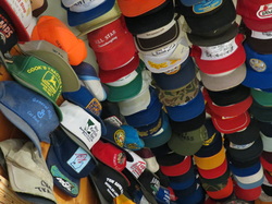 _ Chase added his well-worn John Deere hat (the front of which had completely fallen apart while we were tubing in Vang Vieng, Laos, earlier this summer) to the lodge’s famous collection, making 8,189 hats. He hung the hat in a small cluster above the beef jerky section of the shop and took his registration card for memories.
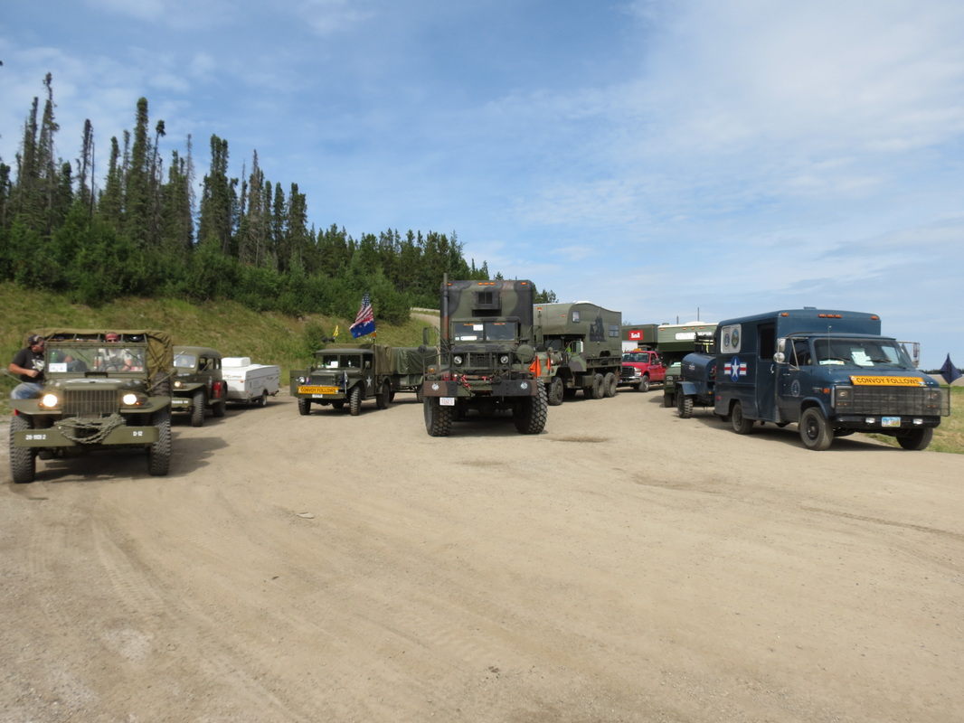
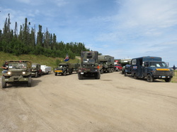 _ As we traveled through the Rockies, we were excited to see the Military Vehicles Preservation Association convoy lining up at the top of a mountain to begin the day’s drive, a leg of their trip the length of the Alaska Highway to celebrate the 70th anniversary of its construction. There were over seventy vintage vehicles, mostly World War II era, and fifteen support vehicles. The owners of the vehicles were private collectors who had restored their vehicles and, in the cases of the larger trucks-turned-RVs, fixed them up to make such a cross-country drive. Our favorites, though, were the smaller Jeep CJ-2As, and there were at least fifteen or twenty of them in the line-up. As the convoy headed out to Toad River, we continued in the opposite direction on the highway towards Fort Nelson, where we stopped for gas and groceries. From there, we traveled a little further down the road and cooked dinner at the First Nations Prophet River area. After dinner, we drove our last section of the Alaska Highway and got onto the Hudson’s Hope Loop, which took us alongside the beautiful Peace River until we stopped at an overlook rest area to set up camp for the night.
Saturday, August 4th
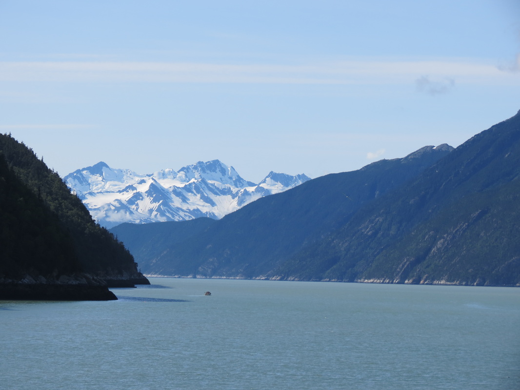
 _ Much to everyone’s surprise (especially the local Skagwegians), we woke up to a beautiful sunny day! We explored town a bit more, including a walk down to the cruise ship dock, where a new boat had unloaded its happy passengers earlier that morning. From the dock, we had some sweet views of the Tracy Arm. Then, we made our way back into town for some pan au chocolate at Glacial Smoothies and Espresso. Noticing an ad in the Skaguay Alaskan paper in the coffee shop, we stopped in a store nearby for a free train whistle with the purchase of some snazzy bear socks. In times of radio silence while driving through massive British Columbia, the train whistle certainly came in useful (without much success, we both attempted playing songs ranging from Lady Gaga’s “Born This Way” and a smattering from Lonely Island).
 _ After much hugging and a few high fives at the Attic, we started the scenic drive out of Skagway through White Pass, climbing some 3,000 feet in just nine miles and crossing the Canadian-America border one more time.
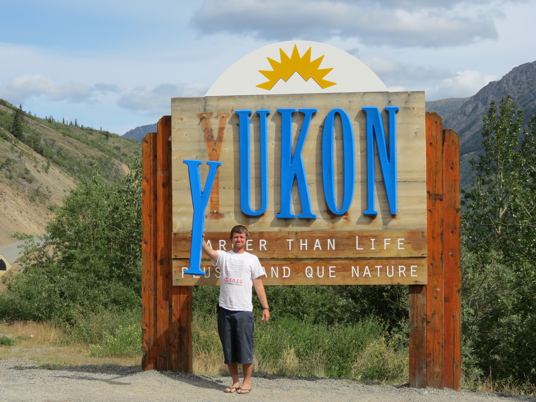
 _ We crossed from BC into the Yukon, where we happened upon the deserted Venus Mill mining structure on Tutshi Lake. Built in 1908, it was meant as a last-ditch effort to try to mine silver from the lake, but it was unsuccessful. Later on we crossed through Carcross (from the original town’s name CARibou CROSSing) and then the Tagish Road onto the Alaska Highway for the third and longest stretch of our trip.
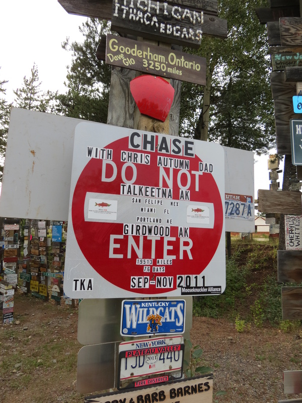
 _ We made a quick stop in Teslin for gas and groceries before making a nice lunch overlooking Nisultin Bay just outside of town. With a full tank in the trusty Pilot and full stomachs, we covered a lot of ground before reaching the Watson Lake Signpost Forest. We meandered around a bit and made the necessary stops to check up on Chase’s two signs there. We skipped out on the Northern Lights Centre, deciding that we would just have to wait until our return to Alaska to see them again in the sky and not on film. From there, we drove for a bit and started seeking out a place to rest for the night. Our first stop was place we will forever call mosquito land. We took a turnoff, hopeful for a nice spot, but it looped around back towards the Highway. We found what appeared a nice spot in the back of the loop, but after a few minutes of setting up the tent, we were swarmed with plaque-like quantities of mosquitoes and quickly decided to pack it all in and search for something better. We stopped in a rock quarry a few miles down the road that was still fairly mosquito-infested but a much better option for a place to make dinner and get some rest.
|


 RSS Feed